2016-12-01 Västerås

From the bus to Vasteras

From the bus to Vasteras

Our plane arrived about 7 am,. Getting quickly through immigration, we collected our bags, and headed out into minus 2°C (a bit of a shock after > 30°C in Townsville and in Bangkok). We managed to catch the 7:55 am express bus to Västerås which headed east into the rising sun past snow powdered fields for the 1 h 20 min/110 km trip. Mia kindly collected us and took us home for a much needed rest.

Tillberga vs VSK Bandy Match (3-2)

Tillberga vs VSK Bandy Match (3-2)

We’re enjoying sharing time with family, exploring Vãsterås and generally unwinding. We’ve been kept busy so far. One evening was a Bandy competition. Bandy is a variant of hockey played on ice – it is much more like hockey than Ice Hockey. It is incredibly fast, and apart from the bit about getting the ball into the opposing team’s goal, we had little idea of the rules. But who needs rules – the excitement was clear. This was a darby with two local Vãsterås teams;  “our” team, Tillberga Vãsterås were the underdogs, taking on VSK who recently won their 20th National Championship… but we won 3:2 much to the surprise/shock of VSK.

2016-12-03_g5d37220Mia and family are keen on horses, so we went to the stables. These are somewhat different to what one thinks of in Australia, because of the extreme cold. There are huge heated barns with the horse stalls and equipment rooms and vast unheated barns that serve as exercise arenas, in addition to the paths outdoors in the snow. It was fun to watch the youngsters riding their horses. 2:30 PM, sun setting – time to go indoors.

2016-12-04_g5d37240Walking round town I was surprised to see what looked like parking meters along one of the streets here, until I looked closer. They turned out to be power outlets. When you park your car on the street you plug in to the mains power which runs small heaters to keep the battery and oil from freezing so you can start your car when you return. Not a thing we worry about in Melbourne.

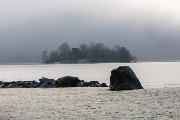
2016-12-04_g5d372612016-12-04_img_3904Vãsterås is on Malaren, a huge lake that stretches from Stockholm and another 100 km further to the east, covering an area over 1100 square km. As Christmas approaches the surface is starting to freeze over. Soon the ice will be thick enough for skating. The local ducks are making the most of the few patches of free water, and in places they have bubblers that keep the water moving and prevent ice formation, so there are small clear patches for the birds.

There used to be a major shipping port here (with water access all the way to Stockholm and to several major regional centres around the lake), but road and rail have taken over. As in Melbourne, the port area is becoming developed with apartment blocks, oriented, by and large, so that there are at least some water views from most of the units.

2016-12-04_g5d37271We’re a little late for the “…season of mists and mellow fruitfulness…” but the evidence of autumn are all around. Mia has a wheelbarrow of apples awaiting processing. Fortunately cool storage is easy here. The wheelbarrow is in the garage, hovering just above freezing. Trees around the streets are loaded with remnant fruit and with red and white berries, which the resident passerine birdlife are no doubt relying on to get them through the cold. It isn’t hard to see how bird migration to warmer climes from the northern winter has selective advantages.

2016-12-04_g5d37264Among the oddities of Vãsterås is a tree-house hotel, 13 m above ground in a huge oak. Hotel Hakspett (hotel woodpecker) as it is called was a concept of a local artist, and was available to rent in the summer. As far as facilities are concerned it is a little primitive. A small bed, a dry toilet and a balcony with lovely views of the park. One gets up to the room in a harness – hardly the most convenient, but it is differently a contrast to the normal hotel room. Alas, the tree has become insecure and the room is no longer available for rent. But there is another, underwater room by the same artist, out in the lake and available for summer guests.

More later. Photo Gallery so far is at: https://goo.gl/photos/yX21ne76vG6MUR6t7


2016-12-06 Västerås

What a change! temperatures: up to 6°C today and the previously slippery, icy paths become safe to walk on. Today the sky is clear and blue so I headed out for a walk through town and along the banks of the lake. Just to give you a better context for where we are, here is an embedded map that you can scroll, zoom etc, and on today’s walk I wandered through town and along the banks of Malaren to the east.


View Larger Map

The shoreline here is dominated by apartment developments, much like docklands in Melbourne, though mostly only 5-6 storys tall. Vãsterås has become a commuter suburb, and this side of the lake area is close to the central station, and it is only 1 h each way to Stockholm.

There are also oodles of marinas. In summer there are always lots of boats out on the water.  By this time of year the water is getting a little solid, so the marina berths are mostly empty and the boats are all wrapped up for winter.  They seem to have the art of shrink-wrapping large yachts worked out.

The water’s edge is fringed by frozen and refrozen ice, and there are lots of interesting patterns to contemplate and photograph.

By the lake at the edge of town is a huge old building that I discovered was the old thermal power station. This was closed in 1982 and is now a historic monument that houses the “Kokpunkten, Västerås’ action water park”. It’s currently surrounded by cranes so I assume they are doing further renovations.

The current power station, across the bay, is a highly sophisticated thermal power station with capacity for 520 MW of electricity generated mostly from combustion of biomass (though it was originally commissioned in the 1960s to use oil).  In Australia we throw away a huge amount of energy in our thermal power plants – cooling water and the like. Here the “waste” heat is piped through town. Under-road heating keeps the central streets free of ice, and households have heat exchangers in their basements to extract the energy for radiators and water heating. The whole town is, thus, efficiently heated. For reference, the plant generates 950 MW of heat that would otherwise be waste, almost twice its electriciity genration capacity. Further eco-credentials; they just opened a new unit that can generate heat and electricity from domestic waste as well as biofuels. This one unit alone can supply about half of the needs of the town for heat and electricity.

Offshore from Vãsterås are lots of small islands that look very scenic. the islands are generally low lying and tree covered. During the most recent ice-age (the Weichselian glaciation), about 70,000 to 10,000 years ago, this whole area was covered in an ice sheet up to 2 km thick. As the ice sheet moved, it ground the granite below relatively flat, so the whole area is undulating rather than mountainous.

Despite the oncoming winter, there are still plenty of waterfowl on the lake. I must find out how they survive when the whole lake freezes over.

That’s all for now. I’ve added more photos to the gallery at https://goo.gl/photos/yX21ne76vG6MUR6t7

2016-12-13 Västerås

There does not seem to be enough time in the day to keep up with posts.  Since the last entry we have been busy exploring. We’ve had warm and sun and cold and snow. Today was -11C, though not too bad when one is appropriately dressed. There are lots of snow ploughs clearing the roads, but lots of icy spots still, so one has to take care walking.

A few days ago I walked round the coast enjoying the changing views, past the power station, and found what looked like some sort of religious retreat, with various buildings, open air chapels and statuary.


Since the sun sets before 3PM, it is not hard to get lots of sunset views.  That soft, warm light that lasts for just a few minutes at sunset in Melbourne summers … here it lasts hours. At midday the sun is barely a hand’s-width above the horizon (with the arm at full stretch, that is).

On Saturday we headed to a nearby town, Sala, where they have an old silver mine with an interesting museum, and there was a market. It was snowing most of the time, so the market stall goods were liberally sprinkled with white.It was a bit hard to see some of the wares.

Four days ago we visited Anundshog, in the sunshine. Two days ago we visited in snow. Quite a difference. However it was challenging to get photos when the snow is blowing horizontally some of the time, without getting snow on the lens, and with gloves to protect the digits from the cold.

Managed to get a mention in the local paper!

A couple of days ago, as I walked through town I was stopped by a couple of guys who enquired what I was planning to do for Lucia, and snapped my photo. I turned up as a head in the local newspaper.

One of the local celebrations at Christmas is the festival of Santa Lucia. We went to the local cathedral (Domkyrkan) for their celebration. Lots of well done choral work and fair maidens wandering around with candles on their heads. Lots of fun.

Tomorrow we head off to Rome for a week or so, so I’ll post more in a few days once we have seen a few sights.

As usual there are more photos in the gallery for Vasteras that I made, just scroll down to find the new ones. Clicking the thumbnails brings up full-page versions as usual for google galleries. https://goo.gl/photos/yX21ne76vG6MUR6t7

2016-12-13 Rome

We are heading south to Rome. We have 4 nights booked right in the heart of the old city, so easy walking to lots of sights. We aren’t expecting long queues at the various venues either. Weather forecast for mid-teens for the next week, so a little warmer than Sweden. We are at the airport awaiting the flight. Jill is annotating our Lonely Planet guide to pick the highlights to visit.

Day 1. Arrive. Baggage collected we head to the SIT airport express bus that gets us to near the Vatican, as close as we can get to our accommodation which is an apartment right in the historic centre… in a maze of little twisty passages all alike… with no vehicle access until after 6PM. Fortunately, towing our bags over the cobbled streets, we finally found it (GPS has problems when all you can see of the sky is a thin ribbon 4 or 5 storeys up). Once set up we had a wander around the local streets in the gathering night, all very interesting.

Day 2. Off to the Vatican, dodging the touts for guided tours… there are so many of them and all are very pestilient. As expected for early morning, Wednesday (everyone is heading to the Pope’s address somewhere every Wednesday) in the low season there are no queues (except for the guided tours where everyone seemed to be hanging around waiting, looking glum). A quick twirl around the Vatican museums took most of the day, and we barely touched the surface of what is there – mostly we just gawped at the opulence and artistry. They had a special display of Rembrandt drawings – I wouldn’t mind one or two of them on my wall. I assume they are worth millions of dollars each.

St Peter’s Square from the cupola on the Dome of St Peter’s Basilica

Day 3. Off early again, this time to St Peter’s Basilica, dodging more tour guide touts, and sellers of selfie sticks. No queues again – people don’t get up early round here. Up, up, up – 321 steps to the inside of the dome. Sadly the walkway there is fenced off with heavy duty wire with narrow gaps, so not so conducive to photography. But this place is HUGE. The people on the floor below appeared tiny. The dome has a diameter of over 40 m and rises high above. There is a narrow stairway climbing between the inner and outer shell of the dome that takes you up to the cupola on the top. From here there are amazing views over Rome (somewhat muted by the layer of smog). Then down, down, down to the Basilica floor below and the crypt below to be awed by the gold and splendour.

Day 4. Another beautiful sunny day. We headed off for a gentle walk around the Colosseum, Palatine Hill and Forum. Those old Romans really knew how to party. Sadly the buildings are mostly ruins now (after 2 millenia I guess you can expect a little wear and tear). The elaborate marble that was once fixed to the walls has gone – recycled on other constructions over the ages, leaving rough brick or stone. But the scale is HUGE. The Palatine hill was where the Emperor and other VIP’s lived and the reconstructions in the museum show amazing architecture. Our word Palace derives from the Palatine.


We also visited the Trevi Fountain, a spectacularly sculptured monument. This is clearly THE place to be after dark. The area facing the fountain was jam packed. I guess there isn’t much on television on Friday nights so what else do you do in Rome?

Day 4. Today is a quiet day to catch up after the frenzy of the last few weeks. Another lovely day with sun and blue sky. Amazing luck. After a sleep-in we wandered along the narrow twisty roads towards the “Spanish Steps” which are a famous landmark. The steps are large, ornate, branching marble steps with a fountain at the bottom and a church across the road at the top. And a gazillion tourists. Then we headed on to the grounds of the Villa Borghese – huge areas of parklands and buildings, mansions etc. We visited a few of the galleries, enjoyed wandering around, then headed home via the Spanish Steps. Did I say they were crowded when we went up.  They were crowded to the power of 10 when we went down. The road leading to them was just a surging mass of humanity. Amazing. This seems to be the neighborhood for designer labels – Cartier, Louis Vuitton, Bulgari etc etc. We asked a local police officer if this was normal and she said it was a fairly typical Saturday there. Maybe a little busier than normal because Christmas was a week away. Time for dinner than an early night in preparation for heading south to Pompei in the morning.

Lots and lots of photos at https://goo.gl/photos/wCp2cn2j78DYKNwo9

Enjoy.

2016-12-18 Pompei


We took a rental car down the coast. Some coastal “resort” development along the long Mediterranean beaches with a lot of new building going on. Lots of cars, not much parking, all of which is packed (and this is the low season — it must be hell in summer). Seems typical. One wonders why the city planners don’t think to mandate sufficient parking space to accommodate the need as new buildings go up.

Then out of the suburbs into coastal scrubland – very interesting looking. The road wends its way through small towns and some agricultural areas, with some interesting coastal scenery in places. We are travelling at what we think is a sensible speed only 10-20 kph faster than the signposted speed limit; and still people are banking up behind us and passing us on double white lines… Italian drivers…! Then, time pressing to get to our destination, we head inland to the freeway towards Pompei. We arrive on time, find our accommodation: comfortable but chilly – not the well-insulated constant 22°C that we have been used to indoors in Sweden.

gardens in one of the mansions

storeroom of artefacts

We spend our first day exploring the famed Pompei ruins. The town and its inhabitants were buried during the eruption of Vesuvius in AD79, preserving a snapshot of Roman life under metres of volcanic ash. This is an amazing place, well deserving of the UNESCO World Heritage Site listing, and we spent all day there. The skies were overcast, but fortunately the rain held off until quite late in the day so wasn’t a real problem. There are lots of mansions etc on display, some with spectacular decorations (especially considering they are about 2000 years old) as well as lots of temples, shops, brothels, etc. etc.. Although the guide map  gives paths to take for 1, 2 or 4 h, we spent over 7 hours there and could easily have spend more time without getting bored.


Burnt bread, Pompei

Herculaneum, showing depth of the old docks from the current surface

Herculaneum; skeletal remains

Next morning dawned still overcast so we don our raincoats and head to Heraculaneum by train – it’s only 20 km or so by road, but neither Jill nor I thought it was worth the risk to life to mix with the lunacy of Italian drivers, and the parking, based on our experience, was likely to be hard to find. And the train was fine. The ruins were buried by a cooler flow of ash, so there is more preservation of organic structures. In places beams, doors and the like are still there – charred but recognisable. Burnt loaves, fruit, grain and other seeds and so on give a picture of everyday life (though we didn’t see much of this at Heraculaneum, but in one of the few museological displays in Pompei). Walls are more intact overall. Heraculaneum was a port town, and the entrance to the site is by a ramp at current ground level, from which you can look down to the excavated dockside structures. It gives a good impression of the depth of the ash burying the town. Here they also have a good display of the “gruesome bits” – remains of the previous inhabitants effectively fossilised as they died. However, here the initial eruption left only a few cm of ash on the town and the majority of the inhabitants fled. It was the following night when a series of 6 pyroclastic flows came over the town – at about 250°C it was probably the heat that killed the remaining residents.

Pompei, Hermaphroditus statue (a siezed fake antiquity)

We returned to the train back to Pompei, and since the station was close to the other enterance to the one we used yesterday we give it another try and found a corner of the site we had missed getting to before. Here are some interesting buildings, mosaics and paintings. Eventually we find the “antiquarium” mentioned on a sign post. We discover we have to go through a small corridor with no signs at the back of the bookshop and go up one floor or down one floor for the two sets of displays. Another vagary of the Italian way of doing things. There are some interesting items on display from various archaeological excavations and including a display of faked “ancient Roman artefacts” from various seizures by the Italian art police.

Heading back to our apartment we pass another fine example of Italian creative parking. Here is a car parked perpendicular to the kerb, half on the footpath to get the tail from totally blocking the road, in a gap betwen the parallel-parked cars that was there because it was a zebra crossing. I wonder how many fines/demerit points that would get in Australia.


Boscoreale – Roman olive press

Our third day, we pack up for our return to Rome via Boscoreale where there is a museum with artefacts from the local digs, plus a Roman farm they have recently dug from the ash. The 5 km drive there through the streets probably took 2 years off our lives as we contended with narrow roads with stone sides and lots of intruding lamp posts, power poles, house corners and so on, and lots of Italian drivers, cement-trucks and garbage trucks. Jill, behind the wheel, did an amazing job and we survived unscathed. Once at the museum we were surprised to find that there was parking, and amazingly, it was free. Boscoreale museum is small, but has lots of pots, bottles, art, sculptures, geology and so on, though almost exclusively with descriptions only in Italian that we have to muddle through with guesses as to the meanings.

Naples urban sprawl from Mt Vesuvius. Urban development spreads way to the right of what is shown in the photo.

Then we headed off and, given we had time, took a punt on getting to the top of Vesuvius. More narrow roads full of homicidal Italian drivers. Two hands on the steering wheel is rare. If there is a passenger, one hand will be gesticulating wildly as they speak (they also do this when they talk on the phone, so presumably they have a haptic feedback system on the phones that transfers the hand gestures to the phone at the other end of the connection); or they will be holding a phone to their ear. I made a quick tally for a minute or so on one of the local roads, and almost 50% of drivers were holding a phone to their ear; the remainder had a cigarette in one hand (it seemed like almost everyone smokes profusely here, and the streets are consequently littered with cigarette butts because littering is a national pass-time); and sometimes it was phone + cigarette and/or gesticulation and god only knows who was doing the steering. Somehow we managed to make it to the right road and wend our wiggly way up to the carpark where we left tha car for the final 3 km climb to the summit. From there we interesting views into the crater (alas, no bubbling lava, just a big hole full of volcanic ash, with a few thin tendrils of steam from a couple of places round the rim), and extensive views over the surrounding area. Naples is one huge urban sprawl – perhaps not surprising given that it is a city of around 1 million.

Venice and surounds. Venice lies on the small island in the middle of the bay.

A comfortable overnight near the airport gave us a relatively low-stress return to the car-rental then on to the plane. Flying north over Italy was interesting – a geography lesson, as we plotted our route on the map, picking out places like Venice through the distance haze. Then snowcapped alps, and then, unfortunately, just a sea of cloud tops until Stockholm.


Lots of photos at https://goo.gl/photos/NxWnyPqwzvcLwEQP7


2016-12-24 Stockholm

After the bustle of Italy, it was a relief to return to Sweden. Alas, all the snow was gone – no white Christmas for us this year. After a couple of days in Vãsterås to reorgainse, we headed off to Stockholm for family festivities – Elspeth’s 90th birthday and Christmas – hosted by Tomas and Cristina. Everyone had lots of fun, and lots of food. Jill and I are avoiding bathroom scales!  Among other “traditional” Swedish activities we watched Kalle Anka (Donald Duck) — the hour-long TV program of various (ancient) cartoons apparently is the program that rates highest for number of viewers of all programs through the year. We had a special treat that Cristina organised:  a choral Christmas concert with a great choir and accompanist, and a great tenor soloist, in a very historic theatre. The place held an audience of about 200, and the place was full.

We spent the following 3 days gently exploring Stockholm.Stockholm is a compact city of about 1.5 million people, with a density of about 5000 people per square km. Compare this with Melbourne – 4.5 million and spread thinly at 500 people per square km. The city lies at the mouth of Malaren, the lake that stretches inland past Vãsterås, and the adjacent patch of Baltic sea has an extensive archipelago of islands (zoom out on the map below to get an impression of how extensive the archipelago is).

The current city site was occupied about 1000 years ago as a Viking settlement, strategically located on trade routes inland via Malaren and along the Baltic coast and beyond.  The core of the present city, Gamla Stan (Old Town) was established on a central island at the mouth of Malaren in about the 13th century and rose to prominence as a trading port on the Baltic. We enjoyed our walks  through Gamla Stan with its narrow cobbled streets and historic buildings and ferry rides.

Gamla stan from ferry

We spent an worthwhile couple of hours in Fotografiska, a private museum currently hosting an exhibition (we have a dream) of 114 fantastic portraits featuring people who have, through their actions, made a mark on the world – peace activists, women’s rights activists … the collection is a powerful reminder that individuals can make a difference in the world.

We also visited the Vasa museum. This museum is centred on the reconstructed remains of the ship Vasa. Built in 1626-1628, the ship was one of the most powerfully armed warships of its day. At the time Sweden was in conflict with a number of Baltic countries including Poland/Lithuania. Seeing the potential of ships as mobile gun platforms King Gustav ordered more canon, and heavier canon that was the norm, making the ship somewhat top heavy. On its maiden voyage, 1300 metres from shore, the Vasa heeled in a strong wind gust, shipping water through the open lower gun ports and exceeding the ship’s ability to right itself. It sank rapidly in 32 m water, 120 m from shore. Despite the closeness of shore, 30 of the crew drowned (swimming was probably not high on the curriculum in the navy of the day). Attempts to raise the ship failed, and it lay, under the cold water buried in mud that excluded oxygen and helped preserve it, for over 300 years. She was rediscovered by an amateur archaeologist in 1950, and eventually raised in 1961. Since then there has been a long process of restoration and preservation, and the museum features quite a lot of data on the preservation processes, what worked and what failed (a lot of what they learned in restoration of the Vasa is now being applied to other recovered wrecks). If you are ever in Stockholm and have any interest in history or archaeology, the Vasamuseet is well worth a visit.

We also got chance to meet up with one of Jill’s old school friends, Ellie and her family for a very pleasant dinner and chat, the evening before we headed back to Vãsterås.

2016-12-31 Västerås New Year

The end of the year approached. We had a fine family feast. Jill and Mia completed yet another 1000 piece jigsaw puzzle. All this to sporadic bangs and flashes. Swedes do like their pyrotechnics. There seem to be few regulations on sale of fireworks. With sunset around 3pm there was plenty of dark to illuminate with bangs and flashes. Rockets pocked the skies in all directions as soon as it was reasonably dark, and they just kept on going. I headed down into town to see the official New Year Fireworks. The official ones were even bigger (I think there are limits on the size of rockets etc sold in the shops).

Wandering back through town after the fireworks there were large crowds of people, many somewhat inebriated, but not unruly. After the blatant presence of police and paramilitary on show everywhere we went in Rome, it was lovely that in all the New Year’s eve celebrations I only saw 6 police patrolling the streets of Västerås .

The Valby Open Air Museum is only a few km walk, so Jill and I went there to admire the old buildings. The museum is a sort of farm with rare or endangered breeds of Swedish livestock, with a collection of old, traditional buildings of various ages, relocated here from various places in Vastmansland.

On the other side of town is Anund’s Hög. This bronze age site features a large burial mound about 60 m across and 9 m high plus several smaller ones, several sets of standing stones arranged in the form of boat outlines, and some rune stones. Fascinating, and very pretty in the light dusting of snow, with the low angled sunlight (even at mid-day the sun is not far above the horizon at this time of year).

A cold snap brought a fresh load of snow, and we got stuck into a task we don’t usually face in Australia – clearing snow from driveways and footpaths. Everything looks picturesque with a nice blanket of snow. It does make the streets rather slippery, but the snow ploughs get to work quickly, clearing the fresh snow to the sides and spreading a sprinkle of gravel to minimise skidding.


As usual there are lots of photos in a gallery: https://goo.gl/photos/P9DZrWXg4ycLYKUP8 .

2017-01-06 Mariefred and Grippsholm Castle

Friday, and Erik kindly took us to Grippsholm Slott (castle). Mariefred is a lovely small town on the banks of Malaren (now freezing over). Grippsholm Slott was initially founded around the mid 14th century, and the current castle was constructed 1537-1545. Since then it has been a royal residence on and off over the centuries. in 1822 the building came to host the national portrait collection, an amazing collection of portraits covering many centures up to current (sadly, most of the ‘modern’ art was lacking the fine qualities of most of the older works – some of the older stuff is rather whimsical, as illustrated here). It also houses a stuffed lion, infamous for its absysmal taxidermy.

As usual there are more photos at: https://goo.gl/photos/va5h71hZ37Z2v5sZA

2017-01-07 Uppsala

We spend the weekend in Uppsala, hosted by one of Jill’s swimming friends from her school days. We had a fantastic time.

Uppsala is the 4th largest city in Sweden, with a population of about 140,000. It has a cathedral, and is well known as a university town. The University was founded in 1477, but the town is much older.

The initial site, now called Gamla Uppsala (old Uppsala) is a few km north, and has some prehistoric burial mounds. From the 3rd centrury AD it was a major religious, economic and political centre. There is the old cathedral, initially build in the 11th century. The museum there is very interesting, with a nice collection of artefacts and a timeline of events in the area.

Uppsala at its current location became dominant around 1274 when the cathedral at Gamla Uppsala burned down. The new cathedral, consecrated in 1435 is a gothic masterpiece and one of the largest in Europe, with spires reaching almost 120 m high.

On Sunday we had the pleasure of a walk in the forests outside Uppsala. We were taken to a popular venue for skating – the lake was frozen 10-15 cm deep and there were scores of people out on the lake taking the trails cleared of snow (1km, 4 km or 10 km options if I recall correctly). The ice was somewhat slippery to walk on so we elected to take a trail over the ridge to overlook another lake. All very scenic and a lovely way to spend a morning.

A gallery of Uppsala photos is at: https://goo.gl/photos/XuZS41tUoXn34oYL8


2017-01-09 UK

Ryanair fly from the airport in Västerås, so we took advantage of their flights to Stanstead-London (return flight for including 20kg luggage was under AU$200 for the two of us!). We had been shown the “50p flights” video (https://www.youtube.com/watch?v=CoJEyW8hqrg) but in reality it all worked smoothly and with no surprises.

From Stanstead we headed North and spent a couple of days with my cousin Duncan near Leicester.  We enjoyed some of the local attractions including the Space Centre, which has some fine displays of space travel artifacts and historical details. Moon landings don’t seem so long ago, but the first was nearly 50 years ago.

We also went on some walks including to Foxton Locks. These are a marvel of engineering, built in the early 1800s to answer the challenge of a 23 metre height difference between two canal systems. There are 2 banks of 5 lock gates, and it takes canal boats a little over 1 h to pass through.

Around 1900 they built an inclined plane system which lifted/descended pairs of barges using steam power in about 10 minutes, considerably speeding transport of goods along the canals. Today the inclined plane is in ruins, though the locks are still working and carrying many (recreational) boats each day.

From Leicester we headed south through sometimes heavy rain to visit Jill’s cousin Robert and Sally near Southampton. It was good to share some time with them, and to explore the local sights. We spend one day in the Purbeck area.Corfe Castle sits on a small hill, beside a small town of the same name. It was built by William the Conqueror and expanded in the 12th and 13th centuries.It went through several owners over the years and around 1645 the castle was blown up using gunpowder by an order of parilament. It seems the owner of the time was on the wrong side of the civil war.

After exploring the castle and taking a walk along the local hills in a howling, icy gale, we drove down to Kimmeridge where we wandered along the beach admiring the fossils in the strata there. The fossils are there  in plenty, though ones like in the mage here are a little difficult to recover and a little too heavy to take back to Australia in our bags.

We also visited the local Bird of Prey and Reptile sanctuary. This was clearly the low-season. Jill and I were among only about a dozen visitors. We had a lot of fun getting up-close with lots of very stylish birds. The sanctuary was established when the existing, council centre for rescue of injured owls was set to close. Sadly, legal costs associated with taking over the sanctuary ate up all their financial reserves, so they are struggling to make ends meet, let alone make the needed improvements they had expected to do.


We next headed to West Yorkshire to visit another of Jill’s relatives. The minute we arrived we were whisked to a pub in Haworth for the prize-giving for the 11 km fell-run that Jo had just competed in (and was in line for one of the prizes).  The pub was crowded with a convivial group – it seemed that the running club is rather large and it felt like we were among a large, friendly family. Videos of the runners were playing on a large screen. We were treated to sights of hundreds of runners splashing along muddy paths and through rivers, and jumping, hopping, running, walking or (most often) slipping and sliding down steep muddy slopes. The runners in the pub were appropriately daubed with mud. The prize giving proceeded with announcement of names for each section and loading up the winners with more things than they could carry. At the end any left over chocolates etc were thrown in profusion into the audience, where they were pounced on with great delight.

Afterwards, we were treated to a tour of Haworth, home of the Bronte sisters, and an interesting country town with a very steep main street. Alas, the Parsonage Museum was closed… something to do when we are next in the neighborhood.

Over the next couple of days we  explored the local sights, including visiting Salt’s Mill. Salt’s Mill, buit by Titus Salt in 1853 was the largest industrial building of it’s day with over one million square feet of workspace, and facitites for every stage from raw wool to finished woven textiles. Titus Salt had a strong humanitarian streak, and build a suburb, Saltaire, to house the workers in, for the time, extremely good living conditions, with good sanitation and water, recreational facilities, places of worship, hospital etc. The site is well preserved and has World Heritage listing. The mill itself now houses galleries, shops, restaurants and a small museum.

We also explored Hebden Bridge and had a lovely walk through the woods to Gibson’s Mill, now housing a cafe and small museum, though we only found out about the museum after we got back (so we have another new thing we can do when we pass by in the future).

Then it was time to head south, via Leicester, and visiting another of Jill’s relatives in Cambridge en route to Stanstead, ready for our return flight.

A larger gallery of images is at https://goo.gl/photos/6C2ANvmLhibbgg618.

2017-01-20 Sweden

Back in Sweden safely – Mr Trump did not turn off the GPS whilst our Ryanair flight was half way there 🙂

Alas, the snow has thawed. Sweden is gripped by mild weather.  Our plans to head north to the cottage in the mountains for a few days of gentle cross country skiing are scotched – given the daytime thawing temperatures followed by sub-zero overnight, all we could expect is lots if nasty icy conditions which are not pleasant on skis. Plan B is relaxation; and gentle walks around Vasteras (with camera), visits to Jill’s mum (all of 8 minutes walk away), reading books (lots of books given at Christmas that still need reading).

First, a day in Enköping, half way to Stockholm. It is much smaller than Västerås – population about 21,000 and  has several manufacturing industries, a hospital and an army electronic warfare centre Ledningsregementet (LedR). Whilst not a place I would add to the “places to revisit” list, it was an interesting day.

On the way back Erik pointed out that the E18 motorway went through a couple of tunnels  that had been added to provide an uninterrupted wildlife corridor above, rather than being needed because there was a hill to get through. They dug the road into a trench in the solid rock and tunnel under for about 200 m, leaving the woods above undisturbed. the sides of the highway are fenced, which probably helps to funnel wildlife onto the resulting bridge. It’s costly, I guess, but the alternative is deaths on the roads when cars hit deer and elk at high speed.

On one of our wanders around town, we noticed a counter machine set up beside one of the cycle/walk ways. It had some interesting statistics. We passed at half past 2 PM, and already there had been over 1000 cyclists and almost 900 pedestrians registered. Year-to-date numbers averaged around 1000 cyclists and 1000 pedestrians each day. That is quite a bit of traffic, especially considering this was winter, with cold and often icy conditions.  It is clearly worth the effort they put into snow clearing and salt and grit spreading on the cycle paths as they do on the roads.

Although there was no fresh snow, the temperatures had been low enough to freeze the lake to over 10 cm thick ice, which is considered the safe thickness for skating etc, so Jill and I headed onto the lake. Jill, bravely, took skates. After slipping and falling she packed them up and donned her ice cleats – a much safer way to walk on the ice (without ice cleats it is almost impossible to walk on the ice – it is as slippery as ice!). The lake ice was lovely – lots of patterns with crystals, bubbles, cracks and so on. From out on the lake there are also different views to the islands and the mainland. It was all very nice (apart from Jill’s bruised ribs). We walked out about a km, past the underwater hotel (above the water is a raft with a small room, inside are steps down to a sleeping room a couple of metres under the water level. It is an interesting concept, though I suspect it would be better on the great barrier reef than in a lake where the water is probably fairly turbid most of the time, and there really isn’t that much diversity of aquatic life to amuse one in Malaren).

Another day we spend on bicycles heading to Bjorno, an island a few km south east, which is mostly parkland with jogging tracks through the woods and along the coast. It is rather scenic. By then the ice was melting rapidly, so there was a mm or so of water over the ice – still plenty of ice to support skaters and ice yachts, but it really made it look like the people were walking on water.

Our 2 months has flown. Tomorrow we had down to Stockholm for a family lunch with Tomas and Cristina. We’ll stay for the monday (exploring the museums), then we are off to the airport on Tues for our return (via another day in Bangkok).

I’ve put a gallery with larger photos online at https://goo.gl/photos/e8hCkM1N2aSa6JQ5A


2017-02-01 Bangkok

Heading home, and another day to explore Bangkok en route. Weather forecast for 34-36°C – quite a change from Sweden. Arrival in Suvarnabhumi Airport was a bit tedious – Thai-air check in staff in Stockholm had been unable to give us our boarding pass for the on-flight, so we spent an hour bouncing from one place to another, no-one seemed able to give us a boarding pass. We finally decided the only option was an online checkin – that worked, once we had mastered the arcane, identity stealing, free wifi system (note: it demanded your name, passport number, email address, mobile phone number, shoe size … (ok, maybe not the shoe size). However entering random data in the fields also seemed to work, so if you are ever faced with this privacy dilemma, try random data first.

Sweden is largely a cash-free society. Transactions are processed by card, or for individuals there is a system called Swish that allows people to transfer money from ones account to someone else’s at the wave of a mobile phone. In contrast, Bangkok is almost entirely a cash society. One cannot use credit card to buy train tickets, entry to tourist venues, taxis, ferries, groceries (we did find a Tesco supermarket that took credit card, but it was the only place). Fortunately the money changers at the airport (and in town) give fair rates – there was only 1-2 % difference between the buy and sell rates, so the translation was better than one gets with credit card anyway. We changed our UK 5 pound and 10 pound notes. The latter is being replaced by new plastic notes and the old ones become valueless early in 2017; the 10 pound notes will be replaced early 2018. Offloading them in Bangkok was a bonus.

Airport train (45 Baht (under AU$2))  and a couple of local train connections got us to a ferry termial where we took the local ferry (15 Baht ~ $0.60) up-river to the Grand Palace. We found the entry, bought our tickets (cash only) and explored the amazing murals (probably they told stories, but we aren’t up on the local mythology – very interesting nonetheless). There were quite a lot of people there at 9 am when we arrived; by noon it was getting crowded. We noted a huge tented area outside, equipped with chairs and fans. We presume this is where the people wait to be admitted to pay their respects to the late king who is lying in state in a room in the palace. We were told that people wait from about 4AM and if you aren’t there by 7am you are unlikely to get in that day!. A visit to the Queen’s textile museum at the end was very interesting too.

We then headed downriver to the Chinatown terminal where we explored the streets. We ended up in an amazing market – it went on for block after block with vast numbers of tiny shops squeezed in along all the tiny alleyways, with trolleys, motorbikes etc dodging pedestrians to deliver goods … a splendid cultural experience.

By then we were getting a little weary and so we explored a Tesco supermarket we happened to pass. In the associated food court we decided on the omlette on rice with green curry. We got enough food to feed a large family. The “medium” curry was on the warmish side to our taste, but ver tasty (not complaining, just noting that “medium” ius a relative term that clearly means something different to Thais than it is to we Aussies). The cost was about AU$2 each. Not bad value!

Filled with rice, omlette and curry, we waddled north and east towards the railway, detouring to the Bangok Art and Cultural centre, which turned out to be very interesting. There was a nice display of photography from a competition they had run, and some interesting artworks (interactive), all packaged in some interesting architecture.

Another detour took us through some huge shopping centres. Amazing, though at first glance you would be challenged to state which country you were in (posters of the late king were a give-away for those in the know).

Then on to the airport train and a few hours in the cool air conditioned airport before our flight.

As usual, there is a gallery of larger images: https://goo.gl/photos/3JgkrGnwsFGYSW8q9

That’s all for this trip. Stay tuned for our next trip …

2017 Aug-Sept – Brisbane, USA (Eclipse) and Costa Rica

Brisbane, USA and Costa Rica

Off soon.Just a quick starter page until we get there.

First stop Brisbane to visit friends and relatives, and a conference in Kingscliff to celebrate Marilyn Renfree’s 70th year.

Then on to the USA to visit Jill’s cousin Anita and family near the Grand Tetons National Park. The path of a total solar eclipse goes near on 21 Aug.


The eclipse should be fantastic (assuming the skies are clear etc). Here is an image I took of the eclipse in 2012 North of Cairns.

Just after start of totality, flares are visible in the corona round the lower arc of the moon’s edge. Totality lasted just over 2 minutes, but it seemed like just seconds!

Steven and Judy catch up with us in Salt Lake City for the drive north, and eclipse viewing.

After the eclipse we head to Costa Rica for a month (the first 2 weeks with Steven and Judy). Rainforests, cloud forests, beaches, birds (avian) and other wildlife (animal) and volcanoes and rivers and ….. we will have fun.


Gold Coast area.

We’re on our way. Up at 3:15 am for the 4 am taxi to the airport for the Brisbane flight, then down to the Gold Coast.

Southport beach

We enjoyed strolls along the beach. One man had an Eclectus parrot on his shoulder… apparently it goes everywhere with him. He happily shared…


Lunchtime was approaching and we noticed a sign offering $7 fish and chips, so we gave them a go. That place has to be the best Fish and Chippery on the coast – a huge and tasty Dory fillet and crispy chips the way Jill likes them.

In search of wrapping paper we explored the Pacific Fair shopping centre. It is HUGE! Alas, nice gift wrapping paper was hard to find and we traversed the whole length and breadth before we got something usable. They did have some artistic seats though.

We travelled on, to Burleigh Heads, with nice views, including sightings of whales breeching out to sea. Sadly, by the time I had got my camera organised I was too late for photos.

Then to Richard and Liz’s, where we enjoyed a couple of days of their wonderful hospitality, fine food, conversation and a lovely ambience. Jill enjoyed feeding the local kookaburras, butcher birds and magpies.

On our first day there we headed to Binna Burra and took the Davies creek circuit out to the edge of the scarp. It is a lovely walk,


but the rainforest there was as dry as we have ever seen it. Next day we took a relaxed wander round to Natural Bridge (or Natural Arch as it once was called). It is a very pretty area with lots of walks in the rainforest and along the creeks.

The next day we headed off to the conference at Kingscliff, via Mt Warning. The Mt Warning summit track climbs about 700 m through forest, to the peak with extensive views in all directions. Unfortunately the weather was fairly hazy that day. We’ll just have to come back on a clearer day. We did enjoy the bandicoot under the lookout at the top.


Kingscliff Beach – dawn

Our “Reproduction Down Under 2017” conference ran through Saturday, Sunday and Monday morning, and went well. We had around 70 delegates, many international, and the diversity and quality of their presentations was fabulous. We also indulged in some dawn walks along the beach. Most pleasant.

Post-conference, a drive to Brisbane for a bit of sightseeing and re-packing for the international flight on Weds.

Brisbane: we enjoyed a pleasant stay with Viola and her son Phillip. A day wandering around Mt Coot-Tha was very relaxing and a good prelude to today’s flight BNE-LAX-SLC then a 3 -4 h drive. The forest there was dry as could be. Not a trickle coming over Slaughters “Falls”. But it was pleasant in the woodland and the walk was enjoyable. After a good night’s sleep we headed early to the airport to make sure we missed the morning rush hour… It was only after that we realised it was a public holiday so we could probably have had a longer sleep in. Not that we would have slept. Better go before the battery fails.

As usual, I have made a gallery of photos at https://goo.gl/photos/TrswjPPDRFg2o3Vz6. Enjoy.


2017-08-16 to 23rd: USA & Eclipse

After an uneventful flight over the Pacific to LAX we fought our way through immigration and customs/quarrantine, a mere 2.5 h to clear the system, then on to the adjacent teminal for the LAX to salt lake city leg, with another half an hour of queuing for the security scanning. Luckily we allowed for a long connection time, so we didn’t need to panic. At SLC we caught up with Steven and Judy, collected the rental car and headed North.

Echo Canyon, Wyoming

Our route took us through Echo Canyon, site of the Utah War in 1857, where the US army sent troops to Utah to quell reported difficulties with the then Governor of the State, Brigham Young (also the second leader of the Mormon Church). The area has splendid scenery and is well worth a return visit.


Railway park, Evanstown, Wyoming

Then on to Evanston, a small town founded during the construction of the first trans-continental railway, for a food break in Railway Park (body clock wasn’t quite sure what time it was).  From there, a quick couple of hours got us to Jill’s cousin’s place not far south of the Grand Tetons National Park, where we got a fabulous welcome.

In Etna we were too far south for the total eclipse, the midline passed north of Jackson, so next day we headed further north, to prospect potential eclipse viewing sites. At Jackson Hole, munching sandwiches in the park  we got into conversation with a guy, John Kennedy, who, it turned out, made jewelry for a living.

John Kenedy-Jewler

He showed us some of his fascinating work at a nearby jewelry store. He uses cylindrical cut semiprecious stones – agate and the like, as light guides to convey shifting light patterns to the inset diamonds or other faceted stones, to enhance the range of colours and lustres that one saw.

Onwards, up Mormon Row, we enjoyed some lovely scenery with the Tetons in the background, and some historic farmhouses, before heading west, skirting the south of the Tetons and up a narrow winding road to Grand Targhee Ski resort which had a high view over the Tetons. All the ski lift tickets to the top of the range for eclipse day were long sold out (at $100 each!).  we decided the narrow road would be clogged, and the mountain weather too uncertain, and scratched the location from our list.

Friday, and Don and Anita took us rafting down the Snake River. This was a gentle drift down about 9 miles over about 2 h (took us 3 because we hauled out and had a quiet lunch on the river banks with the Tetons laid out as a vista before us.


After returning home, we enjoyed hummingbirds in the back garden. What a lovely day.

Next day more rafting – this time a whitewater section that took us through many rapids, with peaceful stretches between to give time for the adrenaline to settle down and the clothes to dry. We took advice to leave cameras at home – they would have got rather wet and potentially lost in the event of a capsize. Thankfully skipper Don got us through without anyone overboard. At one of the rapids a commercial photography company makes business by selling photos they take as they traverse the rapid. Don kindly bought us a set.

Sunday was a day for getting gear ready, checking latest weather forecasts, poring over maps and general planning.

Monday: Eclipse day. We got up early, and on the strength of forecasts for probably cloud over the tetons area, we headed west into Idaho.  As we went we re-checked satellite imagery for cloud cover, and ended up, eventually, heading for a wildlife refuge north east of Idaho Falls, where, the map promised, there were abundant lakes that might make an attractive foreground for wide-angle photography of the eclipse. Alas we ended up in a long and slow procession of cars on a one-way, no escape track meandering between the dried up lake beds. Eventually we got parked beside a dry reed bed… no water in sight. Hundreds of people obviously had the same idea as us, and the forest service people were working hard to avoid catastrophe. Despite the hassles, we had clear skies, and a fabulous eclipse.

Here is a composite image that shows the corona and some flares during the period of totality.

I cobbled together a 20 second video from shots I took during the period of totality, ending with the “diamond ring” stage.

Tuesday was a relaxation day, lounging around in balmy temperatures, and convivial conversations. And some packing. And some re-packing… eventually I got everything into bags.

Weds, up early, and off to Salt Lake City for the Long-Long overnight flight via LAX to San Jose, Costa Rica.

Our stay in the US was fantastic. Huge thanks to our hosts and family who made our stay so enjoyable.

More photos at https://goo.gl/photos/a9VZppRAdSfh53tFA for your enjoyment.

2017-08-24 Costa Rica

We flew into San Jose airport in the morning, somewhat sleep deprived after an overnight flight. Entry formalities were uneventful, baggage was waiting, and the rental car shuttle was waiting.

First stop was Zooave, a wildlife rescue organisation cum zoo, where we enjoyed a few hot and humid hours touring the exhibits. Then we headed up the Volcan Poas along some decidedly back-street appearing roads (thank goodness for GPS) to our accommodation overlooking the San Jose valley.  Then it rained…. and rained … this, being Costa Rica, is normal. This Steven and Judy caught up with us about 9PM (their ticket took them a different route) from SLC.

Afternoon rain

Unfortunately, Volcan Poas was closed … too much volcanic activity at the summit for tourists. So we spent the day circumnavigating the volcano, meandering on twisty roads round precipitous slopes, with gorgeous waterfalls and rainforests, and a road in some disrepair through the pass, and down to Sarchi Norte, a small town famed for its church and its furniture stores. We were caught there by the afternoon rainstorm – this was starting to become a theme.


Next day we spend most of the day at the Poas Waterfall Park which has a collection of wildlife and a series of waterfalls. We spent so long with animals that the afternoon rain caught us on the walk to the waterfalls. Getting wet in the afternoon is becoming a habit.


Next day we headed off to the far north-east, to Tortuguero.


Tortuguero is accessible only by boat, so we had a bit of a rush to get there in time for the 11am ferry. The ferries are narrow, long boats with huge outboards that zoom along at about 25 kph (give or take a few kph for downstream vs upstream – I calculated the river water speed to be 5-7 kph) for the 1 h ride to Tortuguero township.

Tortuguero, residence

Tortuguerro, named for the turtles that haul up to lay their eggs, is a national park, with a township that is a legacy of the earlier phase of logging the forests. The township is somewhat ramshackle, with the main street being a 2 metre wide concrete path elevated about 40 cm from the ground level.  Floods are presumably common since the houses are all likewise elevated, and a number of the small shops offer “flood boots for rent”. The remaining ‘streets’ are narrow earth walkways. We settled in to our accommodation and booked an early morning nature tour by canoe before a wander round town.  Up early for the 5:45 AM meeting with the guide accompanied by coffee (not to our taste) and fresh fruit (tasty). The couple of hours on the water in a canoe powered by an electric outboard was very enjoyable and Francesco, our guide showed us lots of animals. He had very sharp eyes and picked out animals we would have missed.

We bought some food for lunch at the local bakery (about AU$10 worth fed all 4 of us), then headed off to the park office to do the 2 km “hike” along the forest behind the beach. It was hot and muggy, but we enjoyed ourselves and saw lots of beasties. A jaguar has been killing occasional turtles along the beach, so we located the recent one (phew! 3 days at 28-25°C and the carcass becomes very ripe). The jaguar was gone (alas) but the local vultures were making a meal of the remains. Further along the beach was a very empty turtle shell, the result of another killing a few weeks before. There were lots of evidence of the turtles along the beach, with many turtle tracks from water’s edge to their selected egg laying spot and back to sea. We spent time photographing lizards, and troupes of monkeys. Alas, the monkeys tended to move just before the camera fired. Sigh! We eventually made it back, had showers, and ate at a local restaurant, before heading off for a “turtle tour”. This promised 2 h with a guide on the beach watching turtles haul out, lay eggs and head back out to sea. In reality, we were one of many groups waiting for a signal from the “spotters”. We weren’t allowed to get onto the beach until after the turtles started egg laying. No cameras allowed. No lights except for the guide … And it RAINED torrentially. The dry path that we had walked in the afternoon quickly became ankle deep in water. We had ponchos (though with the heat and humidity, condensation made us wet on the inside anyway). The first turtle we were allowed to see had turned around without egg laying and was returning to sea. Then we got to rush along the track to another section of beach, and then back,  Neand then wait on the beach in drenching rain and wind until we got an all clear from the “spotter” and the guide herded us to the turtle. We got about 20 seconds to admire the nest hole with a collection of eggs, and then we were herded off to give another of the groups chance to see. As a wildlife experience it was somewhat lacking, but I guess standing in torrential rain for 2 hours was an experience to remember.

Red eyed leaf frog

Next day we packed and headed back to the boats for the return to the cars at La Pavona and the drive to our next venue, the Costa Rican Amphibian Research Centre. This is up in the mountains in mixed primary and regenerating rainforest and is run by a keen frog enthusiast. He gave us a 4 hour long night tour focusing on the ecology, where we saw a gazillion amphibians of various sorts,

Fer de lance viper

as well as a Lance de Fer viper – a very, very venomous snake.

Next morning we wandered round the “home paddock” finding frogs in the frog pond and so on, before once again packing and heading off.


Peccary

We had a very enjoyable guided nature walk in the La Selva Nature reserve (it rained, of course – it is rainforest after all), spotting lots of wildlife including a sloth, monkeys and peccaries and lots and lots of different bird species.

Then we headed to our accommodation – Chillamate Eco Lodge for the evening. This place borders the La Selva reserve and comprises a host of buildings in the rainforest, connected by roofed walkways (it rains in the rainforest). We had the “Lodge” to ourselves – a rather odd DIY residence with quirky architecture. They were proud that they had installed a new bathroom for one of the bedrooms, but they hadn’t got round to installing the hot water, so Jill and I had to cope with what they termed “ambient” water temperature. It wasn’t frigid, but it was on the cool side as showers go. After the morning free guided nature walk, we headed onwards, this time towards Volcan Arenal.

Main street La Fortuna. Arenal in background

By good fortune a new highway was opened about a week earlier so we had a reasonably direct and fast road instead of the older alternative that wound through the mountains and took twice as long. Along the older parts we passed through a number of towns. We stopped at one of the largest, La Fortuna, to shop for food in full view of Volcano Arenal.

Costa Rican school

View from our room

A book I read noted that Costa Rica has invested heavily in education and that the country boasts a high level of educational attainment in the population. I snapped a photo of the local school in La Fortuna – basically a couple of prefabricated sheds set out in parallel with the space between roofed in to make a semi-open room.  This was far more sophisticated than many schools that we see – in the villages there is usually a single open plan shed, besser blocks to about 120 cm then bars without windows from there to the unlined corrugated iron roof.  Clearly, then, you don’t need classy buildings to build a good education system.

Arenal is a spectacular volcano with a classical conical shape and sides sloping at about 40 degrees. We glimpsed it, swathed in clouds as we approached. Our accommodation at Arenal Observatory Lodge had a spectacular view of the volcano. By good fortune our room had views in that direction, which was nice in the morning when we had views of the mountain top and could see the residual steam plume from the active crater at the summit. Arenal has had several eruptions in recent times, with spectacular lava flows down the sides in 1968, but they assured us that there was little risk of another such eruption as the magma chamber had now emptied and would take 300 years to re-fill.

We took the morning nature walk, enjoyed the rainforest, took a plunge in the infinity pool with rainforest adjacent. And chased frogs round the frog pond. All very pleasant.

That’s it for the first week. As usual there are lots of photos at https://photos.app.goo.gl/nyEMKPwUxGXH1vuG3

I haven’t processed all the photos yet, so I’ll add more of them to the next gallery.

2017-08-31 Costa Rica Week 2

Our tale resumes at Arenal Observatory Lodge. The surrounding property has a mix of virgin rainforest, regenerating rainforest, and farmland, with lots of trails.

A few minutes from our room, down the hill, is a “frog pond”. We headed there after dinner, in the rain, to see if any frogs were visible. There were lots of red-eyed tree frogs, and a few other species, and I found a couple of Northern cat-eyed snakes. Around the other tracks we found woodpeckers with a nest-hole, lots of oropendulas, a profusion of humming birds of various species (very difficult to photograph – they hardly ever seem to stop moving).


From Volcan Arenal we headed North West along wiggly roads on the edge of Lake Arenal, to a nice eco-lodge on Volcan Tenorio.


We arrived in torrential rain. The common area, as is common in Costa Rica, was an open space with a corrugated iron roof (Walls are less of a necessity when the temperature is so warm and the humidity so high).The rain was thundering on the roof so hard at times that we could not hold conversation. It turned out that our host, Pip Kelly was an Australian, who had married a Costa Rican and settled here to run the accommodation. The lodge we had was very nice, designed by an architect friend, with a lovely semicircular shower with full height window onto the rainforest. Certainly the best shower with a view on our trip.

Off the side of the balcony they had feeders where they placed bananas to attract birds. As a result we had excellent chances to see a lot of different species. There was also a sloth nearby. These look just like a dark patch in the foliage. Even when the location was pointed out we all had difficulty seeing the sloth. I guess the locals have many years experience and have got their eye in.  We’ve taken guided walks in several places and each time the guides have proved excellent at seeing things we would have walked past un-knowing.

We explored a walk in Volcan Tenorio National Park, which took us through some nice rainforest, past a waterfall to the confluence of two streams where the water turned blue due to some unusual chemistry. Aluminosilicates in one stream are precipitated by the acidity in the other stream as particles of a size that diffract the blue light.

Blue colour due to mixing of waters at the confluence

Bidding farewell to Tenoriro we headed on to Monte Verde. This is a vast area with huge tracts of virgin forest mixed with areas of forest regerenerating after farming decades ago.  It is famed for the cloud forest areas, high altitude (cool) forests that get most of their moisture from the clouds blowing over. This region straddles the continental divide so cool moist  pacific air masses blow up into the moist warm air from the Caribbean side – instant cloud. It is meant to be relatively cloudy/rainy, especially at this time of year. Instead, mostly it was dry.

View from our accommodation at Monte Verde

We took a walk in the Monte Verde reserve. Being on the slopes of the continental divide, the track had considerable ups and downs. One of the things they do really well in Costa Rica is STEEP. If you face one way from the track, you see the crowns of trees whose roots are tens of metres below. If you about face you typically face a wall of green where the track has been cut into the steep slope. Rivers cut through the substrate like hot knives through butter, so they tend to form ravines with precipitous sides. Some of the forest trees are huge – 50 metres tall, with trunks 3 metres of more in diameter, and a veritable forest of epiphytes growing all over the trunk and branches.

By early afternoon we were wondering where the rain was – this was rainforest, after all. Then, at a lookout on the continental divide, we enjoyed the spectacle of clouds forming and dissipating as the airmasses swept up the slopes on both sides.

Eating lunch in the shelter at Monte Verde, Jill looked up and found a snake coiled up in the rafters. It was a smallish, non-venomous, blond headed snake. We shared the discovery with a couple of nature walk groups who were hanging around, to mixed delight and anxiety.

Kinkaju

Side Stripe Pit Viper

That night we hired a guide for a private wildlife tour. He drove us to local private reserve of about 100 Ha (1 sq km) which was criss-crossed by walking tracks. There were several other wildlife tours there, and the guides were in communication by radio, sharing sightings. Our guide was excellent and we managed to see quite a lot, including a kinkaju.

Kinkajus (also known as honey bears) are carnivores distantly related to racoons and coatis, but spend their lives high in the canopy, eating mainly fruit. The one we saw was almost invisible high in the tree. Our guide knew there were kinkajus in the reserve and made calls mimicking that of kinkajus. He only located the one we saw when his call elicited movement of the animal above.

We saw a heap of other wildlife – owls, bats, insects, frogs, snakes … the guide gave us almost 3 h (we were the last group to leave the reserve) – not bad for US$100 split between the 4 of us.

Arenal from Santa Elena Cloud Forest Reserve

Next day we visited the Santa Elena cloudforest reserve, a gorgeous area that spans the divide. We headed first to a track that climbed up to the continental divide and then tracked along it. The top of the divide here is about 4 metres wide, and the ground drops off almost cliff like on both sides. Half way along the track on the top there is an observation tower that afforded us a fine view of Volcan Arenal. Amazing views considering this is cloud forest. Even the locals commented that the weather was unusually fine.

Cloud forest in the clouds

We were wondering if we would ever see cloud forest in the cloud, but then, in early afternoon the cloud rolled in. Nice cooling effect. However the pea-soup effect was not so desirable as we negotiated the rather rough, narrow and twisty road back to town.

We had tried to book last night’s guide for another night, but he had another booking. As it turned out this was for the good. Seven spent the evening sorting out his travel plans – given that his flights on Friday took him via Miami, and the airport was closed for the hurricane, he had to find alternative routes to his destination. And it rained. No, it POURED. we would have got drenched.

Next day we packed and headed off. Steven and Judy to San Jose for their onward flights. Jill and I headed north to the Hobbit House, but that is the next installment.

For a gallery of photos, go to https://photos.app.goo.gl/flAMHmllQrPv8cnq2

2017-09-07: Costa Rica 3

Jill likes the local bakeries

Here is the next installment:

The view from Hobbit house balcony

Heading north from Monte Verde, we descended to the plains, where the temperature increase was palpable. In Bagaces we stopped at a local panaderia (bakery) for a lunch break. By means of pointing and grunting and a few common words – dulce (sweet), carne (meat), pollo (chicken) etc, we usually manage to find something yummy. This time Jill discovered huge honey biscuit/pastries.

A little further up the road we find our accommodation for the next 3 nights – the quaint Hobbit Cob Cottage. The view from the patio was rather nice.  We settled in and explored the property, an old farm that the new owners have replanted with trees over the last 15 years. Somewhat exhausted by the heat we decided to take it easy and abandoned plans for further travel that day. Instead we explored the property, finding a frog pond that looked promising for a nocturnal visit.

Roseate spoonbill

Next day we headed south to Palo Verde National Park via a local waterfall. Palo Verde protects about 20,000 Ha including the Tempesque valley and its wetlands and the surrounding dry tropical forested hillsides and limestone ridges. We stopped just outside the park where we found a rice farm with a wet field full of egrets, storks, spoonbills and a variety of smaller birds. The park was very interesting. We took a (sweltering) walk along a limestone ridge to a mirador (lookout) over the Tempesque valley and wetlands. Then we headed down the road to a pleasant little walkway into the wetlands, where we enjoyed jacanas dancing for us. Apparently the best way to explore the wetlands is along the river in a boat, so we thought we’d drive to the end of the road where one might catch a boat. But this is wet season. Probably no boats, and we didn’t make it to the “port” as the road was under water. So we did a 20 point turn and headed back to Hobbit cottage.

Next day we explored another local park – the La Pilas section of Rincon de la Veija Volcanic National Park, which boasts fumaroles and boiling mud pots. At the edge of the park here is a huge geothermal power station in the area that generates about 15% of Costa Rica’s power (65% hydro and some wind power… overall about 98-99% renewable energy).

We also found some fascinating “glass butterflies” that have transparent wings. We got back to the car after spending all morning on a 3.5 km loop trail, just as it started raining.

A few km down the road the rain cleared so we headed back into the park at the Santa Maria section where there is a 3 km each way walk to thermal pools. We wandered down the trail through interesting forest, quite different to the forest at Las Pilas. We found a coral snake which headed off the road ahead of us with a great deal of threshing, then lay at the edge of the track with head under cover and body visible. Prudence dictated we take some telephoto shots and then leave it in peace. By the time we reached the thermal spring large drops were falling from the leaden sky. A quick dip, and then we were off, donning our ponchos. The rain became a deluge, and the track, a river. We got back safely to the ranger station where the ranger bade us farewell (in spanish) from under the roof of the ranger station.

The rain eased later in the evening so we checked out the frog pond behind Hobbit Cottage. The sound was deafening – Frog calls at 110 decibels. Gazillions of frogs there, but could we see them? we finally tracked down a few. The rest remained hidden.


Our next leg took us via Santa Rosa National Park, which was the first national park established in Costa Rica (in 1971). It protects an area of dry tropical forest. We ambled along the trails, enjoying the forest, and commenting on how noisy the primates were – these turned out to be homo sapiens from the university, examining petroglyphs circa 800 AD. The dry forest was fascinating – so different to the wet forests of Monte Verde.

After doing the loop walk near the ranger station, we decided to start on the 12 km each way track to the beach (not intending to go all the way). Within a couple of km we managed to find a troupe of howler monkeys, and a couple of deer. With good fortune we got back to the car before the rain drenched us and headed to our accommodation in the far north-west.

We had a great view from our accommodation across Salinas Bay towards Nicaragua. The island in the photo above is a bird reserve and there was a cloud of frigate birds and others circling above it. Further round the bay are huge resort developments based around tiny beaches. It must be hell in peak season when there are thousands trying to share a beach of coarse sand/gravel that is about 100 metres from side to side by about 20 metres at low tide. Overall we were not impressed by Costa Rican beaches.

Our next destination was Tamarindo, a holiday town on the north west coast. Amazing place. This photo shows the street with our accommodation. Potholed gravel/mud, with a couple of loose horses wandering along to the surprise (?) of the local on the motor bike.


Taking ourselves on a morning nature walk we encountered howler monkeys in the trees a couple of hundred metres from our residence. We returned, drenched with sweat and made good use of the pool to cool down. This being the off season, we think we may have been the only residents. We did a beach walk… then the pool… then in the afternoon we took a beach walk and got a mangrove boat tour up the river. This was interesting, and we saw some interesting things, like green kingfishers, but the nature guide was not as good as we have come to expect in Costa Rica (so far they were all fantastically good).

Barra Honda NP-vertical cave entrance

Potoo, Barra Honda NP

After cooling down in the pool we had a quiet night then headed south via Barra Honda National Park. This park is famous for its limestone caverns, most of which have not yet been explored. These are not the typical tourist caves. If you want to enter, you need a guide, and the entrance involves about 50 metres descent on a vertical ladder. We decided to give the cave a miss other than a photo of the enterance, but the forest walk was very pleasant and we found lots of nice fungi, troupes of monkeys,a Potoo (birds related to tawny frogmouths that try to imitate tree branches when asleep) etc.. Luckily we could avoid the steep climb from the ranger’s station by taking the 4WD track. Fun! Even on the mostly level track circuit we took, we were drenched with sweat for the whole walk. At 100% humidity, the sweat doesn’t dry. We then headed off south to Jaco for our night’s accommodation, which is where we will leave the saga for now.

As usual there is a large gallery of photos: https://photos.app.goo.gl/69x87bU9W0r1aGiy1


.


2017-09-15 Costa Rica 4

After our sweltering walk in Barra Honda National Park, we got stuck in traffic. Google informed us there was a traffic accident a few km down the road that would cause us 6 min delay.  Sadly, Costa Rican traffic police are not so good at clearing the carriageways. The traffic banked up in both directions… it added at least an hour to our travel times. The photo shows some of the 6 km line of bumper to bumper traffic coming in as we departed the accident site. Alas, there were no side roads that we could have detoured round the crash. And when we got to where the accident was indicated, there was no sign of crashed cars, though there were 4 tow trucks, one of them parked in a way that blocked half of the road. Sigh. We were glad to get to Jaco, where we had a room in a beachfront hotel. We think we may have been the only residents when we arrived. A gentle plunge in the pool did wonders in cooling us down. We had a relaxed nocturnal swim in the pool to cool down though we were hard pressed to pick a difference in apparent temperature between in and out of the water.

Next morning we were up early for a quick trip up the road to Carara NP via the famous crocodile bridge. The crocodiles were lazing around on sandbanks or in the water below the bridge. Apparently some tour operators got in the habit of throwing chickens to the crocs. The crocs started to associate people with food … not a good idea. Eventually feeding the crocodiles was banned.

Carara National Park is one of Costa Rica’s more popular parks, being an easy day trip from San Jose. Luckily we are in the off-season so there were no crowds to contend with. Besides crocodiles this is a hot-spot for macaws, and has a lot of primary rain forest. Like most of the national parks we have visited it only has a few, relatively short, walking trails (and one is closed in the wet season, ie now, as it can be under several feet of water when the river floods). Despite the shortness of the trails, we spent about 6 h pottering along, spotting wildlife, trees and fungi, and generally enjoying the environment. By 2pm we’d had our fill, and headed for the car, arriving with the start of the afternoon rain. Brilliant timing – 2 minutes later and we would have got drenched.

Back to Jaco and a cooling swim. Alas there were now other guests – to be expected as it was a long weekend (next day was independence day).

We were up early and on the road by just after 7am. We didn’t get far. Crowds of people obviously getting organised for some procession or other festivities… lots of people in red-white-and-blue (Costa Rica’s flag colours) and traditional looking garb; school groups; bands; we spent a while mingling, but got going before whatever was about to happen happened. This is Costa Rica … the event may have been scheduled for noon. Who knows?

Heading south we stopped at Playa Hermosa (Hermosa beach) which is a popular surfing venue, and took some photos of surfers being pummelled by the pacific swells.  Actually there must be more to it. Some of the surfers just loitered out on the waves out beyond were we could see any obvious waves rising… and waited… and waited… clearly waiting for the perfect wave. Jill got chatting to an American lady on the shore, who, it transpires spends all day on the beach watching her boyfriend bobbing around waiting for the perfect wave. They have more patience than us. After about 30 minutes we headed off, aiming for Rainmaker reserve.

Rainmaker is a private reserve set on a sizeable chunk of near vertical rainforest, with tracks cut into precipitous valley walls, waterfalls, and hanging bridges. It turned out to be rather good. We found frogs hopping along the track, lots of verdant moss and ferns, waterfalls and cascades galore, hanging bridges that would surely be condemned as unsafe in Australia (all the more excitement for the visitor, perhaps) – all perfectly safe so long as you didn’t slip on the algae covered treads, slide through the rotted mesh sides …. Luckily we are agile and not acrophobic, so we had no problems. And they do make one sign a “at your own risk” form before they let you on the trails, so, no worries.

From Rainmaker we headed south to Quepos, a small coastal town that boasts a farmer’s market. We indulged ourselves by buying some Rambutans for Jill (about $2 per kg) and a huge avocado (about AU$1.50). The latter turned out to be less of a good deal. It had a HUGE seed with only a thin coat of flesh, so probably no more avocado than the smaller ones we are used to in OZ.

Next morning we were off early (6:30 am) to Manuel Antonio National Park. This is a bit of a pocket handkerchief sort of park encompassing a stretch of coast with rocky headlands and small beaches. It may be small, but it is close to San Jose so it is a popular destination for CR’s beach lovers. Even by just after 7 am the heat and humidity were building. Where the sun penetrated the canopy the shafts of light were visible as the light bounced from moisture drops in the air.

Toddling down the track we were delighted to see a sloth in clear view (a worker building new walkways pointed it out to us). We watched as it ponderously climbed a Cecropia tree, one of its favourite foods. Once at the top it chewed a few of the young tender leaves, in the process breaking off the top, and dropping it to the ground. Then it laboriously climbed down again. It really seemed like live in slow-motion.

Down at the beach we found what looked like a lookout tower, though we were mystified what could be seen from the top as it was surrounded by vegetation. But as we climbed it we realised its true function – this was a play-gym for capuchin monkeys. They were scurrying, jumping, bouncing all around. Fighting on the platforms, leaping from balconies to trees and vice versa.  Lots of fun.

Onwards round the Cathedral point loop trail we spied a Motmot, a gorgeous bird related to kingfishers, rollers and bee-eaters. Then there were racoons, howler monkeys, and nice forests.

Completing the loop, returned us to the main beach, now thronging with people. There were also more capuchin monkeys, some of whom took great efforts to confiscate food items from the beachgoers. Park rules state that food is not allowed in the park, so it is good that the monkeys work so diligently to find and remove such items. One monkey we saw managed to acquire a 250 g box of biscuits. It dropped it whilst working it open so we grabbed it and gave it to the rangers on the beach.,

From there we took another track, up, up, up (perspiration inducing) and down down, down to a lookout, then back and over the ridge to another. In Costa Rica they specialise in tracks that go up and down a lot. Contouring round hills seems to be out of their mindset. By the time we had returned Jill had spotted a further 3 sloths (causing huge traffic jams on the trails as she pointed them out to passing walkers).

That’s all for now. More later…

As usual there is a gallery of photos at https://photos.app.goo.gl/iiLzbTG9FwocjTY03

2017-09-17 Costa Rica 5

The tale resumes with us heading south towards Sierpe. A brief stop at Hacienda Baru gave us chance to explore an area that was recovering from farming. With more open areas it was easier to see birds, and we managed to spy a Toucan or two as we wandered through.

Sierpe is a small town at the end of the road on the Sierpe River. We went there because Jill chatted with a lady at Arenal Observatory Lodge who organises tours from there to Corcovado National Park, and offered her villa accommodation for us – so we booked and went.

The villa was quite spacious, but rain caused cancellation of the first evening’s night tour that we had tentatively organised. So next day we headed down to the dock for the boat trip downriver to Corcovado, which is barely accessible at all by road, and not in the wet season.

What I hadn’t quite registered is that Corcovado is a further hour by boat from the mouth of River Sierpe across open ocean. I didn’t have motion sickness pills with me. Fortunately the skipper was very good at avoiding waves so I managed without incident. It helped that the scenery was very good as we travelled down the coast.

At Corcovado we headed off for the first walk, spotting various interesting birds. Soon after, the skies turned dark gray, and then it started to rain. Torrents. We donned our ponchos and trundled on through ever deepening water on the track/rivulet. Our feet were soon sodden. But, despite the inclement weather, we had the good fortune to find a Northern Tamandua, one of the anteaters, ambling through the fronds of a palm in search of ants.

We completed our circuit back to the ranger station for lunch. A local gecko caught our attention, taking advantage of spilled fruit juice, and a coati wandered across the lawn. The afternoon walk (still raining) was interesting in terms of environment, but unsuccessful in terms of animals. Then we returned, taking an even longer time on the open ocean as the skipper detoured out in search of whales and dolphins (none, alas). Once again I managed without turning green, though I was happy to get back to the river. We enjoyed relatively rain free river travel, and took another side trip, this time to meander through a narrow channel into the mangroves that line the river sides. Very interesting.

Next morning we headed out of Sierpe, stopping at Finca 6, and archaeological museum that includes some pre-Columbian relicts, notably large stone spheres. These are a Costa Rican speciality, though no-one knows how they were made, why they were made, how they were transported from the original quarry sites to their final locations etc. The ones we saw were around 1 m in diameter. The largest one found so far is 2.6 m in diameter and weighs 24 tonnes, so not a trivial exercise to make them.

From there we headed even further south along the coastal plain past mile after mile of palm plantations before looping up into the hills on a steep and twisty road, getting spectacular views from the top over those plains and across the Dulce Gulf.

Our destination was San Vito where we had accommodation for two nights to give us time to explore the Wilson Botanic Gardens that the guide books felt was well worth a visit.

Our accommodation was a spacious round house with a lovely view over the rainforest. It was raining by the time we arrived so we had a relaxed afternoon enjoying the local views. On the property was a spetacular bamboo grove. George, the owner, told us it was 45 years old, and I measured it at over 30 metres tall. Even the baby bamboo shoots were taller than Jill.

Wilson Botanic gardens turned out to be a bit of a let-down. It sprawls over a large area, with formal gardens and some undeveloped rainforest, and a large lookout tower, which gave good views over the valley as well as views into the nearby tree canopy. We enjoyed our morning there, but couldn’t help thinking that much more could have been done to improve the educational value of the gardens, if only a few informational signs about the groups of plants in the various areas of the gardens.

We got to the car as the rains started (a common theme) and headed north. Our plans – a couple of nights at the quetzal forest before our final 2 nights near San Jose airport.

Heading north we drove through mostly agricultural land on route 2 to San Isidro where the road started to climb, and climb, and climb – eventually reaching over 3300 m, about which point we took a left turn and plunged down 6 km of narrow tttwwwiiiiissstyyy road, dropping about 1000 m (that makes it an average 1 in 6 slope) to our accommodation.

We were up at 5 for a 5:30 am quetzal tour. Our guide took us a few hundred metres down the road to a side track on a steep slope (not many slopes that weren’s steep) where there was a native avacado tree that was favoured by quetzals. There were lots of birds in the tree, but even the guide did not see many of them until they flew off. Incredible how such a colourful bird can be so hard to see. Hiding behind leaves also makes them hard to photograph, but we managed a couple of snaps. The birds were at that spot because the native avocado was fruiting and this is the favourite food of quetzals. They swallow the fruit whole (about 3 cm in diameter!) and it takes some time to get them down.

At 7:30 we returned for breakfast, then headed down to the end of the road where there was a track to a waterfall. It was a pleasant walk with some nice views of the small river, but the best of the two waterfalls was closed with signs declaring danger, track in poor condition (in Spanish). Since lots of people were ignoring these signs, we did too. The next km was, indeed, in poor condition, with stairways broken etc, but the final section which would have given us the waterfall views, was down a steep section with metal stairways that had been wrecked by falling trees. So we satisfied ourselves with a partial view and headed back. We reached the car just as the rain came (again) and had a quiet afternoon with a short bird-watching stint when the rain eased.

In the morning we walked down to the quetzal viewing place about 6:15. Surprisingly there were quite a few people there (Jill counted about 40) so we squeezed ourselves in and took photos of the visible quetzals for 40 minutes before heading back for breakfast.

After packing we headed back up to Route 2 and back to the high point at 3300 m and spent a couple of hours in this alpine environment. We found green spiny lizards and lots of interesting fungus among the vegetation. A very different environment to the ones we had seen previously in Costa Rica. We got back to the car just as the rain started, and drove north, with the phone GPS OSMAnd providing directions. All was going well along route 2 that we assumed would take us to San Jose, but OSMAnd took us off on a series of smaller roads, twisting along ridges and through small villages. A much more interesting route. We were surprised, however, when we had instructions to turn left on 206 – this was a gravel road. A wide gravel road, but certainly not sealed. We followed instructions. The road twisted and turned through steep descents. In places we were very glad we had a 4 wheel drive as there were frequent places where water damage (it rains in costa rica) had dug steep, deep rivulets across the road.

Eventually we made it down to the outskirts of San Jose, when the heavens opened. We spent the next hour and a half crawling through dense traffic in torrential rain. We’d switched to Google maps, hoping it may be more savvy on the traffic and get us round the blockages. “there is congestion ahead” it declared “this is normal !”.

Next morning we headed to town on the local train. Quite an experience (see https://youtu.be/zi19NiXsArk). Not quite mass transit, the train had 2 carriages. It ran about once per hour (up to midday when services stopped). Tickets were purchased on board (2 staff per carriage to assist this). The 20 km trip took about 1 hour (the same as google’s estimate for driving, but without the stress of driving in San Jose traffic, and no hassles parking.)

We visited various museums whilst the clouds built up over the mountains, and just after we left for the 2 km trek to the bus station for the return, the skies opened. Torrential rain that went on and on. After about 30 mins sheltering we decided to head off regardless (the day before the rain continued virtually none stop till after dark). Jill’s small travel umbrella, and my with a poncho gave us some protection from above. However the streets were ankle deep so we both ended up with sodden footwear and pant bottoms. The locals didn’t seem to fare any better. As we walked we were approached regularly by umbrella vendors that seemed to spring up like mushrooms as soon as the rain came.

Next morning we were up early for the shuttle to the airport (~5 min) and the uneventful flights home. We had fun during our travels, but it was good to get home too. It’s nice to have drinkable tap water (though, touch wood, we suffered no illnesses during out travels).

Some final thoughts. Costa Rica is a lovely place to visit. We wonder where all the mosquitos etc are – we saw hardly any. What do the insectivorous birds eat? Costa Rican’s have a rather lax attitude to safety. Main electrical delivery wires were often in easy reach from the ground – sometimes even touching the ground. Shower heads with electrical heaters built in were common. The electrical supply usually wires twisted together with a bit of insulation tape over the joint – ideal practise in a wet environment! On the roads, speed limits were seldom heeded – typically people drove at 20+ kph above the nominal limit. If they want to stop to chat, they just stop the car in the carriageway so everyone has to overtake or wait. Overtaking with double centrelines and blind corners was common. Statistics for traffic accidents per 100,000 vehicles per year: 38 in CR vs 7 in Australia. We took care, and had an accident free trip.

Costa Rica is definitely a great place to visit if you are interested in biology and scenery. It is easy to get around, relatively cheap, the people are friendly and helpful, we never felt any threat on our personal safety (electrical wiring and traffic notwithstanding), and although we have very little Spanish, we got by without major issues.

I’ve uploaded a gallery of photos to https://photos.app.goo.gl/9vAWGqzyy915V7IQ2 (link updated 2017-11-01) and because the photos don’t do justice to their dynamic nature, there is a brief video of a leaf-cutter ant trail at https://youtu.be/kahx8NUZXnk

🙂

India 2018

Just a few days to go before we leave for 1 month touring in India. The plan, Jill and I fly to Delhi where we meet up with Steven for a couple of weeks, covering Agra, Mathura (a good place for the Holi festival, we believe), Khajuraho, Bandhavgarh National Park, Kanha Tiger reserve, then to Jabalpur for a flight back to Delhi. The second half of the trip involves a flight to Leh in Ladakh, in the Himalayan foothills (altitude 3500 m, so we are expecting cooler weather and rather thin air) and from there to the Ulley Valley where there is the prospect of finding snow leopards.

I gather internet is rather limited in many places, so updates to the blog may be intermittent. Uploading photos might be a bottleneck. But then, they might be better than the NBN here in Australia. We will see.

Delhi to Mathura

We took the Thai Airways red-eye from Melbourne via Bangkok to Delhi. Passage through India immigration was smooth, thanks to our e-visas, baggage collected, and headed out. We were collected at the exit by an agent who got us out to a small bus. It’s only a few km from the airport to Nizamuddin railway, but it took about 90 minutes driving. The roads are a chaotic anarchy. A lot of the time we were at walking pace, or stopped. Vendors and beggars came past hawking for trade when we stopped at intersections. Flanking the road was an amazing mix, from modern steel and glass commercial buildings to habitations made from rusty corrugated roofing, or even plastic sheets. Despite the snail pace, we made it to the station in plenty of time, and grabbed lunch in the café that the the agent recommended. It was more of a small food court, but we managed to find some victuals that looked like they were safe to eat.

Finding the train was a challenge. Most of the signage was in Hindi, and the staff were somewhat unhelpful. We found the correct platform, but then we had to find the correct carriage. The trains are amazingly long … we walked the length to left and right – must have gone about 300 metres in each direction. First-Class AC carriage located we clambered aboard and found an empty compartment. By luck, it was the correct one. These trains do long runs. Our trip to Delhi – Agra was only 3 hours, but the train goes on and on, through the night, so one can fold down beds to make the compartment into a 4-bunk sleeper.

Agra, and we caught a taxi to our accommodation. Where we stayed was an easy walk to Agra Fort and the Taj Mahal. In the morning we headed out for an early morning walk, and ended up sending the whole morning in Agra Fort. A lot of the construction is a local red sandstone so it is also called Red Fort. Lots to see and do. The place has a complex history, with successive developments and re-developments. A lot is in need of renovation. Only about 25% is accessible to the public, but it is hours of fun for the photographer.

From Agra Fort it’s only a couple of km line of sight to Taj, but the air was so thick that the Taj Mahal was hardly visible. By midday there was better visibility because of the changing sun position, but I really am glad we don’t have air that bad in Melbourne. Ever.

We headed over the river, visting the “Baby Taj”, another mausoleum on a much smaller scale but still very grand, then to the sunset lookout, south of the Taj, where we had nice views across the river. Sadly, the thick layer of pollution masked the sun by the time it got down near the horizon and made for a rather weak sunset. It was lovely nonetheless.

First thing in the morning we headed to the Taj to arrive before dawn. Already there were long queues. We managed to bypass the queues by hiring a guide, so we rushed in and got a few snaps with the soft dawn light (softened by the thick air … there is a repeating theme here) before the place swarmed with people. The place gets 60,000 visitors per day!

Next day we hired a taxi to Mathura for an overnight stay. This town, the guide books assured us, was THE PLACE for Holi. And the main Holi festival was the next day.

We dumped our gear and headed out for a random walk. We found took a few wrong turns, heading through a slumish area beside the railway, complete with dead pigs in the open drain, and cows basking in knee deep rubbish.  Another turn, somewhat predicated by our attempts to avoid being colour bombed by some kids on the balconies beside the street, took us down to the river where we took a 20 minute boat tour.  Then, in further endeavours to avoid the Holi bombers took us up further side roads, where a friendly local “rescued” us, taking us to an ancient temple site where we had fantastic views over the town. 

Then we headed back through small back streets where there were many pyramids of dried cow pats (fuel for bonfires to celebrate Holi, it seemed like most intersections had one.) With good fortune we got back to our apartment without further colour bombing.

Next day was Holi. We enjoyed that from our balcony overlooking one of the main Holi streets. Ideal viewpoint. Our neighbours went out in the street. They came back absolutely plastered with pigments. They were clearly braver/more foolhardy than us. We don’t know what pigments they use in the powders, but some of them seem rather permanent. Our neighbours spent an hour or more in the shower scrubbing away, and they were still mottled with colour. Their clothes were ruined.


Lots more photos at https://photos.app.goo.gl/crKDZ3jssFzlbgPo1

Agra 2: Fatehpur Sikri, Sikandra, Taj Nature Park

After the Holi excitement had died down in Mathura late in the afternoon, we returned to Agra.

Next day we took a taxi out to Fatehpur Sikri, an ancient fortified temple and palace complex. It was developed initially as the Mughal capital about 500 years ago by Emperor Akbar the great. It served as the capital from 1571 until 1585 when military campaigns took the emperor out to the Pubjab, and the place was abandoned around 1610. It seems a ridiculous effort to build such a city for such a short lifetime. As usual it took us about twice as long as the guide books suggested, and we could easily have spent longer, but we had a second destination – Keoladeo, another half an hour up the road.

Keoladeo, formerly known as Bharatpur bird sanctuary, encompasses almost 30 square km of forests and wetlands. It is famed for its bird life. We arrived in the heat of the day, hired a nature guide and a couple of cycle rickshaw pedallers and headed off down the track. As expected there were lots of birds. The abundance of bird life included a pair of the endangered black headed storks (only about 18 pairs left in the wild in the subcontinent – the rest in Sri Lanka).

Next day we took a Tuk Tuk out to Akbar the Great’s tomb, Sikandra, about 9 km out of the centre of Agra. Here there is a vast square walled garden (~50 Ha) with huge gates north, south, east and west, and the 105 m square tomb building in the centre. It is rated as a Mughal architectural masterpiece. It was built by Akbar’s son after Akbar’s death between 1605 and 1613.

As usual we took twice as long as the guide book says, but we enjoyed exploring the place. All the gates and the main tomb building are elaborately decorated, but the actual crypt where Akbar the Great resides is totally undecorated. I guess when you are so great, the lack of decoration makes a more powerful statement.

Returning from Sikandra, we got the Tuk Tuk driver to drop us near the Taj Mahal east gate, where there was a Nature park that we wanted to explore. It turned out to be rather nice, with pleasant paths through woodlands, lots of birds, and some nice views of the Taj. We walked back to the hotel. The first part was an interesting meander through back streets. Lots of small shops, public water pumps (these are installed every 100 m or so in all the towns – the locals lack piped water and so use these to fill their water containers, do their washing etc), piles of cow patties, potholes you’d need a ladder to climb out of … a very cultural experience.

In the morning we took a dawn walk to the Taj Nature Park, bordering the grounds of the Taj Mahal for photos of the dawn light. We had to talk persuasively at the gate – although the guide books say it opens at 6:30 the people at the gate said 7 am, though there was some difficulty because they spoke no English and we spoke no Hindi. We persisted and eventually they let us in. Dawn was very pretty, though the thick fug of persistent smog did dilute the sunlight on the horizon.

Then it was back to the hotel to pack ready for the pick-up for the drive to the airport for our flight to Khajuraho. What we did not realise was that Agra was a joint military/civilian airport. We got to the external gate to the airport and had endless paperwork, passport and ticket inspections etc and then had to wait for an Air India representative to come and escort us to the terminal building. There we went through a security check and x-rays to get into the terminal. We checked our bags and then had a long wait (fortuitously we had left in very good time… I wouldn’t want to be running late – it took half an hour to get to the terminal building from arriving at the outside gate). And then we had to go through a second security screen with x- rays etc… military and civilian obviously don’t work together. No photos of the airport… the military had lots of no camera signs.

As usual there are more pictures at https://photos.app.goo.gl/1OasXESBcbv4rF8w1

Enjoy.

2018-03-05 Khajuraho

The Agra to Khajuraho flight was uneventful and arrival at Khajuraho was a surprise – a huge terminal building, polished marble floors… all very modern. We gather that the terminal was to be the new International terminal. However there was a tiny glitch. There was an ancient temple that prevented them from extending the old runway to the length needed for international flights. So now they have a really nice domestic terminal.

Khajuraho is famed for its complex of Hindu and Jain temples famed for their Nagara style architecture and erotic sculptures. The site is World Heritage listed. The temples were built mostly between about 950 and 1050 AD by the Chandela dynasty, with about 85 temples spread over 20 square km noted in records from the 12th century, but only a core of 25 temples remain in about 6 square km centred on the Khajuraho town, with the majority in the Western Temple complex.

Arriving late, we took a taxi from the airport to town, and hired the driver, Lachan, for the next day to tour us round the locality. Whilst most of the temples are in reasonable walking distance, in the heat the walking is less than comfortable, and we valued the local knowledge.

After arriving at our accommodation and freshening up Lachan took us to an isolated temple on the outskirts of town for the sunset light, and then to the the “Sound and Light” show in the Western Temple complex where we got a sort of potted history of the complex associated with coloured lights on the various temples as the narrative unrolled. After, we went to an Indian dance show. This was in a theatre within a vast emporium of local (we assume) crafts. The dance show turned out to be rather “Bollywood” – entertaining in a way, but not quite what we had expected.

Next day Lachan picked us up before sunrise, gave us chai from a local vendor (excellent and it was fascinating to see the vendor at work) then took us for dawn light on another temple, and then we spend the morning at the Western Temple Complex, amusing ourselves with our cameras exploring the architecture and carvings.

Although there was a degree of sameness in the architectural style, the different temples all had their unique flavour and there were many interesting angles and shapes to capture. There was also a fascinating diversity in the sculptural elements. It seemed like some of the sculptors had a sense of humour. In one alcove on a temple I found this cheeky sculpture (note how the 4th war elephand is somewhat distracted by the goings on to its left:


There were many other erotic sculptures scattered about. The sculptors seem to have run riot on sexual imagery, and some of the carvings seem somewhat physically challenging.


In the mid-afternoon, Lachan took us on a personal tour of the village.

This was off the tourist beat, and gave us a flavour of village life. We parked outside, since the village streets were walking streets too narrow for vehicles other than bikes. At Lachan’s suggestion Steven bought a couple of bags of boiled sweets from a local shop. When the children flock around the tourists begging money we gave them sweets. That way, Lachan told us, the children would not get into bad habits, begging money from tourists rather than going to school.

The village is organised into sectors, mostly Hindu with various castes. There were a few Muslims, segregated into one small street, and we got the impression that they were not always welcome in the community. We noted that many doorways had tabular annotations, and discovered this was how they record households for polio vaccinations.  Lachan took us to his house for chai. He lives in a small house (2 main rooms) which he is currently extending, with his parents; we weren’t sure if his brother, wife, and daughter also lived there. We were a little surprised to see a very new TV with satellite reception in the main room, but thinking about it, for 2-3 months of the year the daytime temperatures are in the mid-40s and people become somewhat housebound. And when the monsoon rains come, it’s also unpleasant outside, so TV is a valued pastime.

We were also taken to a local private school, set up by charitable support, to provide education to the poor farm workers and orphans. We could not work out why they could not go to the government funded school, but clearly what they were doing was of great benefit. Discussing with the headmaster we were told they supported the education of 300 (10 classes) with free books, and bicycles supplied to assist those further from the village to get to school. We arrived about the end of the school day and were impressed by the students who seemed happy to be at school and studying hard.

Then, off to a temple for sunset light, before another dance show, this one put on by locals. It was much more interesting than the Bollywood affair we’d seen the night before, with live music, energetic and acrobatic dancing, and a feel of enthusiasm.

Next morning we packed and discovered our driver for the transfer to Banhavgarh was already there, so we skipped breakfast (bananas were purchased en route – 40 rupees (AU$0.80) for about a kg.  They were rather nice. I’ve added a few snaps through the window as we drove to give you a feel for the roads and the scenery.

Thus endeth our visit to Khajuraho. As usual there is a gallery of photos at https://photos.app.goo.gl/e1BIRo9y7r2A5vAv2

2018-03-08 Bandhavgarh

06:15 AM: waiting for the endless paperwork before entering the park for the morning safari

Bandhavgarh has a core area of 105 km2 surrounded by a buffer area over 800 km2, so overall a large area for tigers to wander. Supposedly it has one of the highest densities of tigers of all the Indian parks. The area has a long history as a game preserve for the Maharajas, and has a diverse mammalian and bird fauna.

Each morning we would be collected in a “Gypsy” – a small 4WD vehicle adapted to the purpose by putting 2 bench seats in the back. We had a driver who was often very knowledgeable about the wildlife, and we had to take a “nature guide” at the park gates. Some of the nature guides were good, and spotted wildlife and explained the natural history; others were dead weight.

The open topped gypsies tended to get dusty when we were following other vehicles on the unsealed park tracks, and with the often rough roads and poorly padded seats, we were often rather exhausted at the end of a safari.  The morning safaris started well before dawn to get us to the gates and to the tedious paperwork to get into the parks. There is endless bureaucracy here – to do just about anything you need to show your passport; often you need to show your visa papers, fill in endless forms … So, a 5:30 start for the 6:30 dawn gate opening was the norm. The resort gave us a packed breakfast that we got to eat around 9-9:30 in one of the designated centre points. These ranged from a few shelters and a screen out in the paddock to use as a lavatory, to mud-brick buildings and proper toilet facilities.

We had 3 safaris at Bandhavgarh. We saw a variety of wildlife including the Indian Gaur. This species died out in the region due to cattle carried diseases, but 50 were reintroduced in 2012. Sadly no tigers presented themselves. But we did see tiger footprints.


Bandhavgarh to Kana is only 215 km but it takes 5 hours. I snapped some images from the car as we drove.

Here is the road through a typical town


hay delivery by bicycle


This tuk tuk had 15 passengers, the driver and a lot of luggage.


A few km before Kanha we struck a problem. A tractor with a trailer loaded with bricks had collided with a lorry (that is what they call trucks here) on the bridge. Fortunately the resort sent a car so we carried our luggage past the blockage and got to the resort safely.


Lots more photos at https://photos.app.goo.gl/8T1rwEnxysUHsXtZ2


2018-03-10 Kanha National Park and Tiger Reserve

The setup at Kanha was much the same as at Bandhavgarh, with pre-dawn starts for the morning safaris, and endless faffing around with passports and permits. And once again a variety of drivers and “guides” with varying skills and helpfulness. Unlike in Bandhavgarh, however, things seemed more tightly regulated. Gypsies were fitted with GPSs and if the drivers exceeded 25 kph they were penalised, so we had a more comfortable ride and there was a little less dust stirred up by passing vehicles.

The environment at Kanha is more diverse than in the areas we visited at Bandhavgarh with open grassy valleys, open woodland, and denser woodland with undergrowth, especially on the rocky ridges that dissect the park. The area used to be inhabited. It was made a national park in 1955, though the villages remained. But in 1973 the core area was declared a Tiger Reserve and over the next decade the villages were relocated. The grassy valleys are a relic of the past farming. In the extensive buffer areas around the tiger reserve core, there are some villages and sometimes tigers kill the villager’s cattle or other stock. To minimise human-wildlife conflict the there is a government scheme to compensate the vilagers for any losses due to tiger predation, which seems to be working well. The villagers also gain economic value from tiger related tourism so killing of tigers has been greatly reduced.

In Kanha we saw a good diversity of wildlife including swamp deer, a species that was endangered but with breeding programs has become more secure. They seem to enjoy wading into ponds and dams and plunging their head deep to munch on water plants on the bottom.

We also saw quite a lot of vultures. Vultures’ in India suffered dramatic population declines because of widespread use of an of the anti-inflammatory drug diclofenac in cattle. Vultures eating the carcasses were dosed up on the drug, which killed them. Populations of one species, the white rumped vulture, fell from about 80 million in the early 1980s to a few thousand today. When Jill visited India in the 1980s every village had a “vulture tree”, and the village vultures performed a valuable function cleaning up dead carcasses. Loss of vultures led to water contamination and health issues from decaying carcasses. We were very pleased to see vultures in good numbers in Kanha. Diclofenac was banned in India in 2006, so hopefully there will be a progressive return of vulture populations.

 Whilst we were out on safari we did bump into a couple of elephants. These are used by the forest workers, sometimes to flush out tigers from thick bush so that we visitors might see the hidden tiger. These are amazing beasts. Despite their size, they can simply disappear into the forest just metres from the road where we were. Alas, no tigers were flushed. In 5 safaris at Kanha we saw a total of zero tigers. But there were definitely tigers there. We saw fresh tiger footprints to prove it.


From Kanha we took a long drive to Jabalpur where we caught an afternoon flight back to Delhi. The road the driver took to the airport was little more than a farm track, but it did cut a few km off the trip. Alas, the flight was delayed by a couple of hours, and the airport had few facilities. I had the joy of unpacking our baggage – apparently the x-rays had revealed a battery pack. I finally located my Samsung S7 phone, which died between Melbourne and Delhi (luckily I had a backup – my old nexus phone). Phone transferred to my cabin bag, clothes stuffed back into the hold baggage, we twiddled our thumbs and used the fitful free wifi in the “lounge”. Finally we got away, reaching Delhi late. We had a hotel booked in the “Aero City” area near the airport, so it was a short ride in a rickety taxi. The taxi driver had no idea where to find our hotel, and relied on asking locals as we drove through the area, driving past the hotel before we doubled back.

The hotel turned out as advertised to be clean and cheap. With a midday checkout, we enjoyed a relaxing morning catching up on photos and email before we packed and headed off through the streets of Delhi 800 m to the other hotel where we met the rest of the Snow-leopard tour group in preparation for our trip to Ladakh.  We settled into our room and then headed out for a quick look around the neighbourhood, grabbing a couple of samosas each for lunch. Just out of the boiling oil, stuffed with potato and peas they were very tasty and cost a whole 20 rupees each (AU$0.40).

The back streets were a hive of activity with small shops and manufactories, hordes of people, cattle, but few cars – the streets were a bit narrow for vehicular traffic. At one point we watched in amazement as a labourer piled up 21 bricks on a piece of rope, which he placed over his forehead with the bricks on his back. On the basis of a standard brick weighing about 3.5 kg, he was hauling over 70 kg when he proceeded up the stairs into the building site.

Later I saw a woman loading bricks – a different approach – she had a pad on her head with a platform of wood. On this she piled bricks until she was loaded with 13 bricks, then she wandered up stairs, balancing her 40 kg or so on her head. Amazing. Occupational health and safety … it’s a different world here.

By dinner time we considered the possibilities. The hotel restaurant prices were sky high, particularly by Indian standards. And the food hygiene may not have been the best. Steven tried the hotel for lunch and was given a dirty plate etc. In the end we all went out and the 6 of us were fed from the samosa stall – Jill and I shouted dinner for the group, with the total cost, including drinks, was under AU$10.

Early to bed, with an early rise – 4AM – for our early flight to Leh. All went smoothly and I scored a window seat so I took a few snaps. Shots of Delhi were useless – by the time we were ~400 m in the air I could barely see the ground, such was the quality of Delhi air. Fortunately as we approached the Himalayas we got some glimpses of mountain ranges after mountain ranges before our descent into Leh’s joint military/civilian airport; photography forbidden, so I put away the camera before the final approaches.

That’s all for this post. You can view more photos at https://photos.app.goo.gl/3GX6OxWO8JcMGgol2 and https://photos.app.goo.gl/mXn9WcrXvu3RGTtA2

2018-03-14 Flight to Leh from Delhi

I forgot to add the photos from the flight to Leh in the last blog, so here is the updated paragraph and link to the gallery is at https://photos.app.goo.gl/mIsP3zJ7R2xEeyJh2

Early to bed, with an early rise – 4AM – for our early flight to Leh. All went smoothly and I scored a window seat so I took a few snaps. Shots of Delhi were useless – by the time we were ~400 m in the air I could barely see the ground, such was the quality of Delhi air. Fortunately as we approached the Himalayas we got some glimpses of mountain ranges after mountain ranges before our descent into Leh’s joint military/civilian airport; photography forbidden, so I put away the camera before the final approaches.

Approaching Leh, the Indus valley

2018-03-14 Leh, 3500 m – pre-Uley acclimatisation

Leh sits in a valley surrounded by hills. At 3500 m altitude it served as an acclimatisation stop for a couple of days before we headed still higher (Uley is at 4000 m). It’s easy to spend a couple of days based in Leh, as it is an interesting town with interesting surrounds. We were accommodated in the largest hotel in town, which has outlooks over the valley to the snow clad peaks on the other side. Alas we had a room with windows onto a concrete slab, a plant room and limited mountain views and some annoying noises from plant room/ventilation system. Happily they moved us on the second day to a new room with mountain views, which we greatly enjoyed.

Leh is a curious town. In a region where India has borders with both Pakistan and China, there is a degree of military tension. Huge areas are fenced off military bases. About half the resident population are military personnel. Rising up the slopes from the valley floor is a plethora of tourist accommodation, much still being constructed perhaps in preparation for the coming summer tourist season. Once the lowland temperatures start heading over 40°C I suspect the 20 degrees of adiabatic cooling is most welcome. Indrjit, our tour leader tells us that on one summer tour to a lowland national park they had daytime temperatures peaking at 52°C together with considerable humidity. It’s much more comfortable in Leh.

With an early start, we arrived before lunch and had the afternoon free. I had a little wander round the hotel and found a roof access door that gave me some views of the surrounding town and mountains. I noted long queues had formed in the courtyard of an adjacent building. I discovered this was a distribution point for fresh vegetables. These are flown in on a military transport once a week and locals can get a 3 kg bag of mixed vegies for the equivalent of $2 (67 cents per kg) vs about $3 per kg in the grocery stores. Through winter the 2 roads to Leh go through passes that are over 5000 m high and are closed by snow so for 6 months of the year the only access is by air. Even though it is coming on to summer now, the road is still closed. Fresh food is limited and people rely largely on preserved food. Similarly there are large stockpiles of fuel. Mains electricity supplies are unreliable, and small generators are a frequent sight.

Then Steven, Vlad and I took a leisurely walk up the road.  We quickly noticed the thin air – even mild exertion made us huff and puff. The atmospheric pressure at this altitude is around 65% of our normal at near sea level. Steven had brought a tiny pulse oximeter which became an amusement passed around the table at meal times. Everyone had elevated pulse rates and reduced oxygen saturation (87-91% vs 97-99% at sea level atmospheric pressure). We got up to the centre of town (slowly) with cameras snapping regularly as we encountered interesting sights then gradually meandered down. With the help of the OSMand mapping program and a bit of trial and error we made it back. At one point we found that the “street” marked comprised a stroll along a narrow concrete wall top, across a bridge and then a tiny cobbled street about 1.2 m wide.

through back window of 16Leh emergency ambulance parked in street-note rubbish on floor, comfortable stretcher etc.

At the side of the street near the “CBD” we saw a van labelled Ambulance. I peered in the windows out of curiosity. There was a simple stretcher, a padded seat and old gloves and bandages on the floor. I’ll try not to use the local ambulance during my stay.

shopping bag

Given our experience with street kids in Khajuraho Steven and Vlad popped into a local corner store and purchased some sweets to be used to distract the swarms. The sweets were delivered in a bag made from old newspaper pages. In the event, we did not find swarms of kids in Ladakh.

Passing the local school I noticed a sign declaring that the sale of tobacco products within 100 m of an educational institution was prohibited with a financial penalty that had, alas, faded in the sun. Smoking in public places in India is prohibited following a high court decision here that recognised in 2008 that smoking is dangerous and in particular that passive smoking is a health hazard.

One of the things we noted as we walked was the abundance of shaggy street dogs. A somewhat different style to the usually short haired street dogs we had seen previously on our trip. It turns out that the military use dogs as watch dogs on remote patrols in the mountains. Many are released to become street dogs. The concept of neutering the dogs before release is clearly not a policy so they breed prolifically and they present a growing problem.

Next day, we were given a tour of a local Buddhist monastery where we were given a simple exposition of Buddhist belief systems. As I recall from this exposition, there is a striving for enlightenment, which may come after thousands/millions/trillions of cycles of life, death and reincarnation. There were many gods. It quickly became too complicated, so sadly I retain very little of the symbolism of the colourful artworks I had photographed. They had a cabinet with hundreds of compartments each of which contained a book of scriptures.

Up on a local hilltop there is a huge stupa. This was built with funds from a Japanese Buddhist society, so has a rounded base distinct from the Ladakhi stupas that have square bases. There were spectacular views and a sign there pointed to the Khardungla pass, the highest motorable pass in the world at 18,380 ft (5600 m). I suspect that they need to tune the engines for that altitude. My lungs need retuning and we are only at 4000 m.

The local market area was fascinating. Lots of small stalls sold all manner of things. Some women had set up shop on the kerbside with piles of vegetables for sale. There were tinkers and tailors, food stores, tourist junk, the local variant of coffee shops, and so on. One caught my eye because of the storefront access – customers had to climb up a blocks of cement as the store was perched on a wall 2 metres above road level.

Our final destination for the day was up to Leh Palace, perched above the town on a precipitous rocky outcrop. We got some nice views of Leh and the architecture of the building, but access to the inside was not possible.

Next morning I headed up to the hotel roof to capture sunrise views. I discovered the emergency exit at the end of the corridor was blocked because someone had stored some large boxes on the landing outside the door. Health and safety issues are not front of mind here. I headed up to 3rd floor and took the external fire exit stairs (no balustrade) to the roof for some pleasant views over the lower reaches of Leh. It turns out the green(ish) patch surrounded by rocky outcrops just beyond the built up area is the military golf course. The civilian golf course is being constructed as I write, with plans to advertise it as the highest golf course in the world. Who knows, it may bring in even more tourists.

After breakfast we were driven down the road past a Buddhist monastery where we stopped to photograph the prayer wall (the inscriptions are apparently mostly variations on Om Mane Padme Om, which is meant to assist in elevating souls from Hell.

Next stop, a creek where we spied the rare solitary snipe. These birds have spectacular camouflage and were a challenge to see, but we eventually managed a sighting or two.

Further down the road we found Blue Sheep climbing with great agility along a slope. Although called a sheep, it appears to have a mix of sheep and goat characteristics, and current genetic data places it closer to goats than sheep.

Blue Sheep

Our next stop was a stream valley where we were meant to see a bird called the dipper. They were apparently there, though they disappeared quickly whenever I looked, hiding under the ice above the stream water. Still, the ice patterns were nice.

Last stop was to see the Tibetan Partridge, which we found in great numbers, invariably running away as fast as their legs would carry them.

Returning to Leh for lunch we got news that there was a snow leopard sighting at Uley, so we jumped in the cars and raced up there. We climbed to a small ridge (huff-puff-huff-puff in the thin air) and joined a bevy of other people, most with embarrassingly large lenses, aimed at the cliffs about 550 m across the valley. We joined the fray, where others of our group also dragged out huge lenses. But even with huge lenses, the snow leopards at that distance were small in the frame. Gusty, icy winds buffeted us and made photography challenging. After a couple of hours, somewhat chilled, we returned to the cars for the return to Leh, elated to have seen the cats, but disappointed that they were so far away. By our estimation they were 500- 600 m from our viewing spot on the ridge.

In the morning we packed and moved to Uley for our week’s stay. The snow leopards were still there, so we got another chance to see them. But they were hard to spot with just binoculars and even with powerful spotting scopes the view was not so clear. However, discussing with others it seems that these were good sightings, and often the distances are greater. But, as a bonus, we also have 3 animals, and mating, so we certainly did far better than most groups.

A gallery of images: https://photos.app.goo.gl/n7wPhMHuhBdB5FYo1

2018-03-17 Leh to Uley

After breakfast we loaded our bags into the 3 cars that would be our conveyance to Uley and for the duration of our stay. We were surprised to find they were standard 2-wheel drive sedans. We’d expected 4WD vehicles. However the 2WD proved adequate for the job, though with a bit of wheel spinning in places.

The drive from Leh to Uley takes about 2 hours, though the total distance is only 75 km. Part of the way is on the national highway, which is kept in reasonable condition by the military. The minor roads are less fantastic. The final 6.5 km is a single lane unsealed track. The sign at the bottom declares it cost the equivalent of AU$150,000. There is no way such a road could be built in Australia through such steep and unstable terrain for anything like that cost.

Along the main road we stopped to admire the confluence of the Zanskar river (blue) with the Indus (brown). Apparently sometimes it is the other way round. It all depends on what is happening upstream on these two rivers.

A little further along we stopped to view the Buddhist monastery and Basco – Basco Gompa. Like many, this was build on a precipitous rock outcrop perched above the village. Very impressive.


Onwards we drove. The final 6 km climbs steeply with many zig-zags and hair raising hairpin bends. Thankfully we had a good driver.


After dumping our bags and getting a quick intro to the lodge, we all piled back into cars to drive to a neighbouring farm where a wolf had killed a calf the previous night. The carcass had been dragged out to the adjacent field and we spent a few hours observing vulture and eagle visiting to feed.

Then, later in the day we went to another farm, where we had been on our quick visit yesterday, to view the snow leopards again. The distance was still around 600 m – too far for good photos with my lenses, but good enough to admire the beasties, especially via some of the high-powered spotting scopes.

More photos at https://photos.app.goo.gl/6VZT4b0jjCdG8nR63


2018-03-19 Uley

We are up early, alerted to the presence of Ibex on the steep slopes on the other side of the valley. These Ibex are amazing. They are prancing on what is a landslip zone of steep, loose earth. One slip and there is nothing to stop their fall until the rocky river bed a hundred metres or so below. I guess there must be something to eat on that apparently barren slope, but what it is I cannot see. The ibex gradually work their way along the slope to a less steep area, and then away, out of sight.

The snow leopards are still up on the rocks high on the other side of the valley.  The current thinking is that the group comprises a female with a male cub ~18 months old, and an adult male. There was a risk that the cub would be killed by the male. However, the cub kept well away from the male. The male and adult female are mating on and off. The distance to the snow-leopards is around 600 m so not ideal for photography. One of our party commented that this was the first time they had been photographing wildlife that they could not see with their naked eye.

One of the staff has a “super-zoom” camera, and has given us a copy of a movie he made of the snow leopards mating.

A gallery with more photos: https://photos.app.goo.gl/put0WtgKlff1pGI43


2018-03-20 Uley-Archery

A new day. Overnight minimum -7°C so it is chilly at dawn as the light creeps across the mountains to our south.The valley slopes here glacial tillite, dissected into steep v-shaped ravines by water and erosion, though they only get a few days of rain each year. In places boulders are perched on tall columns of tillite, looking precarious, though in the generally dry conditions prevailing, these columns probably are centuries old.


The snow leopards are still bonking on the high slopes across the valley. It isn’t the best for photography. I need a longer lens… and a wheelbarrow to carry it. One of those “superzoom” cameras is looking very attractive. They might not match the quality of my SLR cameras, but if you need a long zoom, they can give huge range with low size and weight. And over 600 m the amount of distortion due to heat haze degrades the images even with the best of lenses (yes, even up in the mountains with daytime maximum around 6°C there is heat haze – the video in the last post shows this very well).  Above is a cropped image from the frame. Here is the whole frame taken with 560 mm lens … spot the snow leopards:

Around lunchtime we see some of the staff practising their archery. There are archery competitions between the villages, and Uley is the top dog. The locals seem to be having fun. Trying to get images of the archers at the moment of release of the arrow is challenging. Even with motor drive at 10 frames per second, mostly I get consecutive shots one before release, and the next with the arrow nowhere to be seen.

More images at https://photos.app.goo.gl/zopyPOaz2Hqr51cF3


2018-03-21 – Hemis Shukpachan

preparing for dawn photos

Next day, I join Steven and Vlad in dawn photography. We get to our selected vantage point early, get set up, and await the sun. Alas, there must have been cloud on the horizon so we didn’t get the best of the dawn light. Oh well… there is always tomorrow.


After breakfast, we head to the next valley and the village of Hemis Shukpachan. The road, as is normal round here, is very curvaceous, and we have lovely views of the mountains all around. Most of the ranges here have peaks above 5600 m with permanent snow caps. In the passes there are usually multiple shrines and prayer flags. If every flap of each flag is a prayer, the prayer recipients must be overwhelmed.

Below the village we spend a couple of hours observing urials (a subspecies of the wild sheep Ovis orientales) as then progressed along the slopes. There seemed little to eat, but apparently they dig out roots to eat when the going gets tough.

Whilst we watch the urials, the drivers bide their time, building micro-walls with stones from the roadside. What they build is remarkable – they manage to get a nice flat face despite the irregularity of the stones they have used. Next time I need a retaining wall built I should call upon a Ladakh native to do it.

After the urials, we return to the village and explore the giant Buddah statue that dominates the village skyline. From there we also get good views over the rooftops. It must be a harsh life out here in winter when snow covers the roads and access is limited.

Lunch, as usual, is elaborate, with tables and chairs and multiple dishes. We eat as we watch tiny birds on the snowfield next to the carpark. Then we set up to photograph the fox that lives in the nearby copse of trees. The spotters head off to shoo the fox towards us. Sadly, the fox races across a dip in the snowfield below us with only its ears showing above the snowline, then acros the field beyond. As seems usual here, the animal is too far away to get good photos. The next stop is an old, disused, wolf trap. This is basically a circular stone-wall enclosure with a narrow enterance. Suitable bait was placed inside and once the wolf entered, the door is blocked and the wolf killed. Fortunately in these enlightened times wolves are protected species and the wolf-trap has become a litter-trap.

Nearby, a small stupa catches my eye with the interesting patterns and colours of the ground and rocks around.

More photos at: https://photos.app.goo.gl/Yof9ptziUizVeZHb2

2018-03-22 Uley

Today we learn that a snow leopard has killed a yak calf in an overnight pen on a neighbouring farm, and we are invited to view the kill in the pen.  This is one of the old pens with open top. The snow leopard conservancy organisation has been funding wire to enclose the tops of the animal pens to prevent access by snow leopards and minimise the risk of stock losses for the farmers, but oddly, this has not happened here in this centre of snow leopard activity. Cynically, one might believe that the calf kill is good business. If it helps keep the snow leopards in the area, then more tourists will come in, promoting the local economy. We are assured that the farmer will be compensated for the loss of the calf.

The yak calf is not small. It appears to have been suffocated. A classic approach of the snow leopards is to hold the prey by the neck until they are dead.  There does not seem to be much evidence that the leopard ate anything from the carcass.

The plan is to drag the kill onto the nearby field, and tomorrow we will see if the snow leopard (or other beasties) come to feast, whilst we watch (with cameras and spotting scopes at the ready) from around the farm house.

In the late afternoon we visit the farm house to which Snow Leopard Lodge belongs, as Dolma, the lady of the house, prepares yak butter tea and other local delicacies and with the aid of her son explains something of the local way of life.

As usual there are more photos. The gallery can be found at:
https://photos.app.goo.gl/vq8B4LoddT2i61ew2

2018-03-23 Snow leopard

As predicted, the snow leopard stayed close. The general pattern is that they will feed from a kill over the next 3-5 days. The spotters have identified the cat high in the rocks above the farm. This is a new animal, not one of the 3 we were watching earlier across the valley. This is an adult female that normally lives in the next valley, but she is here with us and we are not complaining. The cat is high on the ridge, sheltering under some boulders. We spend a long day watching events from the farm. A large flock of red billed choughs entertains us for a while. There must be hundreds of them wheeling in the sky, and landing for periods among the rocks and stunted bushes on the slopes.

Then, suddenly, late in the afternoon, the cat makes its move. In just a few seconds of fluid feline grace it flows down the boulder strewn slope and reaches the kill. Fantastic. And this time it is close enough to see (though still rather far for photography when you don’t have the BBC’s budget for cameras and HUGE telephoto lenses)

More photos in a gallery at https://photos.app.goo.gl/BlCmEorYehyK6r9U2

2018-03-24 Last day in Uley

Wow, what a week. We have been busy dawn to dusk every day, and I have not got any blog writing done since we arrived. We have no internet here. Since today will be mostly sitting and waiting, I have brought the laptop with me and I will make notes as the day progresses to give a feel for how our days have passed. I’m typing this up in a word processor as we have no internet. I probably won’t find time to post until we get back to Delhi. Even with the screen on full brightness, it is hard to see. There is so much UV radiation that my photochromic glasses are very dark, even though I have a wide brimmed hat and the sky is overcast. My lips have taken a battering with the UV and dry air and they are very sore. For the past 2 days I have been wearing a balaclava to cover my mouth to give it some protection. Since it is also cold, the balaclava serves dual purpose.

24/3/18 05:45 get up and dressed, pack the bags for the transfer this afternoon to Leh this afternoon, clearing the rooms for the next group expected to arrive around lunchtime. 6:15 gather for coffee and biscuits, before the drive up the road.

24/3/18 06:45 AM at a small farm in the valley above Uley. Temperature hovering on -4°C. We’re rugged up in our down jackets etc High on the ridge above us there is a snow leopard peering down at the activity as we set up our cameras. About 100 m away across the stony slopes is the carcass of the yak calf that the snow leopard killed 2 nights ago. A Himalayan fox is gorging on the carcass, and a mob of magpies hop around, keeping out of reach, and picking up any small pieces of meat dropped by the fox. The calf is a valuable animal, but the farmer will be compensated for his loss and for the access that allows us to view the snow leopard. If the farmers earn more from tourism fuelled by snow leopards than their losses to predation, there is no pressure for the farmers to kill these magnificent beasts.

Yesterday we spend the whole day here from 06:30 am until 6:00 pm. The leopard was resting in a dark crevice between two huge boulders, occasionally poking its head out to check out our activities. Then, suddenly a bit after 4PM, she emerged, descended the slope with a fluid feline grace and started to feed. We enjoyed the sight until failing light called a close, and we headed off, elated to have seen the leopard so close.

Snow leopards generally feed from a kill over 3-4 days, so we are hoping that she will come down from the ridge to the carcass before we need to leave for Leh at 4pm. One danger is if a wolf comes to the carcass. Foxes don’t upset the leopards – there is plenty of meat on a yak calf for all to eat, but snow leopards are wary of wolves and she will abandon the carcass if a wolf or wolves appear. Although wolves are about the same size as snow leopards, they often hunt in packs and a pack of wolves is more than a match for a snow leopard. A fox has now come slinking across the hillside to feed on the carcass.

8 am. The fox has gone, The magpies are picking up their fill of scraps, the snow leopard gazes imperiously down on us from her ridge-top vantage point. The temperature is hovering on 2°C under an heavy overcast. Remarkably my fingers are OK. The down jackets must be working.

In anticipation of more severe cold than we have actually experienced, jill and I bought some insulated boots to keep our feet warm. I’ve been using mine, but Jill only tried hers today (she god cold toes yesterday). That was when we discovered she had a size 10 and a size 11 boot. I hadn’t noticed that I had the matching odd pair. So Jill now has one boot broken in by me over the last week.

08:20 am. The sun has just climbed over the ridge to our right and is shedding a soft pearly light through the overcast.  The cat remains aloof on the skyline before us.

08:55 am.  Something has disturbed the cat. She startled then disappeared. What startled her is not clear.  Was it the large male snow leopard that we were observing a few days ago? Was it a wold? Will she return?. And then there she is, back on the skyline. Phew.

The temperature has now climbed to +1°C and the breakfast truck has arrived. Whilst we feed ourselves on porridge, eggs, aloo (potato) parathas and pickles, the local spotters keep watch. Fed and filled with chai we return to our cameras.

10:20 am. The temperature has just dropped from 4°C to 3°C. Quiet conversations are going on between various people within our group and with people in the other groups here, in areas out of sight of our “lion king”.  This particular snow leopard is called Gyamba, and starred in a documentary film a couple of years ago. Her name means Queen in the local Ladakhi language. Spoken Ladakhi has a very Tibetan twang to it. The local guides and drivers spend long hours conversing among themselves whilst waiting for us, but they never run out of conversation. The other pastime is wall building. We’ll go off to photograph an animal, and 30 minutes later they will have built a miniature wall with gravel beside the road; good, robust, stable walls. Looking at the hillsides around here , I guess they get lots of practise. All the farmable slopes are segmented by stone walls. Interestingly, here they build the walls with a single layer of boulders, and looking up the slope with a wall agains the sky they have a lacy appearance. I speculate that this results in less damage to the walls from ice and frost-heave, or maybe it is just easier to repair them like that.

The environment here is fascinating. It is a cold desert. Rain is infrequent and the few days they get in the monsoon period generally leads to landslips. When we arrived a week ago the willows had a winter deadness about them, but over the last few days their colour is changing and they are coming into bud. The willows are farmed and coppiced and provide wood for construction and fuel for fires. As I write, the farmer is tossing a basket of yak manure onto the roof of one of the outhouses. It will dry there and provide fuel in combination with the willow. Despite preconceptions the fires here have a relatively innocuous, slightly aromatic odour. The “bio-fuel” burns hot and long, and I guess the sparse smoke distributes the minerals back onto the hillsides.

11:12 am. Gyumba has vanished again from her perch. Has she just shuffled back out of sight on the ridge, or is she on the move, about to descentd to the carcass below? Anticipation builds. I will man my camera in the optimistic hope of the latter.

11:45 No snow leopard…This is a waiting game. There is a cameraman from the BBC up the hill to our right in a neat, camouflaged hide-tent. He has a couple of remote cameras close to the carcass. Thankfully, today he has hidden them so they are not so obvious. Yesterday they were “in shot” for the cameras. I assume our grumbles were conveyed to the BBC man.

The general overcast is starting to break up, and there are hints of blue with fluffy white cloids, and the sun is starting to break through sporadically. To the north is the white caped range that forms the head of the valley. Behind me, in the south, are high, jagged, snowclad peaks. To the sides are the steep rocky slopes of the valley walls. The sun is moving round and I will soon have to move the thermometer before it is hit by direct sun. Current shade temperature has clawed its way up to 6°C.

1 pm. Snow leopard appeared briefly, adopted a sphynx pose, to the clatter of camera shutters, then stood and disappeared again. From Open Street Map on my phone I estimate she was about 400 m away. Too far for good photos with my lenses. But there are plenty of people here with lenses that cost more than a small car, that probably got good photos. Temperature 7°C. Lunch delivery should be soon.

2 pm. Fed and watered. Today’s lunch was rice noodles with vegetables, boiled carrot slices and baked beans, washed down with chai/masala tea, and peanut bars and biscuits for desert. Snow leopard has disappeared again. The overcast has persisted with occasional patches of sun breaking through.

2:30 pm.  Another group has arrived – this is the group that is replacing us at Snow Leopard Lodge. There is a brief flurry as they get set up. The guides quicly damp things down. The snow leopard has returned to its sphynx position on the ridge.

2:45 pm. A brief bit of excitement. 2 large yaks are wandering into the slope towards the kill. They are quickly rounded up by the farmer and the chief spotter, Norboo.  Calm rapidly returns, but the cat has gone again. An icy wind is blowing across the hillside and, despite the balmy 7°C, it starts to feel chilly on the exposed skin. The farm’s many prayerflags are flapping vigorously offering prayers with every flap.  Patches of sunlight are flitting across the snowfield at the head of the valley, making interesting patterns, and bringing out some of the textures of the terrain that were hidden in the overcast light.

3:45 pm I just watched the farmer catch another couple of yak from the adjacent field. He had a handful of some tempting yak treat that he used to get the yak up t im, then he grabbed the rope that was conveniently tied between a nose ring and the horns. Once grabbed it was easy to lead the huge beast to wherever it should be next. Every time the farmer passes he is full of smiles. In an environment as picturesque as this, it is easy to explain the smiles.

We haven’t seen the snow leopard for a while. I fear we will have to leave before it descends to feed on its kill.

4:30 pm. We have to leave, though we fear the leopard will descent the very moment we depart. But the road down is narrow and twisty, and a mistake could plunge us down a cliff or steep scree slope. We have to leave to get to Leh before the light goes for our safety and that of our drivers.

6:45 pm We arrive safely at our hotel on the edge of dark. The drivers will stay in Leh overnight before returning home to Uley the next morning.

At breakfast the next day we learn that the leopard did descend, but only at 6 pm. By then the light would be challenging for photography, all in shade, and the light level falling fast, so we don’t feel too upset. If the snow leopard had come down at 4:35, a few minutes after we left, we’d have been somewhat annoyed.

After breakfast we finalise our packing and head off to the airport for the flight to Delhi. Everyone gets a window seat so we all get good views. Unfortunately someone had put a wing in the way for half of us, so the views were not ideal. The views of these Himalayan foothills bring home the ruggedness of the terrain, and the quantity of fresh water tied up in the ice in those mountains. What will happen here with global climate change is not clear. This year was certainly much warmer that anticipated from past years. The snow had already receded to well above Snow Leopard Lodge. We came prepared for sub-zero temperatures as the daily maximum, when the actual temperature maximum was a relatively balmy 6-8°C.

After 10 days at ~4000 m altitude, with air pressure only about 63% of what we are used to in Melbourne at near sea level, we are expecting a fresh burst of energy when we get back to the lowlands.

Sorry the post was so long and rambling, but it did pass some time whilst we waited.  🙂

Here is a gallery of images to go with this post:
https://photos.app.goo.gl/Pni3xNeuaIr3Nnq62

2018-03-26 Delhi – final days

After the cool, calm and quiet of Ladakh, Delhi was a shock to the system. The daily maximum temperatures around 7°C in Uley and Leh switched to 37°C in Delhi. True, the air was not as thin down on the lowlands; instead it was thick with the pungency of city life. The tranquil soundscape of the mountains became a cacophony of beeping vehicles. After the flight from Leh, we had lunch then we took the afternoon off – luxuriating in flowing water, flushing toilets and other mod-cons that were in short supply up in Uley.

Next day 6 of us headed into Old Delhi on the metro. The metro here is not what you might expect. It isn’t a relic of the British Colonial period, as much of India’s rail infrastructure is. This is brand new. It is run by a state-owned company (unlike here where the once state owned transport infrastructure was sold off to private companies). Wikipedia declares it to be the 12th longest metro system in the world (252 km), with the 16th largest ridership (1 billion per year). But these statistics may be out of date. Stations were being opened whilst we were there. It is clean, smooth, fast and cheap (eg Connaught Place to the airport ~20 km was about AU$1.20 with trains every 15 minutes).

First stop was a major Sikh temple Gurudwara Bangla Sahib. Here we joined a fascinating tour. Sikhism is a religion that arose in the Punjab region around the 15th century AD. Fundamental beliefs include “one creator”, divine unity, equality of all people, and it fosters striving for social justice for the benefit and prosperity of all. Flowing from this they provide free food for any who need it.   The tour took us through the kitchens where they prepare this food; we were told they fed 25,000 people every day, so the scale of the kitchens was amazing.

The complex also houses halls of worship where texts from their holy books are read/sung, study rooms, there is apparently also a school and a hospital here. It was certainly bustling with life. Unfortunately the timing of our visit was out of sync with the timing of the meals. I am sure the full dining hall – thousands of people – would be quite a sight.

From the Sikh temple we headed onwards towards Connaught Pace (detouring via a couple of shops as one of our party wanted to purchase some gifts to take home). The shops were, as always, interesting. We were wafted indoors, taken up to 4th floor, where there were floor to ceiling stocks of Pashmina scarves and the like. There were about 5 staff on just that floor. We were the only customers. On the way out we looked on the floors below.. same story. lots of staff, few, if any customers.

Connaught place to my mind has connotations of British colonial grand architecture. What we found was a circular traffic jam with some rather tired, colonnaded, low rise buildings. For “one of the largest financial, commerical and business centres in New Delhi … that houses the headquarters of several noted Indian firms” (Wikipedia) it was rather a let down. The highlight there was being accosted by trinket sellers, desperate to sell us things… anything… We decided to turn the tables and hassled the hawkers, trying to get them to purchase our tourist maps – look – two maps, only 50 rupees, what a bargain … . In the end they backed off, perhaps hoping to avoid catching whatever madness had apparently afflicted us.

From CP we headed on to visit one of the market areas near Chandni Chowk. What a place. It is a veritable maze of tiny shops lining a network of arcades. Crowded, claustrophobic, chaotic. Thank goodness for GPS or we would never have got back to our station.

Next day Jill and I headed in to Old Delhi intending to explore Red Fort and visit some more of the markets. We trundled to the Metro and got ourselves to Chandni Chowk station, about 500 m from the Red Fort. We tried to evade the endless calls of cycle rikshaw and tuk tuk drivers to avail ourselves of their services. It was as if walking was a crime against humanity.

Reaching Red Fort was easy, though even by 10am the air was thick with haze. Red fort is a UNESCO world heritage site. It was built around 1639 and served as the main residence of the Mughal emperors for the next 200 years.

The red sandstone walls enclose 100 Ha of gardens and palaces of various eras, many of which are in disrepair or are being worked on. The impressive entrance gate/tower complex takes you through an arcade of small shops selling tourist trinkets before one reaches the expansive gardens.

There are remains here of what would have been extensive water features – ponds, fountains etc, none of which are now functional. It must have been a very different place in its heyday.

By the time we had circumnavigated the complex, admired the arches, marble inlays, sculptural elements etc, the mercury was hovering in the high 30s. We espied a new metro station, just outside the red fort gates. Given the choice of melting in the markets, and a nice airconditioned train back to the hotel, we decided on cool, relaxation and a bit more time to pack for our 11:30 PM flight.

This last image serves as a contrast to the usual street dog photos. This spherical beast was probably just a  teensy-weensy little bit over-fed.

More photos at

https://photos.app.goo.gl/eriK6yzoU3Yx2yUe2

That’s all for this trip. Hope you enjoyed the ride.


Guilin, day 1

Guilin lies in southern China and is famous for its karst topography (ie limestone hills). It has the classic sorts of terrain that one sees so often in those Chinese brush paintings. The hills rise like columns from the river plain. It is part of a karst formation that runs down to northern Vietnam, so there is a huge area of this topography, but our photographic tour centered on the areas around Guilin.

2018-07-08 Guilin 7-8 July

China Southern are not in our good books. First they cancelled all direct Guangzhou to Guilin flights, so we had to be redirected via Chongqing, making a 1 hr direct flight into a 6 h dogleg. Then, they lost one of our bags. Unfortunately, the bag contained our tripods, which we needed for the sunset and sunrises at our first destination (see next post). We were finally reunited with the lost bag 2 days later. Better late than never.

We arrived the day before the rest of the photo tour people, so we had booked a nice hotel in a village just outside the central Guilin city area with views over the karst hills. The room had huge windows, so it was lovely to lie in bed and watch the mist play around the rocks. We had time for a short walk around the village in search of dinner. Most had only Chinese menus, so we ate at one that had pictures and some English. We got what turned out to be a huge meal for under AU$5 each.

As we walked around it was clear that most of the motor-scooters, tuktuks etc were electric powered. Very silent.  In the morning we took a walk along the river bank to reed flute cave, but we had too little time to do a cave tour. Still, the walk was very nice.

Then we headed to the airport, met up with the others and headed off in the bus to our first destination, the famous LongJi Rice terraces.

For more photos go to a gallery at https://photos.app.goo.gl/pccC6RsoAWzdz2j9A

2018-07-08 LongJi rice terraces

Getting to the LongJi rice terraces was interesting. The bus had to be parked down in the valley. The whole area is an area of special scenic value and access is restricted. We left our suitcases in our bus and just carried the minimum for overnight (plus camera gear, of course). We entered through a gateway to take a shuttle bus for about 1 hour to get to the LongJi valley floor. From there, because the roads were too narrow and rough, and no parking was available higher up, we used a set of local 4WD vehicles to get closer and then we walked the final few km to the hotel. There were local porters to carry baggage, but Jill and I created havoc by carrying our own bags.Our bags were especially heavy or the route particularly rough. The porters they’d organised for our bags got loaded with tripods from the other porters.

On the way up we had a photographic session in the home of a local family of Yao people. The Yao are one of 55 officially recognised ethnic minorities in China. They traditionally work the rice fields, and the porters were all Yao women. The women let their hair grow. It gets cut only once in their life, when they are 18, and they keep the hair (I think they use it as hair extensions). The women roll their hair up to make a sort of hair-turban. When your hair is a metre or more long that does keep it out of your eyes. We had a chance for portraits of the family, though it got rather crowded with 14 photographers in a small space.

After the Yao session, we headed further up the hill. The hotel was situated towards the top of the rice terraces on one of the ridges, so we had a fine overview of the mountains.

It was fascinating to watch the play of light change as the sun fell, and to see the local workers tending the terraces, spreading fertiliser etc. Sadly, since we had no tripods, we didn’t get fabulous sunset/night images. Mind you, there there was a decided lack of colour and excitement with the sunset, so it probably didn’t matter.

In the morning the organisers had arranged for 3 Yao women to wander along the terraces as models to add interest to the foreground. I found the local farm workers much more interesting though.A ga

A gallery of images can be found at https://photos.app.goo.gl/X8usRoiGhQngs7wM6. Enjoy.

2018-07-10 Day 3 Huixian area

We departed the hotel at the LongJi rice terraces with a 10 minute walk to a roadhead. On the way we passed various gourmet delicacies such as “100 year old eggs” and fresh snails.

From the road-head 4WD vehicles conveyed us bumpily down to the valley to the large car park to await the shuttle buses. It was evident that some celebrations had been going on, as the car park was deep with residue of fireworks. Locals were sweeping the mess together, and every so often there would be an explosion as an unexploded firework finally got the hint.

We also found a catydid insect. Very pretty.

The shuttle-bus rattled us down to the entrance gates were we resumed our journey on our own tour bus.

The route took us south via Guilin, where we coordinated with a taxi that had carried our lost bag from the airport.  And then on towards Huixiang to check in at our hotel for the night. As usual we got the 3rd floor – I was hoping for views, but all we got for the effort of lugging our baggage up 3 flights (lifts are uncommon here) was the wall of the adjacent building. Baggage deposited we headed for lunch.

As usual the food was heavily garlic contaminated, and the “meat”  might not pass muster in Australia. I stuck with rice and omelet.

After lunch we headed on to Huixian glass paddies. The ‘roads’ here are narrow. At one point close to our destination, the bus could not make a turn from a bridge to the road round the hill because there were large rocks piled up at the edge. A bit of diligent rock moving, and a lot of backing and forwarding and eventually the bus got past without even a cm to spare. Round the other side we climbed part way up one of the precipitous rock peaks by scrambling up a rough path to get an overlook with fine views of the flooded fields/fish farms below. We photographed there for an hour or so and then headed down. The bus had to share the track with farm workers, vehicles and drying rice, so we did not get through quickly. By the time we returned to our room with no view it was dark, and we were off at 4AM for our next sunrise photography session so the lack of view was not a great trauma.

I made a gallery of more photos at https://photos.app.goo.gl/ZeFpaogMS57Srgom7.

218-07-11 Day 4 – Buffalo at dawn, Daxian Ancient Town and Wuzhi Hill sunset

Dragging our weary bodies out of bed at 3:45 AM we dressed and headed down to meet the others in the foyer for our 4AM start. We reached our destination out in the paddy fields, with an ancient arch bridge, well before sunrise, and set up for dawn and the arrival of our ‘model’, a local farmer and his water buffalo. The lighting was very difficult, with very dark foreground and much brighter sky,but some of the photos seem to have worked.
Walking back to the bus, we got to see some of the farmwork – harvesting rice was fascinating. They had small harvesters that ran back and forth on caterpillar tracks, and disgorging the grain into sacks as their hoppers were filled.


From there we went on to Daxian Ancient village to meet some of the locals. Access to the village was a road too narrow for our bus so local transport had been organised – a farm vehicle that was comprised of a naked engine attached to a cart. So we clambered into the back and rattled along for a km or two to the village.

At the village we noted a family of children who were sitting on rocks outside a door doing their homework. They were tackling the work without complaint and with considerable concentration, though they allowed us to take photos whilst they worked. We also took photos of other people in the village. 

After our session photographing the people we had a few minutes of free time before gathering for lunch at a local restaurant.


I had fun wandering the streets looking at the people and their wares. Lots of people seemed to be sleeping. Given the mid-30s temperatures, that wasn’t a bad idea. There were lots of “food” items like local crabs about 2 cm across and tiny fish etc. Yum!

After lunch someone suggested we lay out some camera gear. We managed an impressive display of very expensive camera gear. Here are 23 cameras and lenses… and there were more (many) in the camera bags left on the bus. This was just a subset of lenses that our organiser suggested as suitable for the photographic challenges in the village.

WE then returned to the bus to get to our final venue for the day, Wuzhi Hill, which gives a fine view over the Li river and the mountains behind as the sun sets. Very scenic.

A gallery of photos can be viewed at https://photos.app.goo.gl/voanL2FCNkEL9m8y6.


Day 5 – Xianggong hill sunrise to Yangshuo sunset

Another busy day. 3:30am start to get to Xianggong hill. This hill has an amazing overlook to the east over the Li river, so is a famous place for sunrises. So, we were assured, we needed to be there early to get good spots for photography. We were there well before dawn, and it was interesting to see the light change and develop over the next few hours. Unfortunately there was very little colour in the sunrise, but it was pretty nonetheless.

After that we were bussed to a small village where a farmer posed with cattle on an old stone arch bridge. I thought the farmer and beast were not too exciting, but it was interesting to watch the locals go about their daily work.

Afterwards, we drove on to the town of Yangsuo where our hotel was located. We had a couple of hours free to sleep/sightsee as the whim took us. As it was stinking hot I had a short circuit of the town (a thriving tourist town) before taking a shower and siesta. We then had a quick tour of the local market – lots if fascinating things for sale – one section included crates with what looked like cane toads in small mesh bags. Yum!

Our final activity for the day was photographing cormorant fisherman. Two ancient brothers with their cormorants and bamboo rafts had been enlisted for the evening and we spend a couple of hours taking photos of them into the gathering dusk.As usual, there are more photos in a gallery at:
https://photos.app.goo.gl/kceziKjAVqPu5LLH8


218-07-13 Day 6

Another early start, with a tuktuk to a wharf where we took bamboo rafts up river for an hour. We arrived well before dawn intent on photographing our cormorant fishermen in the dawn light and onwards. The location was lovely, with tall mountains reflected in the river, and the fishermen’s kerosine lanterns gave a lovely warm glow on everything around them.


Afterwards, we had a photo session with the fishermen at their home. We had lots of photo opportunities for portraits. See the online gallery for ore images.

After the photoshoot we walked down a riverside track to the local village where we took a local ferry across the Li river. We had chance to explore local markets before we headed off to Guilin – see those photos in the gallery at https://photos.app.goo.gl/cZePw8LJ6m14K5WS8.

218-07-14 Day 7 Guilin

Our final day and a half in Guilin. We have arranged to take one of the famous Li river cruises. A tour bus picked us up at the hotel and wound its way through Guilin picking up more passengers until all seats were filled, then dove another 25 km (40 min) south to the Mopanshan Passenger Wharf. Once we were filled, a lady took the microphone at the front of the bus and began a machine gun narrative. All in Chinese, of course. We were the only westerners on the bus. We assumed she was giving some narrative on the history, culture, geology etc of the Guilin area, but eventually we twigged that she was advertising things. She kept up her patter for the whole journey, gave away some free samples, sprayed stinky perfume on people, and even managed to sell some of the various items she was selling.Here is 15 seconds worth

At the wharf there were people everywhere. We were about the only westerners. Average local wage here is reported to be 75000 yuan (about AU$15000) per year but clearly some must earn more than average – the ferry cruise for a family would cost an average week’s wage or more. The cruise boats were lined up 5 or 6 deep at the wharf, and it was amazing to see them all fill up and cast off. The 9:30 sailing got about 60 boats, all holding about 100 passengers, underway within about 10 minutes.

We were on the 10:30 sailing so we waited around to the appointed time, found our boat and allocated seats and, spot on 10:30 off we went. Curiously, for most of the trip, Jill and I had the roof to ourselves, where we enjoyed the views of the passing mountains and river life. The other 98 passengers seemed to be happy indoors drinking tea. Lunch came at 12:30 on the dot (very regimented) as a prepackaged meal that turned out to be quite good, and very filling.


After 4 h on the river, the ferry left us at Yangsuo, from where we explored the local tourist trinket sellers, the West street shops and then, eventually, to the bus station where we managed to catch the correct public bus to get back to Guilin (AU$4 for the 85 km/1.5 h trip). Thankfully on this bus there was no advertising.

The bus station in Guilin was about 1.5 km from our hotel, but half way we were caught by a thunderstorm. We sheltered for a while, then found a restaurant for dinner, by which time the rain had passed.


After dark we had a look at the pagodas on the lake a few minutes from the hotel.

Next day we had the morning for sightseeing before heading to the airport, so we took a random wander along the river bank. Lots of people were out doing dancing, Tai Chi and other exercises. Down by the water, people were fishing, and a woman was doing her laundry in the river. We had fun, but the temperature and humidity were getting up so it was good to get back to the hotel for a quick shower before the noon checkout.

2018-07-16 Sweden 1

After a long flight sequence: Guilin – Beijing – Amsterdam – Stockholm, plus the 90 min bus trip from Stockholm to Vasteras, we were glad to arrive.

We had planned on typical Swedish summer weather, but instead we have a heatwave with temperatures in the low 30s, a continuation of unusually hot and dry conditions that have prevailed since early may. There are extensive forest fires and firefighting water-bombing planes have been brought in from Italy.

Highlights so far have been a day at Erik’s mother’s country cottage on a lake near Ludvika, and a day cruising on a steam-powered boat across Malaren and up a canal. You can follow the events via the annotated gallery of photos at https://photos.app.goo.gl/Hvt7JcdwyjXfKrvJ6


2018-07-20 UK & Leicester

We had a week in Leicestershire visiting my cousin and uncle. Rather than buzzing around like busy bees, we stayed close to home and enjoyed the quiet peacefulness of the local countryside, museums, canals, meadows and woodlands. We took lots of photos of butterflies, flowers and animals, some scenery and some museum displays. Given the ongoing 30 degree plus temperatures, the locals were wilting, and the plants were mostly water stressed. It’s lucky that they don’t get the summer temperatures that we get in Melbourne (though maybe they would have air conditioning in their buildings if that were so).

I’m having technical issues with the blog website due to a change by the hosting service, that I will have to work out when I return to Melbourne – it makes adding images to a blog page challenging. So, rather than making an illustrated blog page I have annotated a gallery on google so check out the album and narrative at https://photos.app.goo.gl/yzPQ4ZyRM7HcAmU67

2018-07-27 Sweden 2

Despite industrial issues with Ryan Air in Ireland, our flight back to Sweden from Stanstead was only 30 minutes late. I ended up with a window seat so it was interesting to see the scenery we flew over. I’m still working on fixing the issue I have with editing new posts on the blog, so I’ve annotated the gallery I made for you to read the next installment of our adventures.

Here is the link: https://photos.app.goo.gl/2GFqrocJ8v2DfR2e9


2018-10-11 Perth

We arrived in Perth at dusk, collected our rental car and headed to Clare and Garry’s for a good chin-wag and a good night’s sleep. We spent the morning in a stroll to the local lake through the bushland (lots of wildflowers – spoiler alert – this will be a recurring theme). Perth is deservedly renown for the spring wildflowers. The timing varies a bit from year to year, and from North to South, but we seem to have hit a good spot with abundant flowers.

After lunch we headed to Kings Park, a highlight for the Perth visitor. Kings Park was established way back, and has a wonderfully diverse flora, and hosts the Botanic Gardens with a splendid collection. It’s changed over the years. This visit we found an area designed to interest children, with lots of twisty paths to several intricate elevated tunnel complexes made of triangular metal plates and tubes.

After a few hours there we decided it was time to head south to Clare and Garry’s country house in Balingup, our base for the next couple of weeks.

I’ve put a gallery of photos online at https://photos.app.goo.gl/g3aTE5Y8Myp7Mh4m6


2018-10-15 Pemberton

We took advantage of the forecast sunny weather to head south to Pemberton to explore the Jarrah/Marri/Karri forests. Though we were supposed to have sunny weather it remained mostly overcast, but it was dry so we didn’t complain. Just out of Manjimup is the “diamond tree”. This is a huge Karri with a tree-house at the top. There are a series of these made by the foresters as fire-lookout points. Access to the top is via a ladder of spikes that spirals slowly around the trunk. We clambered up 55 metres to the top, but, sadly, the trees have grown up around so the views were probably less extensive than when it was when the lookout was established. Heading south through Pemberton we visited Gloucester National Park. It too has a tree-lookout, though we didn’t climb it. Instead we wandered round the local circuit walks enjoying the prolific floral displays.

The Warren river National Park was very pleasant, with lovely forests and nice river views. Heading home we stopped at The Cascades. Hardly the most spectacular waterfall we have seen, but quietly pretty.

I’ve loaded more photos into an album at https://photos.app.goo.gl/sQTyQnoS44DJLJ3M9

2018-10-13 Balingup

Clare and Garry’s country seat in Balingup is a lovely house high on the hillside, with views over the township and valley. Free internet is just 5 minutes walk down to the Balingup Visitor’s Centre (Ok it is 10 minutes coming back up the hill, but exercise is good 😊). Alas, I have forgotten a crucial bit of computer gear, so I cannot directly download files from my camera chips to my computer. I worked out a couple of roundabout ways, slow and tedious, involving the other computer and wireless hotspots. Not clever. I must make sure I don’t forget next time.

Balingup is a pleasant town through which the Bibbulmun track passes. It has a petrol station and a few shops including a small general store, and a tavern down the side road for those so inclined. A couple of km south along the track is the Golden Valley Arboretum that boasts 1000 trees including 400 species. A couple of km north is the Racecourse Flora Reserve. Given the current rainy, overcast weather, we have enjoyed these local sights and spend some time with cameras snapping the flowers.

For more photos go to https://photos.app.goo.gl/p5NHKUERxGrVoycs8


2018-10-16 Cape Naturaliste to Cape Leeuwin

The day started with mist in the valley below us, and a clear blue sky.With a weather forecast promising dry and sunny, we decided to venture further afield. The Cape to Cape is one of the more famous walks in WA, covering about 120 km and boasting some spectacular coastal scenery.

We first headed up through Dunsborough to Cape Naturaliste, with some gentle coastal walks around Meelup Beach. Off the coast there we were delighted to see whales. Lots and lots of humpback whales. Some pods were waaaay off shore, but some were close enough to see more than a speck of spume when they blew. Unfortunately my shutter finger was a little slow – by the time we’d noticed a whale breaching, aimed and focused, the show was over. Sigh. Luckily fin waves and tail slaps were more prolonged so I got a couple of those.

Cape Naturaliste has a lighthouse that serves as a navigational guide along that very hazardous shoreline, and we took a lovely walk through wildflowers – lots and lots of wildflowers – to a whale lookout were we spend a while watching even more humpbacks in their annual migration.

We then headed south dropping in to Canal Rocks, and to Ellendale historic homestead (closed for maintenance so we only saw the outside). A km up the track is a small grotto where a spring pours out of a limestone cave. The nearby waterfall, we were advised by the warden, no longer flows. Apparently in this limestone country streams appear and disappear unpredictably.

We camped the night at the Conto Road campsite at Cape Fitzgerald. Here the coastline is dominated by outcrops of hard gneiss rock pounded by large swells from the Southern Ocean. Very spectacular.

In the morning we spent an hour or so on the rocks admiring the pounding surf before heading south again.


Our route south took us through the Booranup Karri Forest. The forest here is dominated by 100 year old Karri. Some of the trees were huge. We took a walk for a few km into the woods following a track which we discovered later was the route for a Cape to Cape mountain bike race to be run the following day with 1200 competitors.

By lunchtime we headed down to Augusta, munching a pie at the local bakery before the final stretch to Cape Leeuwin. This cape is a low, windswept rocky promontory with a lighthouse to guide ships round the rocky reefs.

Our return trip took us via the Donovan St Bushland Reserve 2 km north of Augusta where we spent an hour or so finding orchids and other wildflowers. All very very nice.

Then it was time to head back to Balingup.

As usual there is a gallery with lots of nice photos (at least I think they are nice) at https://photos.app.goo.gl/8CqUvNbMtFRVPFLv8

2018-10-18 Balingup, Greenbushes and environs

Friday: According to the track notes, there is a rare stand of wandoo trees a couple of km north, along the Bibbulmun track, so we headed out to find them. We drove to where the road crosses the track to save ourselves a slog through town. The forest here is full of wildflowers. We even found a small patch of kangaroo-paws. We recall them as being common in the bushland round Perth back in our Uni days, but they seem rare now outside gardens. We pottered along photographing orchids and other gems, found the wandoo (not a huge stand of trees that we could see, but pretty), then headed back to the car.

After perusing the map we decided to head east to the Grimshaw-Greenbushes road and thence to Greenbushes.

Greenbushes is a community about 10 km south of Balingup. It has long been a mining town. In the late 1880s tin was discovered and alluvial tin mining commenced. A contaminant of the tin ore was tantalite. In the 1940s commercial uses for tantalum were established and the tantalite from Greenbushes was sent to international markets (among other uses tantalum is used in electronic components, notably capacitors and some resistors, and in steel alloys for a variety of uses). Later Spodumene – a lithium containing mineral, was identified. Nowadays Tantalum and Lithium are the major products of the ongoing open cut and underground mining operations.

Around Greenbushes the mining company has invested heavily in rehabilitation of the old alluvial tin mining works, and there are extensive tracks through the bush and around various dams. Despite the signs proclaiming the value of the dams for waterbirds, we saw not a dicky bird. But we did find lots of wildflowers to photograph so we were happy.

On Saturday Viola, an old school friend of Jill’s, and her son Phillip came by – by chance they are in south-west WA at the same time as we are. It was great to catch up and we have spent the afternoon and Sunday exploring the local bushland again and finding lots more to photograph.

The local Balingup community put on a festival at the local arboretum, with band etc on Saturday afternoon. Alas, with the showery weather there were few people there. Apparently last year it was sunny, and there was a crowd filling the park with picnic rugs covering the slope and festivities late into the night. We feel sorry for the organisers. We left the paltry crowd and explored the arboretum instead (until it started to rain again).

Since the bush around here is full of wildflowers we happily spent Sunday meandering along in the forest with our cameras. Orchids are abundant, though we are having trouble putting specific names to some of them. There are so many sorts of spider orchids etc. However that does not stop us having fun taking their photos. Besides the orchids there are lots more. I am giving my macro lens a thorough workout.

You can see the results of my photographic efforts at https://photos.app.goo.gl/qaABbLqnD61EVJow9

2018-10-22 Cape Naturaliste

Today we headed back to Cape Naturaliste. It was a good chance to show Viola and Phillip some whales and some different vegetation before they headed back to Perth.

With good fortune the forecast rain held off, and we had a very nice day wandering along with our cameras finding beautiful blooms.

Although there were lots of whales, mostly they were far offshore. I think I managed to photograph a Blue Whale – long smooth back with a tiny fin way back from the head. See what you think of the photo (enlarged version in the gallery).

More photos in the gallery at https://photos.app.goo.gl/8TyFeoCAa6ZXfHst7


2018-10-23 Balingup & Bubbulmun Track

Today is a rest day. I took the afternoon to explore part of the Bibbulmun track to the North of town. Heading along the valley bottom it is clear that there are lots of dead and dying trees along the stream. This seems to be a common phenomenon around this corner of Australia.

As I headed up the hill beside the pine plantation I found a very obliging bobtail lizard. Rather than run away, it hung around, happy to hiss and wave its tongue at me. Actually it only opened it’s mouth if I held my hand over it, which made getting photos a bit of a challenge – my arms were not quite long enough to wave over the lizard whilst simultaneously holding the camera to frame the lizard. I did my best.

Further up the slope I found a shiny beetle.


By the time I reached the plateau, wandered the track for a couple of km and photographed some ferns and some Drossera (sundew) it was time to head home.


As usual there are larger photos in a gallery at https://photos.app.goo.gl/5N8emGiyvppreGd8A

2018-10-24 Stirling Ranges, Denmark and the Southern Forests

We packed our tent and headed out early, driving east en route to the Stirling Ranges for a couple of days in the bush.

As usual we got distracted by nature parks on the way. Winejup Reserve wasn’t too exciting, but Farrar nature reserve just outside Kojonup had some nice open forest with lots of wildflowers.

The lady in the Kojonup visitor centre directed us to the Myrtle Benn Flora and Fauna Reserve just on the edge of town. This was named for a progressive teacher who used the area as an outdoor classroom through the 1960s. Here we found an abundance of wildflowers including some very pretty kangaroo paws (Jill was complaining about the paucity of kangaroo paws in our travels to then and was very happy to find some here).

Then onwards down the Albany Highway to Cranbrook where we detoured through more flora reserves. As we drove on, we started to find large ants running across the dashboard – more and more – I finally found a nest of them in a fold of my trousers where I had folded them into my socks, and in the space between my sock and the ankle space of my boot. I must have picked up some hitch hikers when I was snapping a pic of an ant nest.

After a somewhat disappointing view of the Ranges from the Sukey hill lookout (not very high, and too much vegetation for clear views) we headed east to the Stirling Ranges. This range is made of ancient metamorphosed sandstones and shales (1-2 billion years old) and thrusts up to over 1000 m peaks (not much in the global perspective, but when the surrounds are as flat as here, they do stand out.)

We took the Scenic route along Stir-ling Range Drive, a small gravel road through the centre with some nice views from vantage points along the way.

At one of our stops we were delighted to find a legless lizard pretending to be a snake. It was beautiful, and a rather uncommon find.

With our frequent stops along our route, it was close to sunset be-fore we reached the end of the road.  We snapped photos of the evening sun shining past Mt Toolbrunup, before we turned into the camping ground and set up for the evening.

Next morning we set of for a climb of Mt Toolbrunup, about 600 m climb from the car park.  Unlike last night, we could not see the peak – low cloud shrouded the slopes, but we anticipated it would burn off through the morning and we would get nice views by the time we got to the top.

The track started off gently, with woodland wildflowers, climbing through rockier areas with sandstone marked by fossil ripple marks, before hitting a steeper section of scree slope. Then steeper and steeper – the final bit was a scramble up among the rocks and cliffs surrounding the peak.

We arrived at the top to howling winds and 360 degree whiteout.  We hung around, sheltering in the lee of rocks, for a while, getting occasional breaks showing hazy mountain ranges beyond. Eventually we had sufficient breaks to give us a reasonable 360 degree view so we snapped some panoramas and headed down. Going down was slow but somewhat less tiring than heading up. By the time we reached the car we both had legs telling us we had climbed a mountain.

After a quick lunch we decided to head to the Porongorups, a smaller range just south of the Stirling ranges. We expected to find nice nature walks here, but when we got there and consulted the maps the majority of the tracks headed up to the peaks. We decided to give more mountain climbing a miss and explored some of the lower tracks where we admired some of the huge Karri trees.

From there we drove out to Mt Barker township. Another fruitful visit to a visitor centre directed us to a wildflower photo exhibition at the local sport pavilion, where we whiled away an hour enjoying the photos.

The people there directed us to a flora reserve just down the road where, we were told, some keen locals had marked various orchids with name tags. What a great idea. We pottered around there for another hour or so, finding name tags (often with orchids that were past flowering, but also many with fine blooms). We also found some unmarked orchids, so we patted ourselves on the back for our vigilance and took lots of orchid photos.

By then it was late afternoon. We consulted the maps. Alas both Googlemaps and OSMAnd indicated that we would not arrive at our intended campsite at the Warren River until 6PM which did not give us much time to dawdle en route. After a rethink we decided to detour via the Parry Beach camp site on the south coast – only an hour drive. However as we drove through Denmark we recognised the town and realised our good friend Liz lived here. So we popped in to say hello and ended up, thanks to her fabulous hospitality, staying for the night. Liz also solved one of our puzzles. Around Greenbushes we had found some strange vegetative remains that we could not work out. It turns out they were the remains of an invasive weed Watsonia. Liz was very familiar with it – she has a field infested with the plant over her back fence.From Denmark we went west along the south coast highway before cutting up into the Southern Forests. There are some lovely forests here, though we were a little depressed by the failed opportunity – most of the lookouts and attractions had minimal information boards telling of the nature. There were quite a few on the forestry history, but tales of the exploitation of the forests really did nothing for us. We’d much rather have signposts explaining the various ecological communities, telling the age/height/diameter of key trees (the big-karri, for example, has a carpark and boardwalk in its name, but no information about the tree itself!).

In the forest we drove past the Swarbrick Art Trail off the North Walpole Rd. The displays here try to capture the sense of the environmental battles that eventually resulted in the protection of many of the forests here. There is only a short walk, but the forest is nice and some of the artworks are thought provoking.

The road from there wends through some nice forest then we headed up the Western Highway to Shannon National park for a loop through more forest.

We camped the night at Shannon National Park campground. Not were we ideally would have chosen, but there wasn’t time to head on before sunset. The campsite is centred on the disused forestry camp, so the environment was far from pristine. However there were lots of Western Gray Kangaroos on the grassy areas.

After breakfast it was off to see more forests. We enjoyed the drive, marvelling at the sudden changes in vegetation – presumably changes in geology, soil, drainage, fire frequency etc.Of course we spent more time hunting orchids too. We were especially pleased to find a hammer orchid – the only one we found. There are over 400 species of orchids in the South West of WA, so we were having some problems sorting out which was which. We came across two very nice collations of orchid photos and identifiers http://orchidswa.com.au/ and https://chookman.id.au/wp_orchids/. If you need to identify any orchids, especially from WA, these are great resources. I’ll be going back through my photos trying to key out which is which once I find some free time.Our return trip to Ballingup took us along the Blackwood River valley. It was clear here that the trees along the watercourse of the river and tributaries were dead or highly stressed, whilst nearby trees further up the slopes were fine. We suspect that salination following the long drought, possibly with some sulphuric acidification from muds exposed to air, have caused the problem. A book we bought in Augusta had some data on salt in the Blackwood river. It had risen from relatively fresh water in the early part of this century to over 5 g per litre in 2003-2004. We assume it has got higher with the drought, but we have not been able to find more recent data. Here is a photo of the valley of the Tanjerup Brook. It serves as a reminder that the beauty of this area is contingent on good stewardship of the land, something our political decision makers are ignorant of and are failing at.

Here is an annotated gallery of photos for your enjoyment https://photos.app.goo.gl/y4ZgL6kmo6qAoRjL8.

2018-10-27 Balingup final days and Perth

After our long circuit in the last few days, we took it easy, enjoying the birds using the birdbath outside the window and hunting flowers and other nice things in the local reserves.

After tidying up, we locked up and headed north to Perth for our final night.

En route we dropped in to see Leschenault Peninsula Conservation Park, a narrow spit of land 11 km long just north of Bunbury. The beach was fairly boring, but we had fun with some bobtail lizards and wildflowers.


In Perth we enjoyed chatting with Clare and Garry and family, had fun photographing their felines, and enjoyed a few hours with Greg, a good friend since our PhD days, wandering the nature reserve and streets of Dianella, munching a delicious lunch, and meeting some of the characters in the local market, before it was time to head to the airport and depart.


As usual there is a gallery with more and bigger photos

https://photos.app.goo.gl/mtaDcRPvoYUgJce56

That’s all for this trip. Hope you enjoyed the saga.

2019-08-13 Sweden, UK, Crete, Santorini, Athens, SriLanka

This trip takes us to Sweden where we will visit family and enjoy the Scandinavian environs. Then we head on to the UK to visit my cousin in Leicester. From there we fly to Crete, ferry to Santorini, fly to Athens. Then we fly to Sri Lanka for a couple of weeks of touring and safaris before we return home.

The first leg, Melbourne to Sweden was tiring. The flight went via Bangkok and the plane was full. The current pro-democracy unrest in Hong Kong led to a shutdown of the airport so lots of people ended up taking flights with alternate airlines that did not go via HK, filling up any available seats.

In Bangkok we had a 3.5 h wait for our next flight. Fortunately it is a massive building so we got a little exercise on our walk to the next departure gate, and luckily we found a stretch of seats where some form of horizontality was possible.

Alas, the queue at immigration in Stockholm airport was very, very slow and by the time we had got out, the direct bus to Vasteras had gone. The next departure went via Stockholm through building morning peak hour traffic, adding an hour to the travel time. Not what we wanted. We’d assumed there were regular direct buses, but the system has changed since our last visit, and there are now fewer buses and some, as we found, take the circuitous route via the city centre.

We were very glad to get to Västerås and relax.


2019-08-27 UK

After an uneventful flight we arrived in the UK, picked up a rental car, and headed south-west towards the New Forest, to visit relatives. Despite GPS we managed to miss the odd turn, and eventually arrived at School road. Alas, the wrong school road (Google maps fail!). Remarkably, for an area that is relatively well populated, there was no mobile phone coverage. Thankfully we had Open Street Maps (via the OsmAnd app on the phone — no internet needed) which had the correct school road, and we got to our intended destination soon after.

Being bank holiday Monday, there was a fair at the end of the street, so we all went there after lunch for a quick look. The cheese rolling competition demonstrated a distinct lack of skills among the populace.

And being a sweltering day (by local standards – about 30°C there was an array of gratuitously exposed flesh on display.

From the New Forest, we headed North to Leicester to stay with my cousin. Leicester is a bit off the usual tourist beat, but it is a lovely place to visit. From my couin’s place in Blaby (about 8 km south of Leicester CBD) a 5 minutes walk takes one into the countryside, with a web of footpaths and rights of way through the idyllic scenery.

Green everywhere; hedgerows; blackberries a-plenty to forage from, crops, wildflower meadows. The canals that were the major heavy transport routes that made fortunes for the investors, now provide pleasant walkways and support a busy narrow-boat population that putters around the nation at about walking pace. The railways that superseded the canals are often out of service and have become walk/cycle tracks. The local meadows and ponds have lots of dragonflies and damselflies, so you’ll see lots of photos of those in the gallery.

So here is the gallery link: https://photos.app.goo.gl/xTM1yCDwWCLKdSet8

2019-09-09 Mainland Greece

Our plan for this stage was to have no plan. We rented a car and drove around, booking accommodation after lunch each day depending on where we thought we would end up. Not a bad way to travel in the off-season when accommodation was available on the fly. We packed in Delphi, the Rio-Antirrio bridge, Olympia, Methoni, Koroni, Mystras, Mycinae, Argos, Napflion, Corinth, the Temple of Poseidon, and a host of other places we found on our random wandering. We didn’t even bother with Athens (who wants to fight Greek drivers in a big city… not us). So much history to absorb, and only a few days to soak it all up! Highly recommended (out of peak season).

There are two annotated galleries with lots of photos:

https://photos.app.goo.gl/bPLn1oLHxMpJW8E89

https://photos.app.goo.gl/Bf7xC3QVhTbSh7iv8


2019-09-17 Sri Lanka

What an amazing place. I will update with more text later, but for now, here are the annotated galleries of photos: You’ll see from the number of photos that we found Sri Lanka very photogenic.

https://photos.app.goo.gl/zJpq22xPNNiLGVBs5

https://photos.app.goo.gl/XvRmUypRuW4L67zL8

https://photos.app.goo.gl/8BmzHKM5fiUQmWVs9

https://photos.app.goo.gl/BGwgcF34H5UWK6Gu6

https://photos.app.goo.gl/s9MqMHjUaZ6KiYdv7

We used Dazzling Tours, and highly recommend them. They provided sound advice, a car and chauffeur (Nalaka, who was fantastic), picked us up at the airport when we arrived, dropped us at the airport at the end, and made sure everything in between was smooth and stress-free.

E-mail: info@dazzlingtours.com or dazzlingtourssrilanka@gmail.com

Websitewww.dazzlingtours.com

Face Book Fan Pagehttps://www.facebook.com/pages/Dazzling-Tours-Sri-Lanka/507081532722374

Reviews on TripAdvisor –  http://www.tripadvisor.com/5541620?m=19907

2020-03-03 Sweden & UK

Our original plan included a trip to northern Italy. Thanks to COVID19 spreading widely there Ryanair have cancelled our flights, so we will instead have a longer stay in the UK, which is OK as there are always lots of things to do there. (And since I first wrote this, our plan for Ireland was dashed also, by the covid pandemic, so we have had a very truncated trip)

Our initial flight took us via Doha (14 h flying) arriving at 5:20 AM with our onward flight to Stockholm scheduled for 3:40 PM, so we took the opportunity of the long transit time to visit the city. We had a very interesting 6 hours exploring a small part.

We took the brand new Metro into the city, then walked around waving our cameras at the scenery (see map below to see the small area we explored) and enjoying the ambience. Across the bay from where we wandered is a large area of exotic high-rise buildings in an area called the Corniche, which reflects the high income in this tiny state, backed by the world’s third largest oil and gas reserves.

Further round the coast there are some huge developments on reclaimed land (similar to the ones in Dubai from what I could see from the plane as we flew out to Sweden.

I’ve put photos and some text into a gallery at https://photos.app.goo.gl/xJtWTEcjjHRyptzs5. Enjoy.

Sweden, in March, is still winterish, so we have had some grey, overcast and sometimes rainy days. However we are enjoying the change from a summer of heat and bushfires.

Here are some photos from around Vasteras https://photos.app.goo.gl/KS8HifxEcwLRWtqx9.

Here are some from Öland https://photos.app.goo.gl/sZa1cMgo6HNKYDzv7.

After Oland we have a week with family before (Ryanair and COVID willing) we fly to the UK. We had a pleasant afternoon with Jill’s brother and family in Stockholm. I headed to the supermarket with Tomas who needed some things… like in Australia, there has been panic buying: https://photos.app.goo.gl/xvS1wkdEw7dPYzQD8

The self-serve checkout systems in some supermarkets in Sweden are amazing so I took some photos of the system in the local shopping centre ICA supermarket in Vasteras: https://photos.app.goo.gl/vioEZbhAUcpsVW678

We have had a few pleasant days with regular visits to see Jill’s mum, and just pottering around. Here is an annotated gallery from our final week in Sweden. https://photos.app.goo.gl/va7zhSL6W7MXdJrf9

We had an uneventful flight (thankfully) with only 19 passengers in the whole plane, and sped through an almost empty Stansted airport. The whole plane’s baggage was there within a minute of us reaching the baggage carousel.

Stansted airport, midday – empty baggage area.

We collected our rental car and headed to Leicester to visit my cousin.  Due to coronavirus, there were extreme measures in place, so we have not done quite what we had planned. Museums etc are all closed. People have to stay at home (allowed one excursion from the house for exercise a day, but must maintain a minimum separation of 2 metres between people. Shopping is limited. Only food stores and pharmacies etc are allowed to open, and the checkouts have 2 metre measures on the floor to ensure people keep their spacing. We’ve been enjoying brief “exercise” walks with camera (need to keep exercising the shutter finger) round the local paths and fields, enjoying the gorgeous blue-sky sunny weather. Spring is sprung with buds and flowers everywhere.

More photos can be viewed at https://photos.app.goo.gl/qHrvSSn6NxAPniyU6

With the air transport catastrophe caused by the pandemic, we had a few traumas with multiple flight changes and challenges getting through to the airline, but we managed eventually to get a booking on a flight back from London to Melbourne. By good fortune, the flight got in to Melbourne 6 hours before the state government’s mandatory hotel quarantine started, so we were able to go home and quarantine in the comforts of home, which wasn’t such a trauma. We managed to get groceries delivered via online ordering, and we had good internet and lots of books to entertain us, so it wasn’t too bad.

Whilst the lock-downs here seemed to raise the hackles of some, most people accepted the limits, wore masks outside their homes and generally played by the rules. As a result, Australia has virtually eliminated the virus (as I write in December 2020), allowing us to live a relatively normal life (without international travel). We look at the situations in the USA, UK, Europe etc and count our lucky stars!

2021-04-26 Tasmania

Crater lake and deciduous beech Nothofagus gunnii

We headed to Tassy on the ferry, and headed up to Cradle Mt for a few days, then, via the north west and west coast down to Mt Field.  Between Cradle Mountain and Mount Field we hoped to have lots of chance to see lots of deciduous beech in autumn colours. Alas, this year was a bit unusual. The beech leaves turned yellow and then fell off, with no red phase. Still, the yellow was very striking. We also enjoyed all the scenery and the remarkably good weather (for the time of year). It was also a great time of year for fungi, and I spend some time photographing all sorts.

I’ve placed a series of photos in galleries:

2021-12-05 Lake Tyers Beach and Canberra

Finally, we have a change to get away from the city. Covid numbers seem to have stabilised around 1100 cases a day in Victoria, the borders of NSW and ACT are open to those double vaccinated. So it is time for a break.

Our first leg took us via the Redwood Forest near Warburton, a place we keep meaning to have a look at but never get round to it. It has a splendid grove of redwoods. Arriving, as we did, in the middle of the day, there were lots of people there, and the picnickers were dwarfed by the soaring trees.

Redwood forest, Warburton

From the redwood forest we took the scenic route via Poweltown down to East Gippsland and our destination in Lake Tyers Beach. There we shared a couple of enjoyable days with our neighbours’ in their country residence.

Sunrise over the beach at Lake Tyers. The lake is currently open to the sea. The stream through the sandbar is visible at the left of the image.

As usual I have posted a gallery at https://photos.app.goo.gl/D9ZQBexzmQ4H2J89A

From Lake Tyers we headed via Cann River, up the Monaro Highway. All along the road we saw extensive evidence of the fires of the 2019-2020 fire season. Lots of areas had very heavy burning, with dense epicormic regrowth. In places the fire had killed the trees. We didn’t stop to explore these areas due to the rain. Once up to the Monaro Plains we were struck by how green the area was. Usually by December the grasses are dry and and brown. This really is a La Niña year.

Unseasonably green paddocks along the Monaro Highway.

In Canberra we spent our first day exploring the Botanic Gardens and then birdwatching at the Jerebombera wetlands.

Next day Steven took us to the National Portrait Gallery for the “living memories” exhibition, then in the afternoon to see Lake George, which, unusually, has water in it at present. The threatening skies made for an interesting view.

Lake George, full of water.

A gallery of our first couple of days in Canberra: https://photos.app.goo.gl/SGcCZrEFjqb9BxB39

Dawn bicycle rides around the lake, museums and galleries, wildlife watching … lots to see and do. We managed to catch up for a walk and dinner with our good friend Julian. And a family brunch with all the Canberra clan. Very pleasant. and we capped it off with a picnic at Tidbinbilla with Mel and children. Lots of fun.

Early morning hot air balloons over Lake Burley Griffin.
Evening stroll to the lake. The fountain was illuminated. The dark smudges in the sky are the flying foxes heading out from the colony to feed around the suburbs through the night.

Here are links to the final Canberra photo gallery: https://photos.app.goo.gl/5fwRjgbYZFgLKAfh6

Lots of clearfelling and log trucks in evidence along the Imlay Road area en route to Mallacoota.

From Canberra we headed south through Cooma then out towards Mallacoota Inlet, an area that was severely affected by bush-fires in the 2019-2020 season. Over 120 homes were burnt in Mallacoota Inlet, and the residents were evacuated by sea. Now the township seems to have recovered, at least on the surface. We supported the local economy by getting dinner in town (rather good fish and chips) before heading south along a very potholed track to Shipwreck creek for our night’s camp.

The coastal vegetation at Shipwreck creek beach was killed in the fires.
Dawn light on the beach and headland

From Mallacoota we headed west along the coast. We dropped in on our friends Monty and Helen at Valencia Creek for a quick cuppa and ended up invited to the community christmas party, a lovely, friendly affair, complete with Santa arriving on the CFA fire truck. and then a lovely overnight stay.

Fantastic views from Monty and Helen’s house.
Santa’s unconventional “sleigh”

For lots more photos and annotations go to https://photos.app.goo.gl/bU3JMwc1XvfMb7nJ7

2021-02-18 Lake Tyers and Canberra

We headed off to Lake Tyers Beach to stay at our lovely neighbours’ country residence, with Viv, Steph and Rory (and dogs). We had a lovely time, enjoying the beach-side environs, and took a trip to visit Buchan Caves nearby.

Sunlight glittering on Lake Tyers.
Buchan Caves
Minigolf in Lakes Entrance
Sunset at Red Bluff

From Lake Tyers Jill and I headed north to Canberra (Viv, Steph and Rory returned to Melbourne). We took the Suggan Buggan road along the Snowy River. Very pleasant.

Snowy River where we camped

We headed onwards to Canberra where we had a lovely stay with Steven and Judy, with bushwalks, nature watching, museums and art galleries. All very pleasant.

Scribbly gums on Mt Ainslie
An intriguing artwork in the gallery – lots of spotty walls and mirrors.
The Carillon in the morning mist.
Enlighten – a light show festival in Canberra

Time to head south, so we took a circuitous route through the snowy mountains, via Cabramurra and Beechworth. Lots of burnt areas from the previous year’s bush-fires was evident, and Cabramurra was closed from fire damage.

High country – trees damaged by fires, but the everlasting daisies are flowering well.
Burnt out forest near Cabramurra.
Woolshed falls, Beechworth; Reid’s creek walking track

For lots more photos, see the gallery at https://photos.app.goo.gl/dFGGk8R6UGaMCgdb6

2023-09-09 Ecuador

We had a couple of days in Guayaquil on the south-central coast. An interesting town with a reputation for crime, but, fortunately, we had no issues (perhaps because we stayed in the right places. Then we met our driver Washington, who took us round our sightseeing circuit to Quito.

Here is a list of galleries of photos and notes from these travels.

2023-09-09 Guayaquil https://photos.app.goo.gl/X99BvUa4rpmPbngd9

2023-09-10 Guayaquil to Cuenca https://photos.app.goo.gl/9foccpiXsEajpwJd8

2023-09-12 Cuenca to Alausi https://photos.app.goo.gl/j8xYPyJYvNrsdgyr5

2023-09-13 Alausi to Guamote via Lagunas de Ozogoche https://photos.app.goo.gl/3CgRiCJH277EHC8Z8

2023-09-Guamote to Guarande via Chimbarozo foothills and Salinas https://photos.app.goo.gl/XfKV4apVoZ4xfPAC7

2023-09-15 Guaranda to Zumbahua https://photos.app.goo.gl/JACRcLVhLcTTPWtL8

2023-09-16 Zumbahua to Cotopaxi https://photos.app.goo.gl/NZmdugYE1fhtdLVn9

2023-09-17 Cotopaxi to Banos https://photos.app.goo.gl/K36sJD1M8npDFwNNA

2023-09-18 Banos to Pomona https://photos.app.goo.gl/u5mQjQ8JZskXUo3R7

2023-09-19 Pomona to Liana Lodge https://photos.app.goo.gl/xi5R4tL2PD7vjygW9 and https://photos.app.goo.gl/ZJZddGHUPRNHNUcq9

2023-09-21 Tena to Papallacta https://photos.app.goo.gl/BJVfKpYq4Xr8Sf2M9

2023-09-22 Papallacta to Rio Lindo Coffee Farm https://photos.app.goo.gl/KS42GoNG5z1KwhWH8

2023-09-25 Rio Lindo to Reserva Biological de Los Cedros https://photos.app.goo.gl/Agxk4xxWyaM7tA3cA

2023-09-27 Los Cedros to Quito https://photos.app.goo.gl/H5VLvY53qvi9PFGL7

2023-09-28 Quito to Denver https://photos.app.goo.gl/bCJMioEjFYw8kk6z6


2023-09-28 Denver to Phoenix and Washington state

2023-09-29 South East of Denver with Jo and Pete – Autumn aspen and more. https://photos.app.goo.gl/njMLXh1VPetf9Uno7
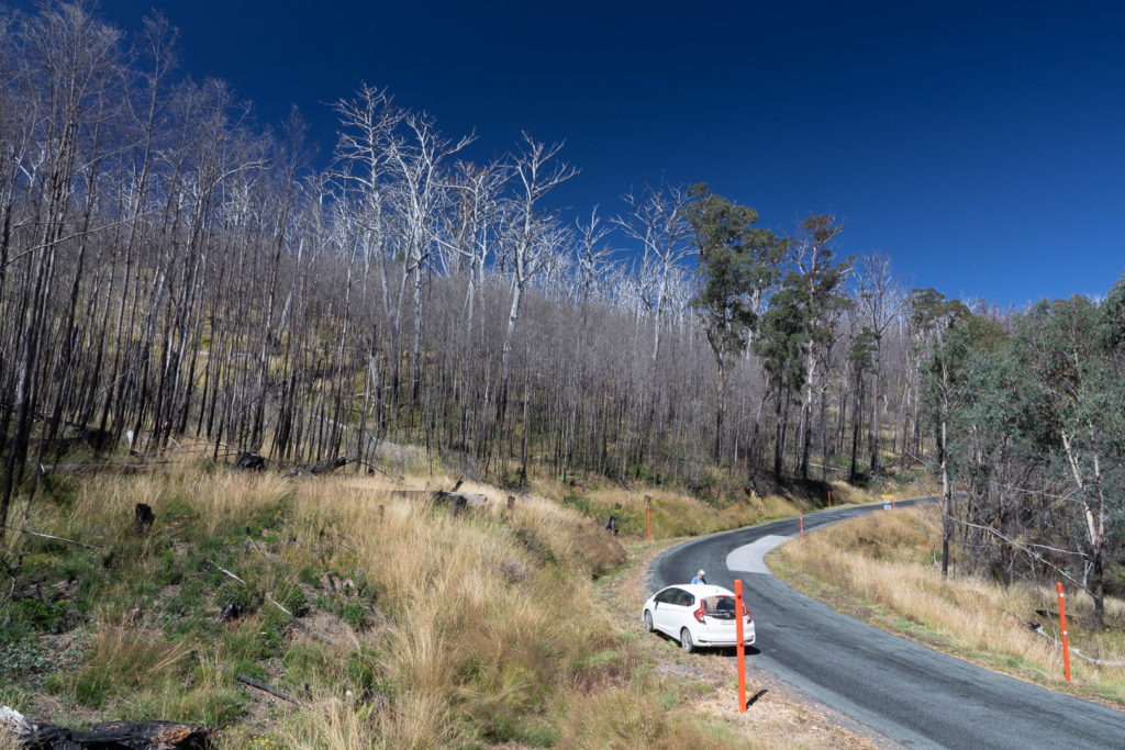
2023-10-02 Fairplay – Salida – Great Sand Dunes NP https://photos.app.goo.gl/b5DsSB7VJTgvcFAfA

2023-10-04 Great Sand Dunes to Rio Grande Forest https://photos.app.goo.gl/EGjwkC8HQ9qsuypz7

2023-10-05 Rio Grande forest to Ouray https://photos.app.goo.gl/cmGqqcQ372pSMoQz5

2023-10-06 Ouray to Mesa Verde https://photos.app.goo.gl/JJ9EjoRNwNaF798t9

2023-10-07 Mesa Verde to Monument Valley https://photos.app.goo.gl/xgviSrjLvQyL7WPP6

2023-10-08 Monument Valley to Sedona to Phoenix https://photos.app.goo.gl/q7PfgDXCQ3R3a6Ey9

2023-10-10 Seattle to Omak https://photos.app.goo.gl/cR4nLE8qFT63DFNv8

2023-10-17 From Omak to the coast via the North Cascades https://photos.app.goo.gl/rXkbMthMT51eap8i7

2023-10-20 Olympic Peninsula https://photos.app.goo.gl/BhDcD3LA1iuKD43n8

2023-10-20 Olympic peninsula, and onwards to Seattle for the flight home https://photos.app.goo.gl/QAtNdJyAik7hnQgUA