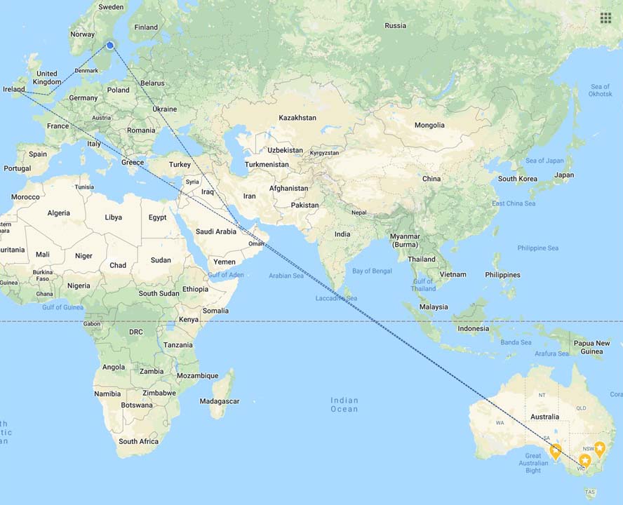
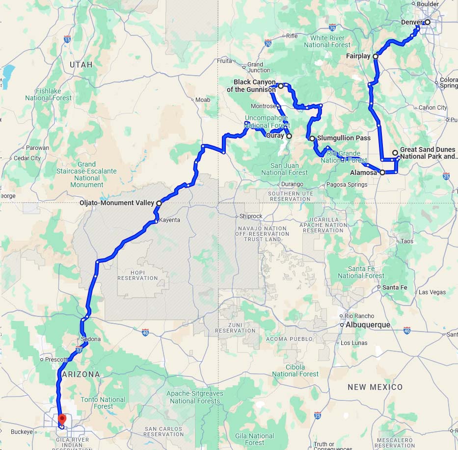
Where we are going
So here is the rough plan:
Fly to Santiago (via Auckland)
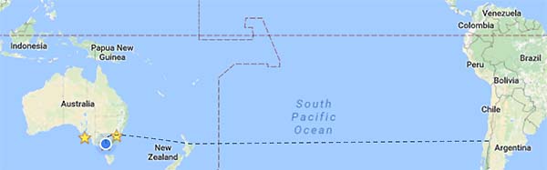
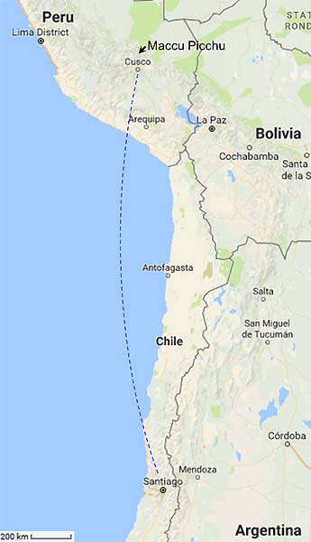
Enjoy Santiago whilst recovering, then on to Cusco and Maccu Picchu (actually I think we go to Cusco via Lima… ignore the dashed line on the map).
then back to Santiago, before returning to Australia.
2016-08-30 Melbourne to Santiago
Time to go. Up at 5am, shower, breakfast, last minute things to pack, then off to the airport. The nice lady at check-in, noting I had a 60 min connection in Sydney, re-booked me on an earlier flight to Sydney, so I had a little extra time to transit to international. Smooth sailing through the Borderforce express lane, and made it to the gate in plenty of time. On the Flight to Auckland I spend some time watching The Man Who Knew Infinity – a biographical drama of the life of the mathematician Ramachandran and his Oxford mentor Hardy. If you haven’t read i t, I recommend it (I may be a bit biassed because of my math’s background, but overall I think they did well).
 Auckland airport… 3h to kill. Time to relax according to the departure boards. Endless miles of foyers to walk to get to the transit area and back to the departure lounges areas. I noted a few odd things in the shops – for example for a mere $300 I could get 7 bottles of colostrum tablets. And there was an amazing, huge industrial robot – the sort of size you might associate with car manufacture, dedicated to getting small drawers containing people’s duty free purchases to them. Seemed rather like a sledgehammer to crack a walnut to me.
 11-odd hours of flying got us to Santiago (managed ~2 h fitful sleep). Spectacular views of the Andes as we descended. Santiago is hemmed in with mountains. It traps the air with inversions. The smog layer for which Santiago is famous were visible clearly, and today was apparently a clear day. The locals tell me that Pinochet wanted to blast through the mountains to the east, to let the smog out over Argentina, though I cannot say if this is an apocryphal story.

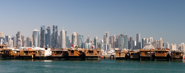
Santiago with the Andes in the background.
At the airport my bag was off quickly and there were no queues or delays so I got out in record time. The ‘free wifi’ that I had been promised turned out to be sllllooooowwwwww. It took about 5 minutes to send a text email saying I had arrived… While that happened I was accosted by “do you want a taxi” people. Then some people with Santiago airport information badges round their necks. They offered to call the number I had for Trish. It’s the housekeeper they said… the voice insisted the car had broken down so I should take a taxi. Was I suspicious? Yes I was. I thanked them for their “assistance” and waited. 5 minutes later there was Todd to pick me up. Yay, another scam averted.
We’re now settled in at Todd and Trish’s and I am about to hit the sack. Buenos Nochias.
Gallery: https://goo.gl/photos/xmymjctyvYV2d3fD9 (just a few pics… not a lot of chance for photography yet).
2016-08-31 First day in Santiago
A day of cool and overcast. Apparently not a bad smog day – we could see the CBD from 5 km away. Santiago, about the midpoint both North-South and East-West, is the only significant city in Chile and it is huge – population over 6 million sprawling over a basin surrounded by mountains. It hosts the tallest building in the southern hemisphere.
 Trish took us in to the city centre for a wander round the Museum of Precolumbian Art. Humans moved into the region from the north around 11-15,000 BCE. Through time and geography there were hundreds of groups. I confess I got lost in the timelines and instead just enjoyed the displays for the art and craft. Lovely pottery, carvings, and those amazing knotted string recording systems called quipu.

Quipu – knotted string collections used for record keeping and communication
After enjoying the museum, Trish took us on a wander through the streets, through the main square, and past innumerable buildings that she named for us. Overall my impression is of rather ‘functional’ architecture. I’m told that it is a consequence of the geography. Rather a late Spanish colonisation from the east, meant that all the opulent extravagance of the early expansion is in the East in Argentina and Brazil.
I’ve put a few more photos in a gallery at https://goo.gl/photos/83heRVaMcb4saG9D6
2016-09-01 Santiago

Historic Central Markets
We awoke (this may be an overstatement – jetlag is still rife) to a blue sky day. Porridge for breakfast. Supermarkets here seem to have no breakfast cereal that isn’t 95% sugar, or, perhaps worse, low sugar but packed with artificial sweeteners. Oats are one of the few safe options. Other odd things: like in Spain, fresh milk is hard to come by. Milk is generally only available as long-life UHT sterilised cartons; brown sugar is rare too.
After breakfast we headed down the road to the Santiago Markets (Mercado Centrale). These are one of the standard tourist destinations in Santiago. The current market was opened in 1872 in a large building featuring an impressive cast iron roof.

Santiago Markets

Santiago Markets
Then we headed over the river to the main market area that sprawls over several blocks. The fishmarket was amazing. Meat market … vegie market … flea market… looked like just about anything you would like was there.

Gran Torre Santiago – the Great Santiago Tower – the tallest in South America
We lunched on empanadas, local equivalents of cornish pasties from a stall in the market. Very tasty. By early afternoon we were starting to wane (wee hours of the morning AEST) so Trish drove us home via various scenic/character-rich suburbs, and past a local landmark the Grand Torre Santiago. This 64 story tower is the tallest building in South America, and not far short of the tallest in Melbourne (Eureka tower -has slightly higher habited floor) and Sydney (Q1 has slightly higher architectural features).

View to South from Lo Barnachea, over newly developed suburbs. Snowcapped mountains just visible above the ever-present smog layer.
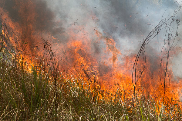
After a reviving cup of coffee Steven and I went for a stroll into the local hills. The map suggested there were some tracks into “green” areas. We wandered the streets for 40 minutes to get to the start of the marked tracks, past new housing development after new housing development. These are gated communities surrounded by walls bearing razor wire and/or electric wires, houses of 250 m2 or more … clearly for the growing middle class. I dread to think what the roads will be like here in a few years. Already Santiago’s smog notorious, especially in winter when people are using wood fires for heating. Occasionally rain clears the air for a few hours to a day. They have a range of gradings for smog ranging up to emergencias, when they close schools and restrict car use based on even/odd number plates etc.. There is a lot of traffic contributing to the smog and congestion is horrible. Yet there seems to be little sign of public transport infrastructure in these newly developing areas. No bus stops. No local shopping areas. I must find out more about what is in the pipeline. Oh and did I say … when we got to where the map showed tracks into the green area, we found a fence and gate, with bulldozers active and clearly a new suburb in the initial stages. Soon all the hills in the area will be sprawling with housing.
Just for interest I looked up the current air quality index (lower is better) for Melbourne (~10-15) and santiago (~75-85 — today was relatively good; I noticed for Valdiva down the coast from here the AQI was 275!).
More photos at https://goo.gl/photos/BbxFT8vo1DwFNanH7.
2016-09-03 Wine tour in the Casablanca valley
After a day in bed suffering from a bug, I was happy to feel up to joining everyone on a wine tour – the plan: head north west to the Casablanca valley. Wine tour/tasting at Veramonte winery, gourmet lunch at a restaurant run by Dave the South African, then on to a small, family-owned winery, Catrala, in the colder area of the valley for a tour and tasting of cold-climate wines.


Veramonte Vineyard, Casablanca Valley
The tour was run by Kylie, an expatriate Melbournian who came to Chile and set herself up in business as Chile Wine Tours. She seems to be doing a good job of it.
Chile is the 5th largest exporter of wine globally, and 9th largest producer. The wine growing regions span a huge range from around 500 km south of Santiago, up to the Atacama region 800 km north of Santiago. The wines were very interesting – somewhat different to the usual Australian wines. It was fascinating to savour a few in their native habitat, and to learn a little about the viticulture industry in this region.

Wine tasting #1, Veramonte, a large winery.

Winetasting #2, Catrala, a small, family run winery.
More photos: https://goo.gl/photos/YUMjMvdDmFPdkmGK7
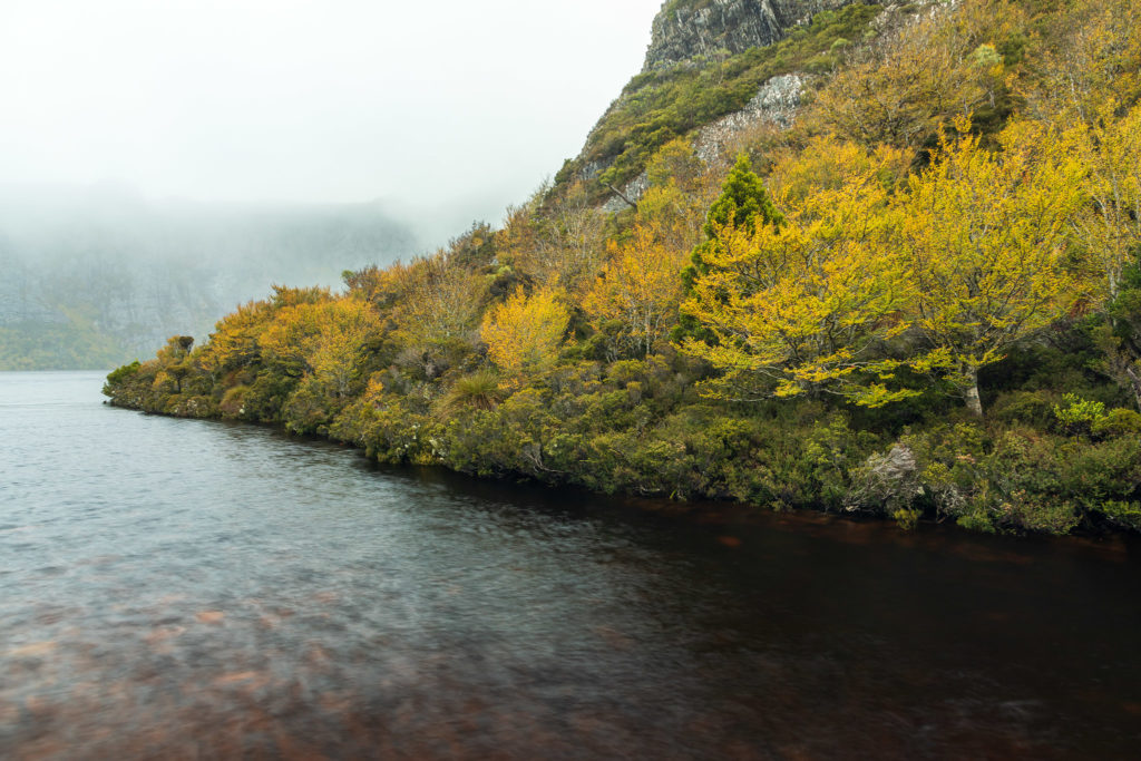
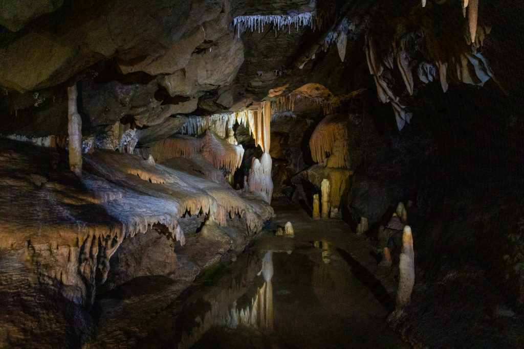
2016-09-05 Pucon and Huerquehue National Park
 Pucon, on the banks of Lake Villaricca is very scenic. The conical, snow covered Vulcan Villaricca a few km away is spectacular. We took a “random walk” on the way here — steven spotted a road on the map that might give us good views of the volcano over the lake. We ended up getting a guided tour of a local farmer’s fields to get to the spot the local thought gave the best views. They were, indeed, spectacular.
The next random walk was a little less successful. The load location looked suitable for wonderful views. Alas 25 km along, 3 km from the scenery, we were stopped by a gate. The end of the road was private property. Sigh.
 Accommodation was fine. $80 a night for a 2 bedroom apartment with lake views. We made do with the 6 cheap matches provided to light the gas for 3 days. And clearly there are some issues with Chilean plumbing that cannot cope with toilet paper. I tried Google but came away unenlightened.
 Wandering around Pucon town centre we heard music and ended up in a concert in the local civic hall. Lovely singing, and we were plied with a plate of cake and a glass of mulled wine. Very pleasant.


 They run tours to walk up the volcano, providing the necessary crampons, ice axe and warm gear, but it is a long long long uphill trudge. We decided it was safer and more scenic to head to the national park with the Araucaria trees and lovely lakes instead. It was very pretty. We headed up there two days in a row (ran out of time on day 1 to go everywhere and see everythin
 g).
g).
Lots more photos, as usual: https://goo.gl/photos/5ZsnBM7f2yNaCwaf9
Now back to Santiago. Today it is raining, so we did well with the fine weather whilst we were down here. We’ll revisit Salto del Laja on the way back and then I will build a post on that scenic attraction.
2016-09-04 & 8 Saltos del Lajo

Saltos del Laja
Saltos del Laja are a set of waterfalls on the Laja river. Together they are around 450 m wide, though access to the western falls is somewhat restricted – the western bank of the falls is owned by a hotel so only guests can get there.

Saltos del Laja, evening light
We arrived on Sunday evening at sunset 7:30. We were surprised to find the narrow path to the falls was wall-to wall market stalls and thronging with people. We rushed past, eager to get the last of the light on the falls. And the falls were very nice. By the time we left it was too dark to photograph the bustle at the stalls, but we planned to return on our way back to get some photos in the daylight.
In the morning we started before dawn by melting the ice from the car windshield and pottered down to the falls. They had locked the gate to the track, but we found a way through and enjoyed the dawn light on the water. After an hour or so pottering around taking photos in the cold (it gets hard to adjust the camera when you lose feeling in your frozen finger tips) we headed south towards Pucon.

Saltos del Laja; the path to the falls is fringed by small market stalls
We dropped back to Saltos del Laja on our return trip to discover the stalls were mostly closed and only a few people around. Maybe the crowds were a Sunday evening thing. Still, it was a lovely place to munch lunch and enjoy the different light to our previous post-sunset and pre-dawn sessions.
More photos: https://goo.gl/photos/PpykrfW3BQ4tqpk37
2016-09-10 Peru

Hills outside Santiago, smog in the valleys, Andes in the far distance

Busker in cafe in Ollantaytambo
We had an early start – up at 04:30 for a 5AM minibus to the airport. I had a window seat so I got views of the mountains to the east (alas, into the glare of the rising sun). Santiago-Lima, Lima-Cusco all went smoothly. Then we had a long bus trip through Cusco Rising to an altitude ~4000 m or so, then down into the Sacred Valley at about 2900m. It gets dark quickly in the mountains here. We enjoyed sunset at 6PM as the bus descended. After dumping bags at our accommodation in Ollantaytambo, we dined at a local eatery. I tried Alpaca steaks, which were very tasty, if a little salty, serenaded by a busker with guitar and pan-pipes.
No gallery for this post. Pics with my phone camera are not worth high res.
2016-09-10 Peru-Ollantaytambo
Ollantay Tambo is a town down in the Sacred Valley on the banks of the Urumbamba river. It’s a railway town where one can catch the Machu Piccu train, and also has its own Inca ruins.

Ollantaytambo from the archaeological site

Stall near Ollantaytambo Station
This is a tourist town, at least in the centre and around the station. At the station there are dozens of small stalls where you can purchase water, snacks, sunblock, handicrafts and other necessities. The square around the archaological site is also full of market stalls.

Ollantaytambo – local transport
Local transport is mostly foot or 3-wheel tuk-tuks made by welding a cabin to the back of a motorbike. They bounce around the cobbled streets in a way that looks most uncomfortable, but anything wider won’t get down some of the narrower streets. The other vehicles we saw were tourist buses… by the hundreds, with special traffic police to try to resolve the endless traffic snarls.

Ollantaytambo; view down the Orumbamba river valley
Although the town seems dominated by tourism, the valley also has a lot of mixed farming, and the views from the hills show how extensive this is.
Lots more photos at https://goo.gl/photos/EALFBNjKspyvTwNZ8
Tomorrow we’re off to Machu Piccu for a couple of days. 
2016-09-12 Peru-Machu Piccu

Machu Piccu
An hour and a half downriver on the scenic railway got us to Aguas Callientes, the station/small town in the valley below Macchu Piccu. From there one can walk up 600 m cimb of steep steps or take a bus (30 minutes of severe zig-zags – we took this easy option).
Day 1: Steven and I took the track to Machu Piccu mountain that rises precipitously 600 m from the ruins. The peak is over 3000 m, so the air is rather thin for climbing. It took us quite a while. We then enjoyed the top, with

Machu Piccu Mountain – endless amusement watching selfie takers.
the spectacular views of the ruins and the

Machu Piccu, cave under the temple of the sun
surrounding mountains, and the amusement of watching the selfie crowd. Then we were told to ‘Vamos’ by the staff, so we headed down and pottered around the ruins until closing time, when we headed down to our accommodation at Aguas Callientes

Machu Piccu
Day 2: Up at 4:15 for 4:30 breakfast then out to the bus-stop just after 5am for the 5:30 first bus. There was already a queue – I counted about 300 in front of us, and by the time the first bus arrived there were 200 more behind us. We eventually got a bus at 5:50 and headed up. First, we headed up the other peak adjacent, Huayna Piccu – fortunately only 300 m vertical climb. Once again the views were fabulous. Early morning light over the mountains, and views of Machu Piccu from the other side. The climb was steep, definitely not for the acrophobic, and near the top are some Inca stairways that are near precipitous. Then down to the ruins again for a gentle potter around with the rest of our travel group.

Inca stairway

Machu Piccu from Huayna Piccu
There are lots more photos here: https://goo.gl/photos/tNbx8DfND6fAUtgB9
2016-09-14 Ollantaytambo to Cusco

Ollantaytambo taxis
We had a final morning wander round the streets of Ollantaytambo before our transport arrived, exploring more of the markets and dodging the taxis.

Ollantaytambo – market wares
Our transport was a passenger van which arrived on time. We loaded the large bags onto the roof rack and climbed in. The driver took the 7 of us via several tourist attractions and on to our accommodation in Cusco. We left at 10am, arrived around 6pm with over 100 km driving on mostly rough roads plus the sightseeing time. Total cost equated to around AU$100 – pretty good value! It’s about the same cost as a taxi from home to Tullamarine airport (~35 mins & 50 km vs 8 h & 100 km).

Housing development
The driver took us up onto the plateau on gravel roads, winding through varied environmental types. In several places we saw lots of tiny buildings in what looked like housing developments. The driver told us that people build small initially, then added more and more rooms as resources became available.

Las Salinas – salt ponds
First stop was the Maras salt mines (Las Salinas). The Inca dried the saline springs in around 300 small pools to make salt. The industry is still run by a cooperative of salt workers, but there are nearer 6000 pools now. They are spectacular. we were able to wander along narrow paths between the ponds to see how it all works. The saline water passes along many small channels, and is directed or blocked into ponds as required by the simple expedient of blocking the channel with a rock. Once full, the pond is blocked and the water dries out over days to leave behind the salt to be harvested. We have seen packets of the Maras salt in many tourist shops as well as the local supermarkets, and they also make salt carvings etc. Our hour there vanished quickly.

Moray Inca site
Next was the Inca remains at Moray. Here there are a series of terraces arranged in circular patterns to make substantial dips. Why? No-one knows, though there is speculation that this was an agricultural research place. I think they were probably filled with water and served as a swimming pool. Or perhaps it was a 3-hole inca golf course. Who knows really?

Artisan workshop
Next a trip along more gravel roads and a visit to an artisinal workshop where they make alpaca, llama, and sheep wool products. They do their own dying with natural plant and animal products, and we were treated to a demonstration of various techniques to generate the different colours. Fascinating. Then we were given an opportunity to buy goods (no pressure, but a variety of things were bought, and I am sure the driver received a commission.

Chinchero Inca site, with Catholic monastry built on Inca foundations
Then, on to the Chinchero site, where the Inca buildings were incorporated into a Francescan monastry. Some interesting architecture. And, as usual, endless sellers of artisinal goods – scarves, blankets, pots, carvings …. At 3800 m we were not the most energetic, so we had a quiet toddle, then headed back (slowly) to the carpark for the final leg into Cusco, and some mildly terrifyingly narrow streets. Somehow our driver managed to squeeze a van through mini-sized gaps. More soon on Cusco. In the mean time enjoy the gallery of photos at https://goo.gl/photos/E2towhSQraeikudd8
2016-09-15 Cusco

Peruvian dancers, Cusco
Cusco – 3400 m above sea level. The air was definitely thin here. It probably affected us more than the locals, but on our first day there were what we took to be traditional Peruvian dancing competitions/exhibitions in the Plaza. Lots and lots of teams – we took hundreds of photos over a couple of hours and they were still going when we left. We couldn’t follow the commentary in rapid Spanish, but the dances seemed to have some common themes – agriculture, food, and boy gets girl. All very colourful.

inca wall
We wandered around the streets, enjoying the ambience. There were lots of Inca walls with beautiful stonework, and what we presumed were Inca stones recycled by people who lacked the skills to make things fit. Street vendors were everywhere, and there were numerous artisan’s markets and streets with lots of tiny (or not so tiny) shops with all manner of things – woolen goods, wood and soapstone carvings, religious (Catholic) iconography, etc.

street vendor wares
One street seller seemed to focus on switchblades, flick-knives and knuckledusters – all illegal in Australia.
Most of the restaurants we ate in had signs in strategic locations “Zona segura en casos de sismos”, a reminder that this is a place prone to dangerous earthquakes. This was also evident in the building constructions – light weight bricks, concrete ring beams etc.

Markets
We spent some time wandering the local market – somewhat like Victoria Markets in Melbourne, but with a Peruvian flavour. Lots of colour and action.

Plaza de Armas, Cusco
As usual, there are more photos. Check out the selection in the gallery https://goo.gl/photos/vDTovP54RveoptGx9
2016-09-18 Santiago

BBQ wineglass stand
The final few days are upon us. Sunday 18th is Indpependence day in Chile, with Monday a national holiday. It celebrates Chile’s declaration of independence from Spain in 1810. Lots of flags are on show. We went to a barbecue with Trish and Todd and family with a group of other English-speakers who live in Santiago and their families. Great company, good wine, fine food, mild weather, no masses of biting insects. Altogether a very pleasant evening.

Statue of the Immaculate Conception, Santiago
Monday was a public holiday, and with little traffic on the roads for a couple of days the air was relatively clear, so we took the opportunity to visit the Parque Metropolitano de Santiago, which occupies a hill on the north side of the city centre. The peak features a large ‘statue of the immaculate conception’ (this is, after all, a deeply Catholic country) and has some good panoramic views over the city (when the smog allows). We took the funicular to the top. The air temperature peaked around 30°C so walking up was not on the agenda.

Santiago views
Afterwards we wandered back to the car through the streets of Bellavista, enjoying the plentiful street art.

Street art, Bellavista

Street art, Bellavista

Las Domenicos Artisan Markets – Insectorium
The next excursion was to the Artisan market at Los Dominicos. Fascinating place with a huge diversity of arts and crafts as well as a bonsai garden and insectorium. Lots of diversity – weaving, knitting, alpaca wool clothing, paintings, photos, pottery, jewellery, pewter work, wood and stone carving, … lots to see and do. And they had interesting coffee with a multi-layered appearance. Very clever.

Las Domenicos Artisan Markets: interesting layering of coffee.

Qing Dynasty armour, exhibition from the Forbidden City
Next day, some packing then another trip into the city for more exploration. Among other things we found an exhibition of Qing dynasty treasures from the Forbidden City.
And then it was time to finish packing and head to the airport — 25 h door to door with a 13 h time shift. Hopefully the jetlag will be easier this way round.
More photos at https://goo.gl/photos/sCcKwdd7yN5WiCX88


 All packed, off we go to the airport for a 2-month trip to Sweden. As we checked in we realised that we had planned a whole day in Bangkok en route. Both Jill and I had forgotten, and we were dressed for a Swedish winter on arrival. So, overnight to Bangkok, where we leave a bag of fleece jumpers at the left-luggage place, change some money and head on the railway towards town. It seems funding for the railway ran out before the line quite made it to town, so we had to take a second line to Victoria Monument, and then a shuttle bus to the centre. Little did we realise how many more modes of transport awaited us.
 Our visit was dominated by the death about 6 weeks earlier of the much loved king who had held the throne for 77 years. Everywhere were symbols of the sorrow at his passing. posters, kilometers of black and white cloth draping along fences, flowers, shrines … most people were wearing black. … a year of national mourning … large numbers of people are coming to Bangkok to mark their sorrow. To cater, there are free shuttle buses etc, and stalls for water and food. Many attractions, such as the national museum, temporarily have free entry. It is an amazing response.
 First stop, the National Museum where there are cultural relics, historical information, and some lovely bats roosting under the eaves. Jill bought a black t-shirt to match the current fashion.
 So off we puttered, taking in giant standing Buddha, Happy Buddha, Fashion Show (this turned out to be a tailoring factory who could turn out made to measure suits in fine cashmere wool in one day for US$200 (in reality probably half that if you are good at bartering). Then, the driver suggested that the next stop, reclining Buddha was closed to tourists until 3 and why don’t we take a boat tour for an hour. We had a boat and driver to ourselves for an hour and a quarter meandering the waterways that percolate through Bangkok. We presume the tuktuk driver got a commission that supplemented the meagre amount we paid for his services.
 The boat trip was fascinating. Bangkok is build on a delta, and chugging up the waterways we found both sides were lined with buildings build on decaying wooden posts sunk into the river bed. In many cases the buidings were lop-sided and lots appeared past redemption and were uninhabited and decaying away.
 The reclining Buddha is vast – 15 m high and 40 m long, nicely gilded. It is in part of the Wat Pho Buddhist temple complex, which itself is huge. We wandered around there for a couple of hours, awed by the intricate decorations, elaborate structures, bonsai trees, temple cats, and Buddha’s everywhere.

 Unsure how to get back to the shuttle bus we enquired with some local official looking people who, once the understood what we wanted, they promptly flagged a passing motorbike – apparently part of the free services, where the two of us crowded on behind the driver for a “thrilling” ride up the road to … well we weren’t sure where to go from the drop-off to get to the shuttle. Standing on the footpath looking lost, however, brought assistance. A nice Thai lady enquired if we needed assistance, and took us from where we were about a km down the roads to the shuttle bus, ensured we got the right shuttle bus to the Victoria Monument station, and then showed us the right place to find the railway. It turned out she was employed to assist, another part of the free services. She was fluent in English, and, it turned out, Swedish too. She had married a Swede and had lived some time in Sweden so Jill and she had a good natter in Swedish.
 Rail to the airport was uneventful but sardine-like – rush hour again and the airport line serves city to suburbs too. In to the airport, retrieve the left baggage, in though immigration (very slow) and then a few hours catching up on rest and cool before our flight.


 A ga
A ga


 After that we were bussed to a small village where a farmer posed with cattle on an old stone arch bridge. I thought the farmer and beast were not too exciting, but it was interesting to watch the locals go about their daily work.
 Afterwards, we drove on to the town of Yangsuo where our hotel was located. We had a couple of hours free to sleep/sightsee as the whim took us. As it was stinking hot I had a short circuit of the town (a thriving tourist town) before taking a shower and siesta. We then had a quick tour of the local market – lots if fascinating things for sale – one section included crates with what looked like cane toads in small mesh bags. Yum!
 As usual, there are more photos in a gallery at:


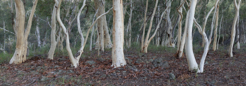
 We took advantage of the forecast sunny weather to head south to Pemberton to explore the Jarrah/Marri/Karri forests. Though we were supposed to have sunny weather it remained mostly overcast, but it was dry so we didn’t complain. Just out of Manjimup is the “diamond tree”. This is a huge Karri with a tree-house at the top. There are a series of these made by the foresters as fire-lookout points. Access to the top is via a ladder of spikes that spirals slowly around the trunk. We clambered up 55 metres to the top, but, sadly, the trees have grown up around so the views were probably less extensive than when it was when the lookout was established. Heading south through Pemberton we visited Gloucester National Park. It too has a tree-lookout, though we didn’t climb it. Instead we wandered round the local circuit walks enjoying the prolific floral displays.
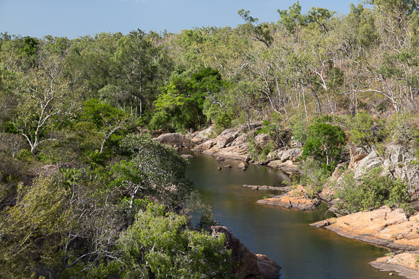
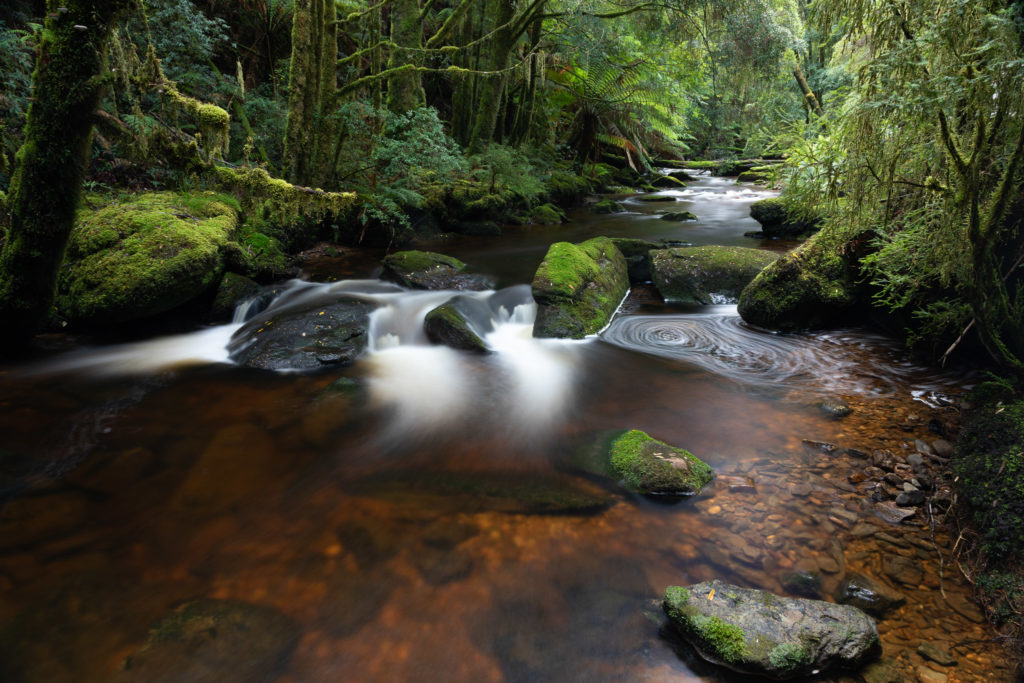
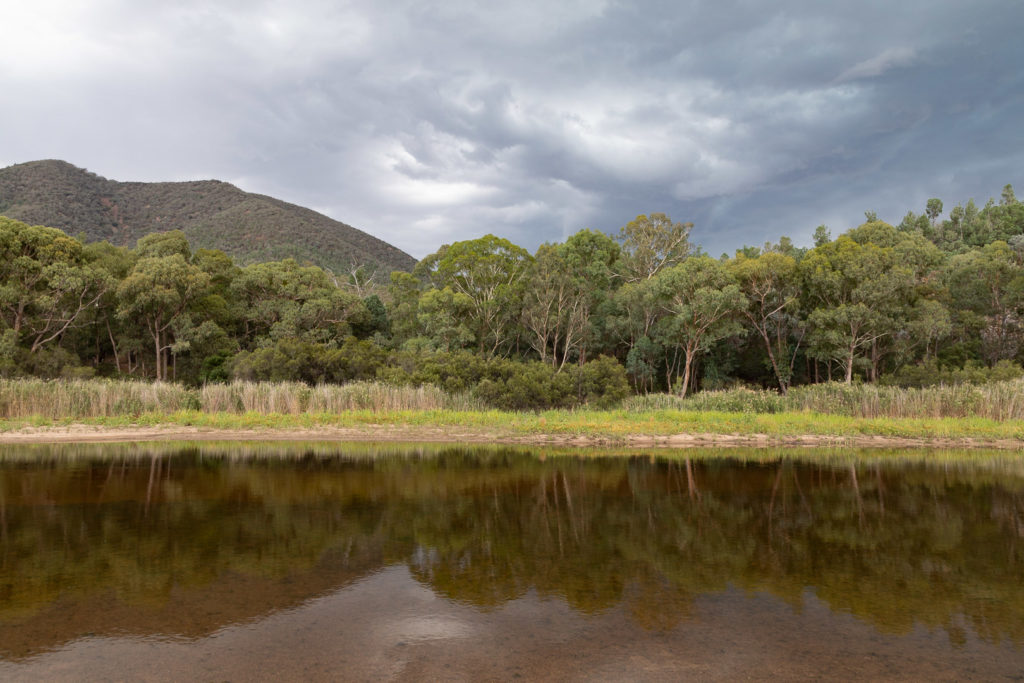
 The Warren river National Park was very pleasant, with lovely forests and nice river views. Heading home we stopped at The Cascades. Hardly the most spectacular waterfall we have seen, but quietly pretty.


 With a weather forecast promising dry and sunny, we decided to venture further afield. The Cape to Cape is one of the more famous walks in WA, covering about 120 km and boasting some spectacular coastal scenery.
 Cape Naturaliste has a lighthouse that serves as a navigational guide along that very hazardous shoreline, and we took a lovely walk through wildflowers – lots and lots of wildflowers – to a whale lookout were we spend a while watching even more humpbacks in their annual migration.
 We then headed south dropping in to Canal Rocks, and to Ellendale historic homestead (closed for maintenance so we only saw the outside). A km up the track is a small grotto where a spring pours out of a limestone cave. The nearby waterfall, we were advised by the warden, no longer flows. Apparently in this limestone country streams appear and disappear unpredictably.
 We camped the night at the Conto Road campsite at Cape Fitzgerald. Here the coastline is dominated by outcrops of hard gneiss rock pounded by large swells from the Southern Ocean. Very spectacular.


 Today we headed back to Cape Naturaliste. It was a good chance to show Viola and Phillip some whales and some different vegetation before they headed back to Perth.


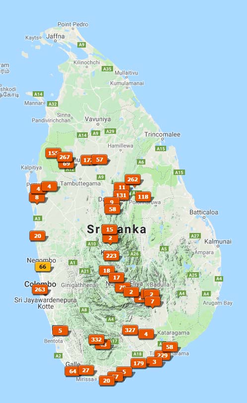
 We used Dazzling Tours, and highly recommend them. They provided sound advice, a car and chauffeur (Nalaka, who was fantastic), picked us up at the airport when we arrived, dropped us at the airport at the end, and made sure everything in between was smooth and stress-free.


