2016-11-14 to 2016-11-19 Townsville

Part 1

Full moon on the Townsville foreshore, preceding the coral spawning

Full moon on the Townsville foreshore, preceding the coral spawning

Well here we are in sunny North Queensland. daytime temperatures around 30 in the shade, and nights dropping to mid-20s overnight. Basically it is HOT. We are staying initially in Townsville with our friend Damien (we spent our first evening on the foreshore admiring the huge full moon whilst munching cheese and dips. Very relaxing), then heading down the coast to AIMS (Australian Institute of Marine Science, where we will be part of a team studying coral spawning for the few days when this happens).

Townsville foreshore. Stinger season - nothe the no swimming sign.

Townsville foreshore. Stinger season – note the the no swimming sign.

Strolling round Townsville we were struck by the lack of crowds. This is not a tourist mecca. Sure, there are a few tourists about, but this is not the Gold Coast nor Cairns, where the whole economy seems to revolve around the visitors. We wandered along “the strand”, a slender park along the waterfront. Marine stingers of various types are prevalent in summer, so swimming has to be restricted to protected areas with nets or filtered water to exclude them.

Townsville seafront from the point - swimming area and port area in the background

Townsville seafront from the point – swimming area and port area in the background

The north end of the Strand is Kissing Point Fort (established on the rocky headland around 1891 as part of the coastal defense of the time, and expanded in the 1940s as strategic fortification to protect the coral sea). There are lots of historical plaques and displays on the interesting history.

At the south end of the Strand is the aquarium and the Museum of Tropical Queensland. We visited the latter. They have some lovely displays – shipwrecks (the Pandora), dinosaur fossils, coral and other natural history, and a history of Townsville (150 years), and all without great crowds of tourists. 🙂

Fossil plesiosaur (detail of eye) in museum

Fossil plesiosaur (detail of eye) in museum

Displays in museum

Displays in museum


Next day we headed North for an hour or so to the Paluma area, the southernmost part of the strip of North Queensland Rainforest. We had a quick look at Crystal Creek, a popular waterhole area in hot weather. then up along 18 km of narrow winding road to Paluma. At 1000 m, it was a relief – temperatures in the low 20s. We enjoyed a few short rainforest walks and explored the township.

Paluma ranges
Paluma ranges
Paluma ranges
Paluma ranges
Paluma ranges
Paluma ranges
Paluma ranges
Crystal Creek Waterholes
previous arrow
next arrow
Paluma ranges
Paluma ranges
Paluma ranges
Paluma ranges
Paluma ranges
Paluma ranges
Paluma ranges
Crystal Creek Waterholes
previous arrow
next arrow

In the morning we visited James Cook Uni, which turns out to be about 10 km out of town. They have some impressive facilities for animal research there. They have one of the few veterinary courses, a medical school, and so on.

AIMS facilities

AIMS facilities

With time flying we then headed around the coast to AIMS, in time for our laboratory inductions and paperwork needed to get our access passes. They have a fantastic setup. Huge areas of aquaria. An amazing system for water treatment – filtration, salinity regulation, temperature regulation – all controlled by a high tech computerised system that would not be out of place in a chemical factory. And everything is duplicated so if any part breaks it switches over the the alternative to keep everything running while repairs are made. They process and use 1.5 million litres of water every day, which gives you some idea of the the scale of the system.

Coral gamete bundles rising to the surface after spawning

Coral gamete bundles rising to the surface after spawning

The coral spawning studies required a team of 8 AIMS staff to charter a boat out to the middle reef for several days where they collected colonies that were starting to set eggs. These were brought back and placed in aquaria in time for the right timing of full moon/tide/whatever. Each species has its own rhythm, starting spawning 4 or more days after the full moon at a specific time of night. They can generally predict within a day or 2 when each will spawn, but to some extent it is a waiting game.


Colonies are placed in small tanks

Collecting coral gamete bundles

Collecting coral gamete bundles

where researchers like us could collect the spawn for various experiments.It gets busy at times. This is all done under dim red lights. Rather a challenge for photography. We were collecting for cryopreservation so we got the samples from whichever species were available and headed to our makeshift lab to process them. Fortunately we could do the processing under normal lights.

g5d35471g5d35523


So far we have had a relatively calm start – only a few spawning at a time. The guess is that tonight it will start to get hectic with all hands on deck as multiple colonies of multiple species all start to spawn over the span of a few hours. I expect tonight we will be working into the wee hours. Luckily it is interesting stuff. The hours will fly by.

I’ll add more posts later. Here is a gallery of images from this trip so far:

https://goo.gl/photos/2mFXoy12VtMCR95Z7

Part 2 2016-11-20 to 2016-11-24

2016-11-20_img-3605-3612-stack-3605New moon + 6 days. Different coral species spawn at different times after sunset – predictably within about plus or minus 30 minutes, and at different days after the full moon. There is also variation between individual coral colonies (made up of thousands of genetically identical polyps, formed by budding from the original founder), so different individuals of each species may spawn a day or two apart, so each night we get a different range of

Cryo-Lab setup at AIMS

Cryo-Lab setup at AIMS

corals spawning through the dusk to midnight period. The staggered spawning times is a blessing since we can then process the early spawners whilst waiting for the later spawners. Even then it gets hectic as we may have half a dozen individuals spawning in quick succession.

In between the lab work we have a little free time. I spent a couple of hours this afternoon exploring the local environs.

2016-11-21_g5d35664The local beach features lots of turtle tracks, so I took great care not to step on any nests with buried eggs. At the end of the beach is a granite promontory which I clambered up onto. Walking on the leveller bits of granite outcrop was pleasant. The nasty spikey grass in between the outcrops was decidely unpleasant. But the scenery was rather nice, and the white breasted sea eagle soaring above my head was a bonus. They are really spectacular birds. After an hour or so I was drenched with sweat (a problem with 30+ temperatures and unshaded sun), so I headed back for a cool shower.


2016-11-21_g5d356882016-11-21_g5d35717


2016-11-21_g5d357272016-11-21_g5d35726


wildfire beside road

wild fire beside road

23/11/16. Today Jill is feeling a little more energetic, so we headed off for a little adventure in the local National Park. 3 km down the road we discovered a wildfire, clearly just started – a few square metres when we reached it. By the time we’d stopped and backed up it was spread along about 10 m. I snapped a few photos – by then it was growing rapidly, so we headed back to AIMS to alert the reception who could contact the fire authorities. By the time we got back, en route to the park, the fire was well established and growing fast in the robust breeze.

2016-11-23_g5d35938Onwards to Bowling Green Bay National Park: it is actually fairly large – 554 sq km, spreading from the coast to Mt Elliot and Saddle Mt, and incorporating some RAMSAR wetlands. Exploring these RAMSAR wetlands, however, might be problematical – Crocodile Creek and Alligator Creek indicate the sorts if dangers for the unwary ornithologist.

2016-11-23_img_3724We judiciously went towards the mountains and the headwaters of Alligator Creek. This is a very pretty area. We’re at the end of the dry season so water flow is almost down to nothing, but there are still lots of waterholes. We enjoyed watching turtles, nesting fish defending their territories and lovely woodlands. We took ourselves up the track to Cockatoo Ck, which proved a physically taxing walk with temperatures around 30°C and reasonably humid. We had swim in the waterhole there (alas, somewhat algal and warm, but refreshing nonetheless) then headed back, enjoying sights of blue winged kookaburras and so on.

Back down on the flats, in the acreage properties there are various places offering buckets of mangoes at $10. Clearly money grows on trees here 🙂

On the way back, there was a fire crew working on the fire, now covering several hectares. Hopefully our alert helped them get there promptly and minimise the problems.

gamete bundle emission bottom right

gamete bundle emission bottom right

Dinner, then back to the lab. Lots of coral spawning; lots of sperm freezing, but we were still in bed by 1am so not too bad. And as a special bonus I got a photo with a coral spitting out a gamete bundle. It’s a pity that I don’t have the specialist lenses or access to the coral at the peak of spawning to get good shots.

coral gamete bundle breakdown

coral gamete bundle breakdown

In case you are wondering what we are spending our nights doing, we are contributing to the development of a “frozen zoo” with different species of coral. So we wait for the coral to spawn, releasing gamete bundles. These coral are hermaphrodites – each polyp makes sperm and egg. These are released as a gamete bundle, that rises to the surface, and then, over time, the bundles break down, releasing the sperm and egg. They have ways of preventing self-fertilisation, so the sperm need to find eggs from a different individual, hence the need for synchronised spawning. Once the gamete bundles have broken down we can suck up the sperm from the bottom of the tube (the eggs go to other groups), and freeze the sperm in liquid nitrogen.

Jill and Mike doing science

Jill and Mike doing science

24/11/16 Back to the lab for the morning.  Lots of interesting activity. Coral have algae called Symbiodynium living inside them. These algae get protection from the coral, and in return, being photosynthetic, generate nutrient for the coral. When the coral get too hot they spit out the algae as part of their stress response – this is the coral bleaching that is increasingly a problem in the Great Barrier Reef (and elsewhere round the globe).These algae were being cryopreserved as part of the whole project.

Coral planula larvae, each about 1 mm long, and 4 days after fertilisation.

Coral planula larvae, each about 1 mm long, and 4 days after fertilisation.

Also there were some larvae – teeny tiny larvae about 1 mm long, about 4 days after fertilisation. These will shortly undergo transformation and settlement.


Bowerbird bower, AIMS

Bowerbird bower, AIMS

A hidden advantage of hauling around large cameras with imposing lenses is people think you are a photographer and point you to scenic places. One of the cleaning staff kindly took us to see a great bowerbird bower tucked away under bushes in a corner of the AIMS facility. The bird had acquired a fascinating collection of “trinkets” including roofing screws and laboratory vials. I wish the bird had been present and displaying, but we cannot have everything.

Time to dash to the lab for the night spawning. More later. I’ve added more photos to the trip gallery so scroll down to see the new ones: https://goo.gl/photos/2mFXoy12VtMCR95Z7

Part 3

coral spawning

Coral spawning.

GFP colours

Green fluorescent protein colours in blue light. When I used a flash this beastie was just a uniform dull brown blob

24/11/12 Evening. There were now early coral spawning today, so I got a chance to get a few images of coral at night. One of the staff pointed me to a tank where I could use a white light… much easier, but still a challenge. The coral polyps are tiny and getting sufficient depth of field is hard. The air-glass-water interface of the tank introduces substantial chromatic and other optical aberrations. Oh for a nice rod lens that I can poke into the water and get clear shots from really close up.

Linkia (blue linkia) starfish - part of an arm.

Linkia (blue linkia) starfish – part of an arm.


25/11/16 I had a little free time so I took photos of some of the creatures in the aquaria at AIMS (above). There are lots and lots of nice things to see. And at sunset I headed up to the top of the hill behind the house for some sunset shots.gs-2016-11-25-20161125_191337

gecko outside the insect screened verandah

gecko outside the insect screened verandah

After dark we enjoyed watching the geckos feeding on moths attracted to the lights of the house.

Kingfisher, Cape Pallarendra Conservation Park, Townsville

Kingfisher, Cape Pallarendra Conservation Park, Townsville

26/11/2016 Time to pack for our evening flight. We took the opportunity to visit Cape Pallarendra Conservation Park just outside Townsville, literally only 15 mins from the centre of town. We saw a lovely kingfisher, an osprey fishing, WW2 coastal bunkers and observation posts and nice beaches.

Osprey, Cape Pallarendra Conservation Park, Townsville

Osprey, Cape Pallarendra Conservation Park, Townsville


Final observations on Townsville: They have amazingly slow traffic lights. If you want to get anywhere fast, avoid the main roads with lights – take the back streets. The weather when we were there was relatively pleasant – 32 daytime and 26 overnight minimum; not too bad, but draining to do anything energetic, especially out in the full sun. Multiple showers per day helped. A lot of the year the temperatures are higher and come with high humidity and correspondingly high discomfort levels. Apparently we were very lucky with the weather. Of course, when it is hot, it might be nice to swim in the sea. Alas, for half the year there are marine stingers that make swimming hazardous. And swimming on remote beaches also comes with the risk of crocodiles. The advice is not to walk along the water’s edge. The city is dominated by Castle Hill, a rugged granite monolith that rises about 280 m from the city, dominating the skyline. We drove up just before sunset and discovered the road was full of people in lycra. We thought it must be a fun-run, but it seems that many of the locals take a daily jog to the top. We were surprised.

Overall we had a fantastic time. Townsville is a great place to visit, and the AIMS research centre was amazing.

I’ve added more photos to the trip gallery so scroll down to see the new ones: https://goo.gl/photos/2mFXoy12VtMCR95Z7

And here is a short video of the coral spawning. Some of it is rather shakey – hand-held because I couldn’t get a tripod in place, and at high magnification, but it gives you an idea of what we could see in a more dynamic way than the still photos. Note that youtube may offer you the video at reduced resolution so if you play at full screen size, select the 1080p under quality within the settings dialogue (the cogwheel at the bottom right when you mouse over the video)

Stay tuned… we’re off to Sweden tomorrow. 🙂


2017 Aug-Sept – Brisbane, USA (Eclipse) and Costa Rica

Brisbane, USA and Costa Rica

Off soon.Just a quick starter page until we get there.

First stop Brisbane to visit friends and relatives, and a conference in Kingscliff to celebrate Marilyn Renfree’s 70th year.

Then on to the USA to visit Jill’s cousin Anita and family near the Grand Tetons National Park. The path of a total solar eclipse goes near on 21 Aug.


The eclipse should be fantastic (assuming the skies are clear etc). Here is an image I took of the eclipse in 2012 North of Cairns.

Just after start of totality, flares are visible in the corona round the lower arc of the moon’s edge. Totality lasted just over 2 minutes, but it seemed like just seconds!

Steven and Judy catch up with us in Salt Lake City for the drive north, and eclipse viewing.

After the eclipse we head to Costa Rica for a month (the first 2 weeks with Steven and Judy). Rainforests, cloud forests, beaches, birds (avian) and other wildlife (animal) and volcanoes and rivers and ….. we will have fun.


Gold Coast area.

We’re on our way. Up at 3:15 am for the 4 am taxi to the airport for the Brisbane flight, then down to the Gold Coast.

Southport beach

We enjoyed strolls along the beach. One man had an Eclectus parrot on his shoulder… apparently it goes everywhere with him. He happily shared…


Lunchtime was approaching and we noticed a sign offering $7 fish and chips, so we gave them a go. That place has to be the best Fish and Chippery on the coast – a huge and tasty Dory fillet and crispy chips the way Jill likes them.

In search of wrapping paper we explored the Pacific Fair shopping centre. It is HUGE! Alas, nice gift wrapping paper was hard to find and we traversed the whole length and breadth before we got something usable. They did have some artistic seats though.

We travelled on, to Burleigh Heads, with nice views, including sightings of whales breeching out to sea. Sadly, by the time I had got my camera organised I was too late for photos.

Then to Richard and Liz’s, where we enjoyed a couple of days of their wonderful hospitality, fine food, conversation and a lovely ambience. Jill enjoyed feeding the local kookaburras, butcher birds and magpies.

On our first day there we headed to Binna Burra and took the Davies creek circuit out to the edge of the scarp. It is a lovely walk,


but the rainforest there was as dry as we have ever seen it. Next day we took a relaxed wander round to Natural Bridge (or Natural Arch as it once was called). It is a very pretty area with lots of walks in the rainforest and along the creeks.

The next day we headed off to the conference at Kingscliff, via Mt Warning. The Mt Warning summit track climbs about 700 m through forest, to the peak with extensive views in all directions. Unfortunately the weather was fairly hazy that day. We’ll just have to come back on a clearer day. We did enjoy the bandicoot under the lookout at the top.


Kingscliff Beach – dawn

Our “Reproduction Down Under 2017” conference ran through Saturday, Sunday and Monday morning, and went well. We had around 70 delegates, many international, and the diversity and quality of their presentations was fabulous. We also indulged in some dawn walks along the beach. Most pleasant.

Post-conference, a drive to Brisbane for a bit of sightseeing and re-packing for the international flight on Weds.

Brisbane: we enjoyed a pleasant stay with Viola and her son Phillip. A day wandering around Mt Coot-Tha was very relaxing and a good prelude to today’s flight BNE-LAX-SLC then a 3 -4 h drive. The forest there was dry as could be. Not a trickle coming over Slaughters “Falls”. But it was pleasant in the woodland and the walk was enjoyable. After a good night’s sleep we headed early to the airport to make sure we missed the morning rush hour… It was only after that we realised it was a public holiday so we could probably have had a longer sleep in. Not that we would have slept. Better go before the battery fails.

As usual, I have made a gallery of photos at https://goo.gl/photos/TrswjPPDRFg2o3Vz6. Enjoy.


2018-10-11 Perth

We arrived in Perth at dusk, collected our rental car and headed to Clare and Garry’s for a good chin-wag and a good night’s sleep. We spent the morning in a stroll to the local lake through the bushland (lots of wildflowers – spoiler alert – this will be a recurring theme). Perth is deservedly renown for the spring wildflowers. The timing varies a bit from year to year, and from North to South, but we seem to have hit a good spot with abundant flowers.

After lunch we headed to Kings Park, a highlight for the Perth visitor. Kings Park was established way back, and has a wonderfully diverse flora, and hosts the Botanic Gardens with a splendid collection. It’s changed over the years. This visit we found an area designed to interest children, with lots of twisty paths to several intricate elevated tunnel complexes made of triangular metal plates and tubes.

After a few hours there we decided it was time to head south to Clare and Garry’s country house in Balingup, our base for the next couple of weeks.

I’ve put a gallery of photos online at https://photos.app.goo.gl/g3aTE5Y8Myp7Mh4m6


2018-10-15 Pemberton

We took advantage of the forecast sunny weather to head south to Pemberton to explore the Jarrah/Marri/Karri forests. Though we were supposed to have sunny weather it remained mostly overcast, but it was dry so we didn’t complain. Just out of Manjimup is the “diamond tree”. This is a huge Karri with a tree-house at the top. There are a series of these made by the foresters as fire-lookout points. Access to the top is via a ladder of spikes that spirals slowly around the trunk. We clambered up 55 metres to the top, but, sadly, the trees have grown up around so the views were probably less extensive than when it was when the lookout was established. Heading south through Pemberton we visited Gloucester National Park. It too has a tree-lookout, though we didn’t climb it. Instead we wandered round the local circuit walks enjoying the prolific floral displays.

The Warren river National Park was very pleasant, with lovely forests and nice river views. Heading home we stopped at The Cascades. Hardly the most spectacular waterfall we have seen, but quietly pretty.

I’ve loaded more photos into an album at https://photos.app.goo.gl/sQTyQnoS44DJLJ3M9

2018-10-13 Balingup

Clare and Garry’s country seat in Balingup is a lovely house high on the hillside, with views over the township and valley. Free internet is just 5 minutes walk down to the Balingup Visitor’s Centre (Ok it is 10 minutes coming back up the hill, but exercise is good 😊). Alas, I have forgotten a crucial bit of computer gear, so I cannot directly download files from my camera chips to my computer. I worked out a couple of roundabout ways, slow and tedious, involving the other computer and wireless hotspots. Not clever. I must make sure I don’t forget next time.

Balingup is a pleasant town through which the Bibbulmun track passes. It has a petrol station and a few shops including a small general store, and a tavern down the side road for those so inclined. A couple of km south along the track is the Golden Valley Arboretum that boasts 1000 trees including 400 species. A couple of km north is the Racecourse Flora Reserve. Given the current rainy, overcast weather, we have enjoyed these local sights and spend some time with cameras snapping the flowers.

For more photos go to https://photos.app.goo.gl/p5NHKUERxGrVoycs8


2018-10-16 Cape Naturaliste to Cape Leeuwin

The day started with mist in the valley below us, and a clear blue sky.With a weather forecast promising dry and sunny, we decided to venture further afield. The Cape to Cape is one of the more famous walks in WA, covering about 120 km and boasting some spectacular coastal scenery.

We first headed up through Dunsborough to Cape Naturaliste, with some gentle coastal walks around Meelup Beach. Off the coast there we were delighted to see whales. Lots and lots of humpback whales. Some pods were waaaay off shore, but some were close enough to see more than a speck of spume when they blew. Unfortunately my shutter finger was a little slow – by the time we’d noticed a whale breaching, aimed and focused, the show was over. Sigh. Luckily fin waves and tail slaps were more prolonged so I got a couple of those.

Cape Naturaliste has a lighthouse that serves as a navigational guide along that very hazardous shoreline, and we took a lovely walk through wildflowers – lots and lots of wildflowers – to a whale lookout were we spend a while watching even more humpbacks in their annual migration.

We then headed south dropping in to Canal Rocks, and to Ellendale historic homestead (closed for maintenance so we only saw the outside). A km up the track is a small grotto where a spring pours out of a limestone cave. The nearby waterfall, we were advised by the warden, no longer flows. Apparently in this limestone country streams appear and disappear unpredictably.

We camped the night at the Conto Road campsite at Cape Fitzgerald. Here the coastline is dominated by outcrops of hard gneiss rock pounded by large swells from the Southern Ocean. Very spectacular.

In the morning we spent an hour or so on the rocks admiring the pounding surf before heading south again.


Our route south took us through the Booranup Karri Forest. The forest here is dominated by 100 year old Karri. Some of the trees were huge. We took a walk for a few km into the woods following a track which we discovered later was the route for a Cape to Cape mountain bike race to be run the following day with 1200 competitors.

By lunchtime we headed down to Augusta, munching a pie at the local bakery before the final stretch to Cape Leeuwin. This cape is a low, windswept rocky promontory with a lighthouse to guide ships round the rocky reefs.

Our return trip took us via the Donovan St Bushland Reserve 2 km north of Augusta where we spent an hour or so finding orchids and other wildflowers. All very very nice.

Then it was time to head back to Balingup.

As usual there is a gallery with lots of nice photos (at least I think they are nice) at https://photos.app.goo.gl/8CqUvNbMtFRVPFLv8

2018-10-18 Balingup, Greenbushes and environs

Friday: According to the track notes, there is a rare stand of wandoo trees a couple of km north, along the Bibbulmun track, so we headed out to find them. We drove to where the road crosses the track to save ourselves a slog through town. The forest here is full of wildflowers. We even found a small patch of kangaroo-paws. We recall them as being common in the bushland round Perth back in our Uni days, but they seem rare now outside gardens. We pottered along photographing orchids and other gems, found the wandoo (not a huge stand of trees that we could see, but pretty), then headed back to the car.

After perusing the map we decided to head east to the Grimshaw-Greenbushes road and thence to Greenbushes.

Greenbushes is a community about 10 km south of Balingup. It has long been a mining town. In the late 1880s tin was discovered and alluvial tin mining commenced. A contaminant of the tin ore was tantalite. In the 1940s commercial uses for tantalum were established and the tantalite from Greenbushes was sent to international markets (among other uses tantalum is used in electronic components, notably capacitors and some resistors, and in steel alloys for a variety of uses). Later Spodumene – a lithium containing mineral, was identified. Nowadays Tantalum and Lithium are the major products of the ongoing open cut and underground mining operations.

Around Greenbushes the mining company has invested heavily in rehabilitation of the old alluvial tin mining works, and there are extensive tracks through the bush and around various dams. Despite the signs proclaiming the value of the dams for waterbirds, we saw not a dicky bird. But we did find lots of wildflowers to photograph so we were happy.

On Saturday Viola, an old school friend of Jill’s, and her son Phillip came by – by chance they are in south-west WA at the same time as we are. It was great to catch up and we have spent the afternoon and Sunday exploring the local bushland again and finding lots more to photograph.

The local Balingup community put on a festival at the local arboretum, with band etc on Saturday afternoon. Alas, with the showery weather there were few people there. Apparently last year it was sunny, and there was a crowd filling the park with picnic rugs covering the slope and festivities late into the night. We feel sorry for the organisers. We left the paltry crowd and explored the arboretum instead (until it started to rain again).

Since the bush around here is full of wildflowers we happily spent Sunday meandering along in the forest with our cameras. Orchids are abundant, though we are having trouble putting specific names to some of them. There are so many sorts of spider orchids etc. However that does not stop us having fun taking their photos. Besides the orchids there are lots more. I am giving my macro lens a thorough workout.

You can see the results of my photographic efforts at https://photos.app.goo.gl/qaABbLqnD61EVJow9

2018-10-22 Cape Naturaliste

Today we headed back to Cape Naturaliste. It was a good chance to show Viola and Phillip some whales and some different vegetation before they headed back to Perth.

With good fortune the forecast rain held off, and we had a very nice day wandering along with our cameras finding beautiful blooms.

Although there were lots of whales, mostly they were far offshore. I think I managed to photograph a Blue Whale – long smooth back with a tiny fin way back from the head. See what you think of the photo (enlarged version in the gallery).

More photos in the gallery at https://photos.app.goo.gl/8TyFeoCAa6ZXfHst7


2018-10-23 Balingup & Bubbulmun Track

Today is a rest day. I took the afternoon to explore part of the Bibbulmun track to the North of town. Heading along the valley bottom it is clear that there are lots of dead and dying trees along the stream. This seems to be a common phenomenon around this corner of Australia.

As I headed up the hill beside the pine plantation I found a very obliging bobtail lizard. Rather than run away, it hung around, happy to hiss and wave its tongue at me. Actually it only opened it’s mouth if I held my hand over it, which made getting photos a bit of a challenge – my arms were not quite long enough to wave over the lizard whilst simultaneously holding the camera to frame the lizard. I did my best.

Further up the slope I found a shiny beetle.


By the time I reached the plateau, wandered the track for a couple of km and photographed some ferns and some Drossera (sundew) it was time to head home.


As usual there are larger photos in a gallery at https://photos.app.goo.gl/5N8emGiyvppreGd8A

2018-10-24 Stirling Ranges, Denmark and the Southern Forests

We packed our tent and headed out early, driving east en route to the Stirling Ranges for a couple of days in the bush.

As usual we got distracted by nature parks on the way. Winejup Reserve wasn’t too exciting, but Farrar nature reserve just outside Kojonup had some nice open forest with lots of wildflowers.

The lady in the Kojonup visitor centre directed us to the Myrtle Benn Flora and Fauna Reserve just on the edge of town. This was named for a progressive teacher who used the area as an outdoor classroom through the 1960s. Here we found an abundance of wildflowers including some very pretty kangaroo paws (Jill was complaining about the paucity of kangaroo paws in our travels to then and was very happy to find some here).

Then onwards down the Albany Highway to Cranbrook where we detoured through more flora reserves. As we drove on, we started to find large ants running across the dashboard – more and more – I finally found a nest of them in a fold of my trousers where I had folded them into my socks, and in the space between my sock and the ankle space of my boot. I must have picked up some hitch hikers when I was snapping a pic of an ant nest.

After a somewhat disappointing view of the Ranges from the Sukey hill lookout (not very high, and too much vegetation for clear views) we headed east to the Stirling Ranges. This range is made of ancient metamorphosed sandstones and shales (1-2 billion years old) and thrusts up to over 1000 m peaks (not much in the global perspective, but when the surrounds are as flat as here, they do stand out.)

We took the Scenic route along Stir-ling Range Drive, a small gravel road through the centre with some nice views from vantage points along the way.

At one of our stops we were delighted to find a legless lizard pretending to be a snake. It was beautiful, and a rather uncommon find.

With our frequent stops along our route, it was close to sunset be-fore we reached the end of the road.  We snapped photos of the evening sun shining past Mt Toolbrunup, before we turned into the camping ground and set up for the evening.

Next morning we set of for a climb of Mt Toolbrunup, about 600 m climb from the car park.  Unlike last night, we could not see the peak – low cloud shrouded the slopes, but we anticipated it would burn off through the morning and we would get nice views by the time we got to the top.

The track started off gently, with woodland wildflowers, climbing through rockier areas with sandstone marked by fossil ripple marks, before hitting a steeper section of scree slope. Then steeper and steeper – the final bit was a scramble up among the rocks and cliffs surrounding the peak.

We arrived at the top to howling winds and 360 degree whiteout.  We hung around, sheltering in the lee of rocks, for a while, getting occasional breaks showing hazy mountain ranges beyond. Eventually we had sufficient breaks to give us a reasonable 360 degree view so we snapped some panoramas and headed down. Going down was slow but somewhat less tiring than heading up. By the time we reached the car we both had legs telling us we had climbed a mountain.

After a quick lunch we decided to head to the Porongorups, a smaller range just south of the Stirling ranges. We expected to find nice nature walks here, but when we got there and consulted the maps the majority of the tracks headed up to the peaks. We decided to give more mountain climbing a miss and explored some of the lower tracks where we admired some of the huge Karri trees.

From there we drove out to Mt Barker township. Another fruitful visit to a visitor centre directed us to a wildflower photo exhibition at the local sport pavilion, where we whiled away an hour enjoying the photos.

The people there directed us to a flora reserve just down the road where, we were told, some keen locals had marked various orchids with name tags. What a great idea. We pottered around there for another hour or so, finding name tags (often with orchids that were past flowering, but also many with fine blooms). We also found some unmarked orchids, so we patted ourselves on the back for our vigilance and took lots of orchid photos.

By then it was late afternoon. We consulted the maps. Alas both Googlemaps and OSMAnd indicated that we would not arrive at our intended campsite at the Warren River until 6PM which did not give us much time to dawdle en route. After a rethink we decided to detour via the Parry Beach camp site on the south coast – only an hour drive. However as we drove through Denmark we recognised the town and realised our good friend Liz lived here. So we popped in to say hello and ended up, thanks to her fabulous hospitality, staying for the night. Liz also solved one of our puzzles. Around Greenbushes we had found some strange vegetative remains that we could not work out. It turns out they were the remains of an invasive weed Watsonia. Liz was very familiar with it – she has a field infested with the plant over her back fence.From Denmark we went west along the south coast highway before cutting up into the Southern Forests. There are some lovely forests here, though we were a little depressed by the failed opportunity – most of the lookouts and attractions had minimal information boards telling of the nature. There were quite a few on the forestry history, but tales of the exploitation of the forests really did nothing for us. We’d much rather have signposts explaining the various ecological communities, telling the age/height/diameter of key trees (the big-karri, for example, has a carpark and boardwalk in its name, but no information about the tree itself!).

In the forest we drove past the Swarbrick Art Trail off the North Walpole Rd. The displays here try to capture the sense of the environmental battles that eventually resulted in the protection of many of the forests here. There is only a short walk, but the forest is nice and some of the artworks are thought provoking.

The road from there wends through some nice forest then we headed up the Western Highway to Shannon National park for a loop through more forest.

We camped the night at Shannon National Park campground. Not were we ideally would have chosen, but there wasn’t time to head on before sunset. The campsite is centred on the disused forestry camp, so the environment was far from pristine. However there were lots of Western Gray Kangaroos on the grassy areas.

After breakfast it was off to see more forests. We enjoyed the drive, marvelling at the sudden changes in vegetation – presumably changes in geology, soil, drainage, fire frequency etc.Of course we spent more time hunting orchids too. We were especially pleased to find a hammer orchid – the only one we found. There are over 400 species of orchids in the South West of WA, so we were having some problems sorting out which was which. We came across two very nice collations of orchid photos and identifiers http://orchidswa.com.au/ and https://chookman.id.au/wp_orchids/. If you need to identify any orchids, especially from WA, these are great resources. I’ll be going back through my photos trying to key out which is which once I find some free time.Our return trip to Ballingup took us along the Blackwood River valley. It was clear here that the trees along the watercourse of the river and tributaries were dead or highly stressed, whilst nearby trees further up the slopes were fine. We suspect that salination following the long drought, possibly with some sulphuric acidification from muds exposed to air, have caused the problem. A book we bought in Augusta had some data on salt in the Blackwood river. It had risen from relatively fresh water in the early part of this century to over 5 g per litre in 2003-2004. We assume it has got higher with the drought, but we have not been able to find more recent data. Here is a photo of the valley of the Tanjerup Brook. It serves as a reminder that the beauty of this area is contingent on good stewardship of the land, something our political decision makers are ignorant of and are failing at.

Here is an annotated gallery of photos for your enjoyment https://photos.app.goo.gl/y4ZgL6kmo6qAoRjL8.

2018-10-27 Balingup final days and Perth

After our long circuit in the last few days, we took it easy, enjoying the birds using the birdbath outside the window and hunting flowers and other nice things in the local reserves.

After tidying up, we locked up and headed north to Perth for our final night.

En route we dropped in to see Leschenault Peninsula Conservation Park, a narrow spit of land 11 km long just north of Bunbury. The beach was fairly boring, but we had fun with some bobtail lizards and wildflowers.


In Perth we enjoyed chatting with Clare and Garry and family, had fun photographing their felines, and enjoyed a few hours with Greg, a good friend since our PhD days, wandering the nature reserve and streets of Dianella, munching a delicious lunch, and meeting some of the characters in the local market, before it was time to head to the airport and depart.


As usual there is a gallery with more and bigger photos

https://photos.app.goo.gl/mtaDcRPvoYUgJce56

That’s all for this trip. Hope you enjoyed the saga.

2021-04-26 Tasmania

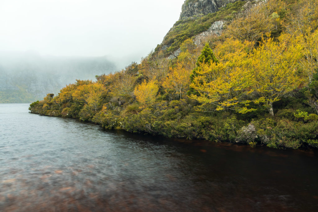
Crater lake and deciduous beech Nothofagus gunnii

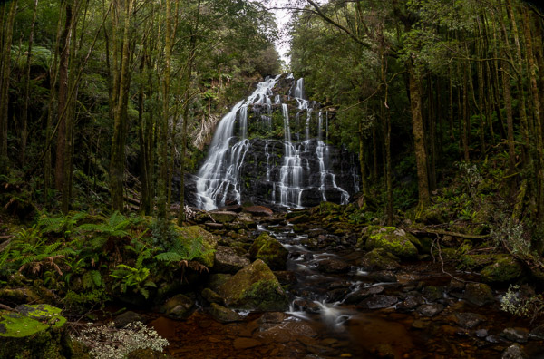
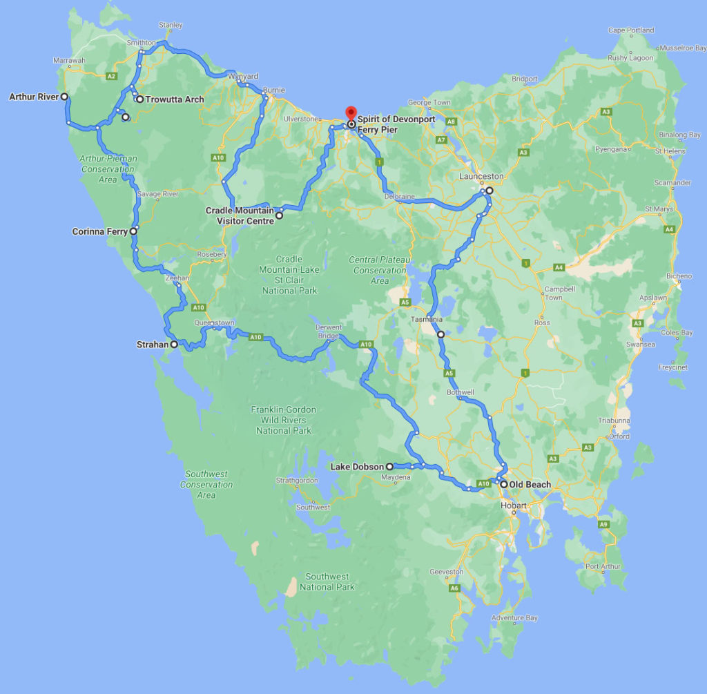
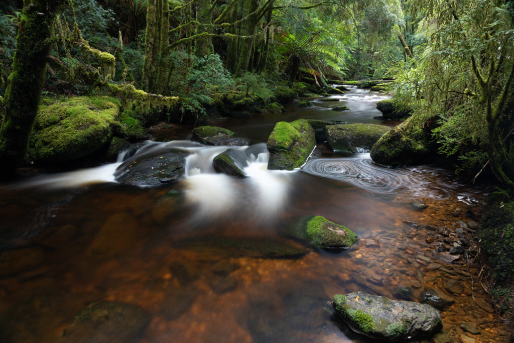
We headed to Tassy on the ferry, and headed up to Cradle Mt for a few days, then, via the north west and west coast down to Mt Field.  Between Cradle Mountain and Mount Field we hoped to have lots of chance to see lots of deciduous beech in autumn colours. Alas, this year was a bit unusual. The beech leaves turned yellow and then fell off, with no red phase. Still, the yellow was very striking. We also enjoyed all the scenery and the remarkably good weather (for the time of year). It was also a great time of year for fungi, and I spend some time photographing all sorts.

I’ve placed a series of photos in galleries:

2021-12-05 Lake Tyers Beach and Canberra

Finally, we have a change to get away from the city. Covid numbers seem to have stabilised around 1100 cases a day in Victoria, the borders of NSW and ACT are open to those double vaccinated. So it is time for a break.

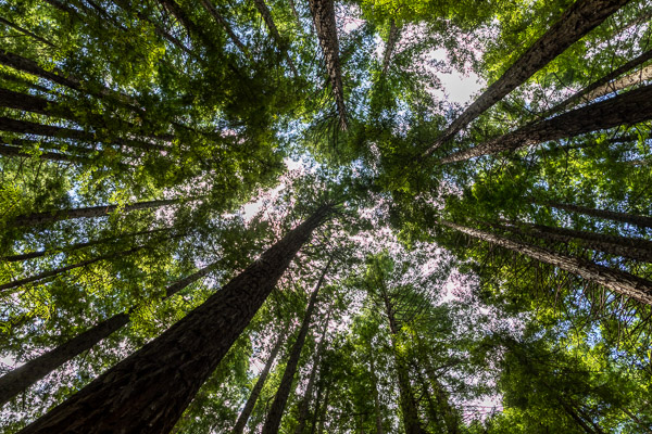
Our first leg took us via the Redwood Forest near Warburton, a place we keep meaning to have a look at but never get round to it. It has a splendid grove of redwoods. Arriving, as we did, in the middle of the day, there were lots of people there, and the picnickers were dwarfed by the soaring trees.

Redwood forest, Warburton

From the redwood forest we took the scenic route via Poweltown down to East Gippsland and our destination in Lake Tyers Beach. There we shared a couple of enjoyable days with our neighbours’ in their country residence.

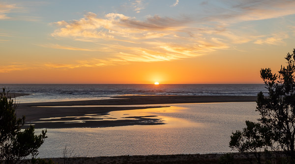
Sunrise over the beach at Lake Tyers. The lake is currently open to the sea. The stream through the sandbar is visible at the left of the image.

As usual I have posted a gallery at https://photos.app.goo.gl/D9ZQBexzmQ4H2J89A

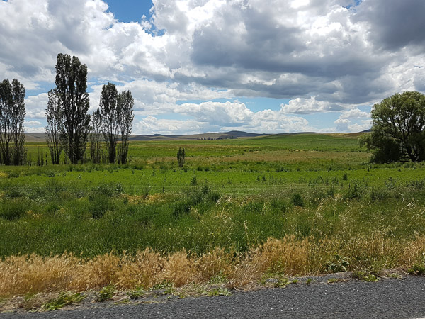
From Lake Tyers we headed via Cann River, up the Monaro Highway. All along the road we saw extensive evidence of the fires of the 2019-2020 fire season. Lots of areas had very heavy burning, with dense epicormic regrowth. In places the fire had killed the trees. We didn’t stop to explore these areas due to the rain. Once up to the Monaro Plains we were struck by how green the area was. Usually by December the grasses are dry and and brown. This really is a La Niña year.

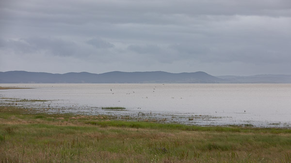
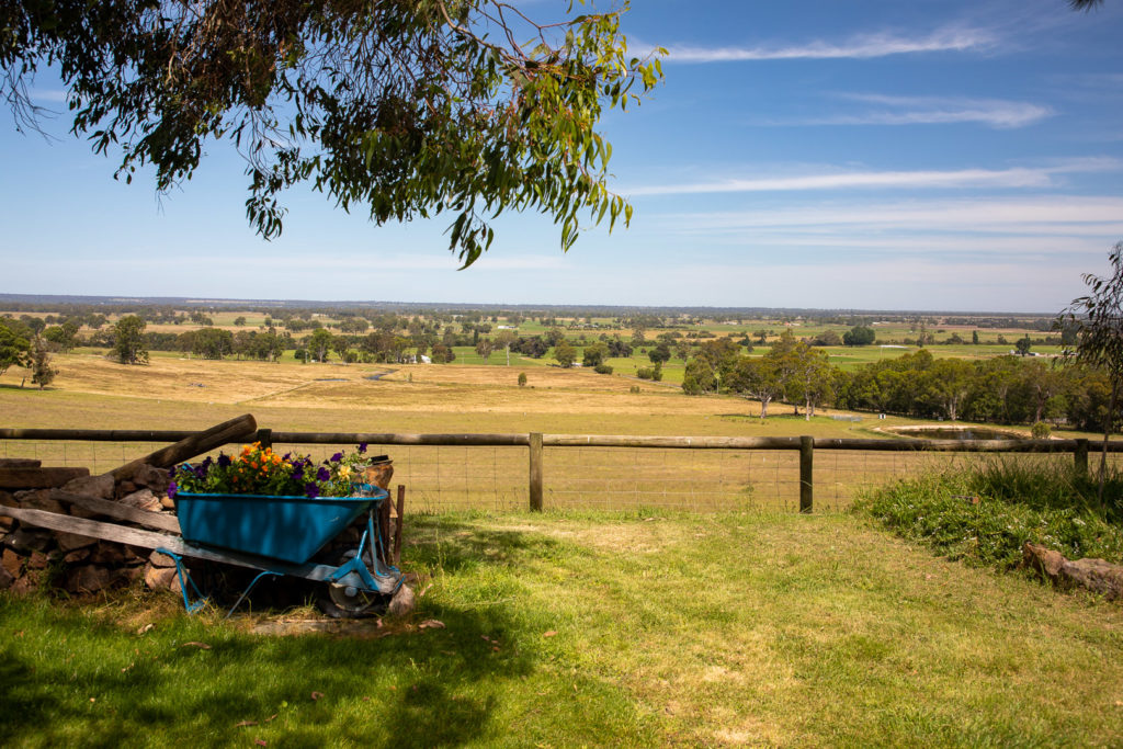
Unseasonably green paddocks along the Monaro Highway.

In Canberra we spent our first day exploring the Botanic Gardens and then birdwatching at the Jerebombera wetlands.

Next day Steven took us to the National Portrait Gallery for the “living memories” exhibition, then in the afternoon to see Lake George, which, unusually, has water in it at present. The threatening skies made for an interesting view.

Lake George, full of water.

A gallery of our first couple of days in Canberra: https://photos.app.goo.gl/SGcCZrEFjqb9BxB39

Dawn bicycle rides around the lake, museums and galleries, wildlife watching … lots to see and do. We managed to catch up for a walk and dinner with our good friend Julian. And a family brunch with all the Canberra clan. Very pleasant. and we capped it off with a picnic at Tidbinbilla with Mel and children. Lots of fun.

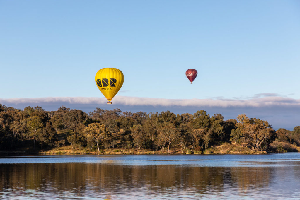
Early morning hot air balloons over Lake Burley Griffin.
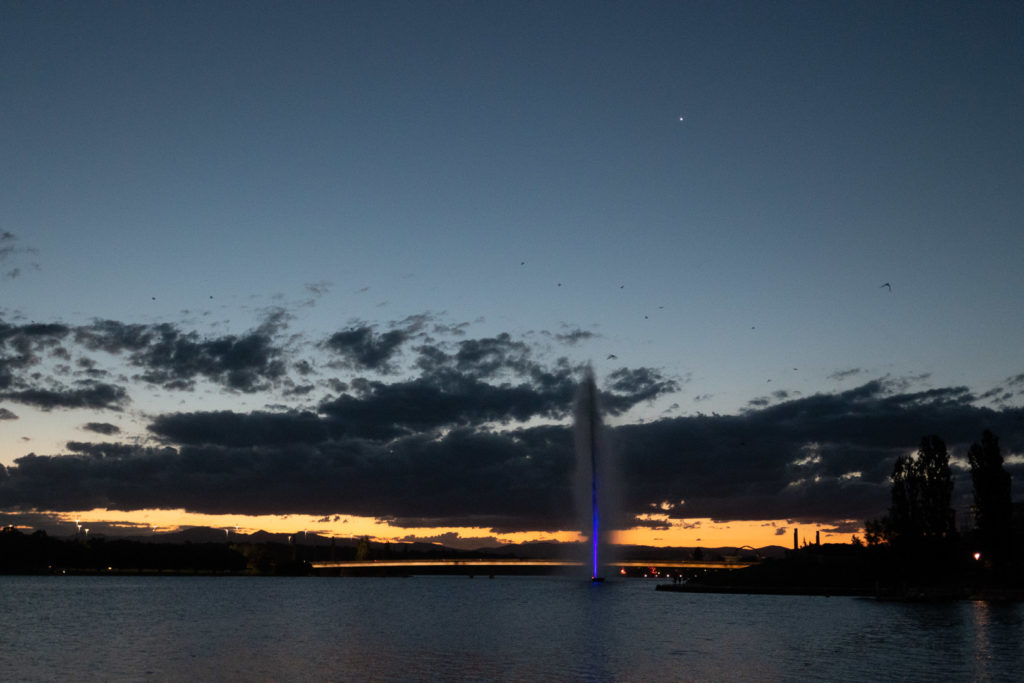
Evening stroll to the lake. The fountain was illuminated. The dark smudges in the sky are the flying foxes heading out from the colony to feed around the suburbs through the night.

Here are links to the final Canberra photo gallery: https://photos.app.goo.gl/5fwRjgbYZFgLKAfh6

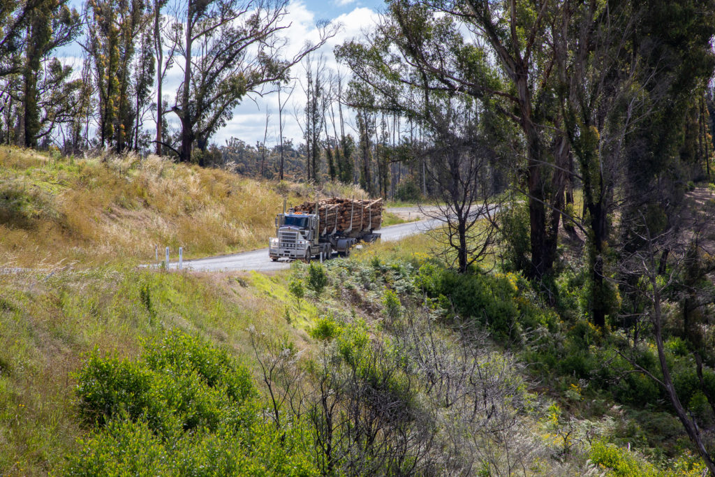
Lots of clearfelling and log trucks in evidence along the Imlay Road area en route to Mallacoota.

From Canberra we headed south through Cooma then out towards Mallacoota Inlet, an area that was severely affected by bush-fires in the 2019-2020 season. Over 120 homes were burnt in Mallacoota Inlet, and the residents were evacuated by sea. Now the township seems to have recovered, at least on the surface. We supported the local economy by getting dinner in town (rather good fish and chips) before heading south along a very potholed track to Shipwreck creek for our night’s camp.

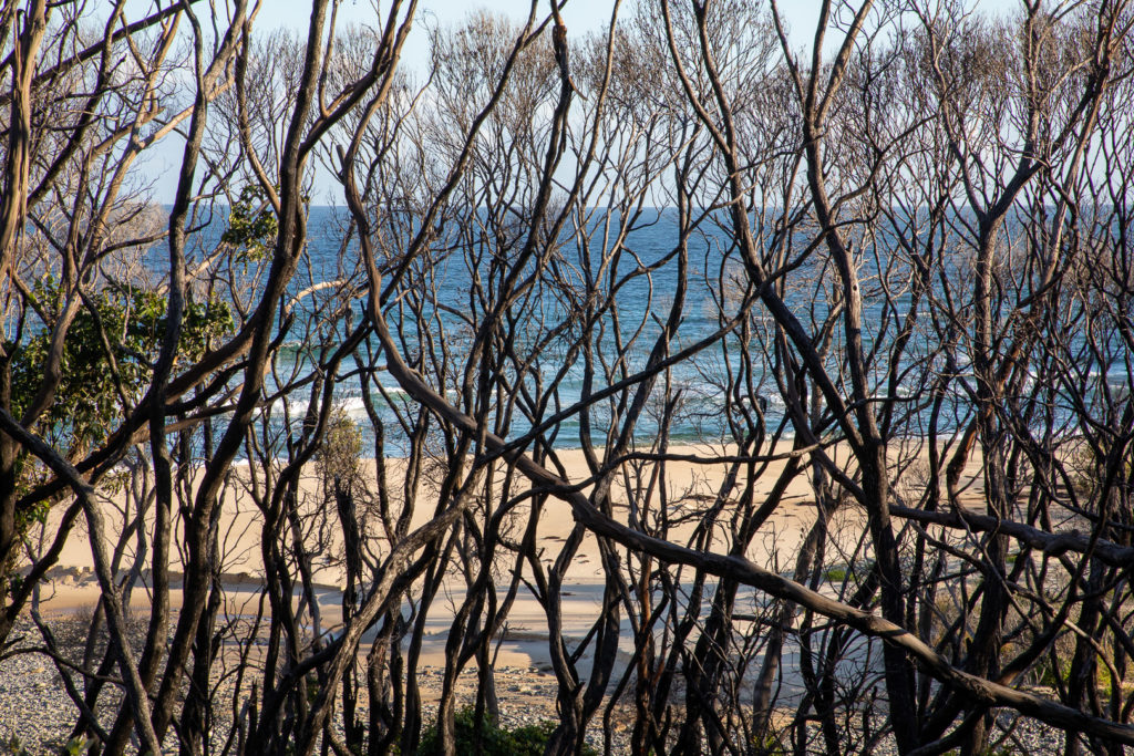
The coastal vegetation at Shipwreck creek beach was killed in the fires.
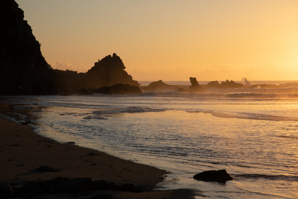
Dawn light on the beach and headland

From Mallacoota we headed west along the coast. We dropped in on our friends Monty and Helen at Valencia Creek for a quick cuppa and ended up invited to the community christmas party, a lovely, friendly affair, complete with Santa arriving on the CFA fire truck. and then a lovely overnight stay.

Fantastic views from Monty and Helen’s house.
Santa’s unconventional “sleigh”

For lots more photos and annotations go to https://photos.app.goo.gl/bU3JMwc1XvfMb7nJ7

2021-02-18 Lake Tyers and Canberra

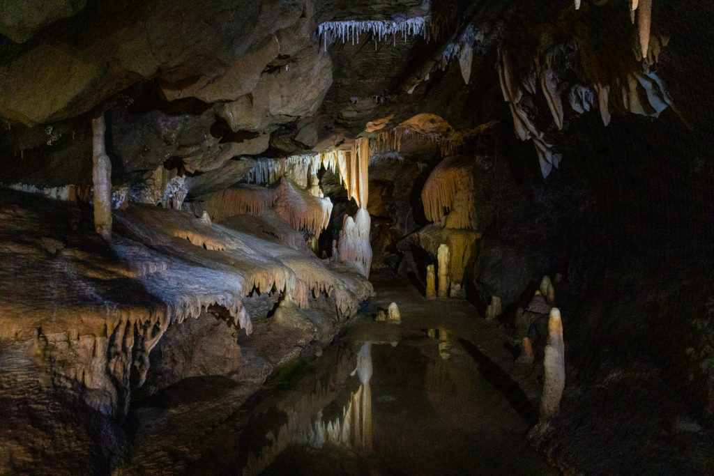
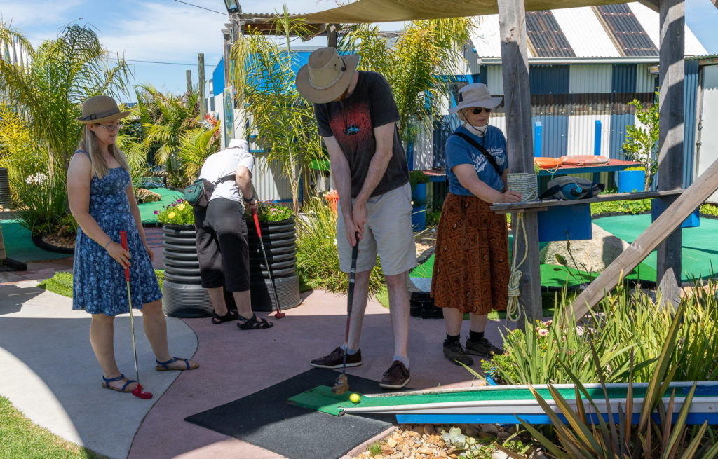
We headed off to Lake Tyers Beach to stay at our lovely neighbours’ country residence, with Viv, Steph and Rory (and dogs). We had a lovely time, enjoying the beach-side environs, and took a trip to visit Buchan Caves nearby.

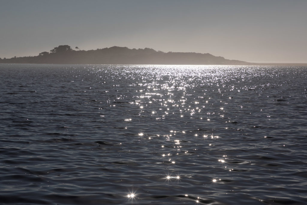
Sunlight glittering on Lake Tyers.
Buchan Caves
Minigolf in Lakes Entrance
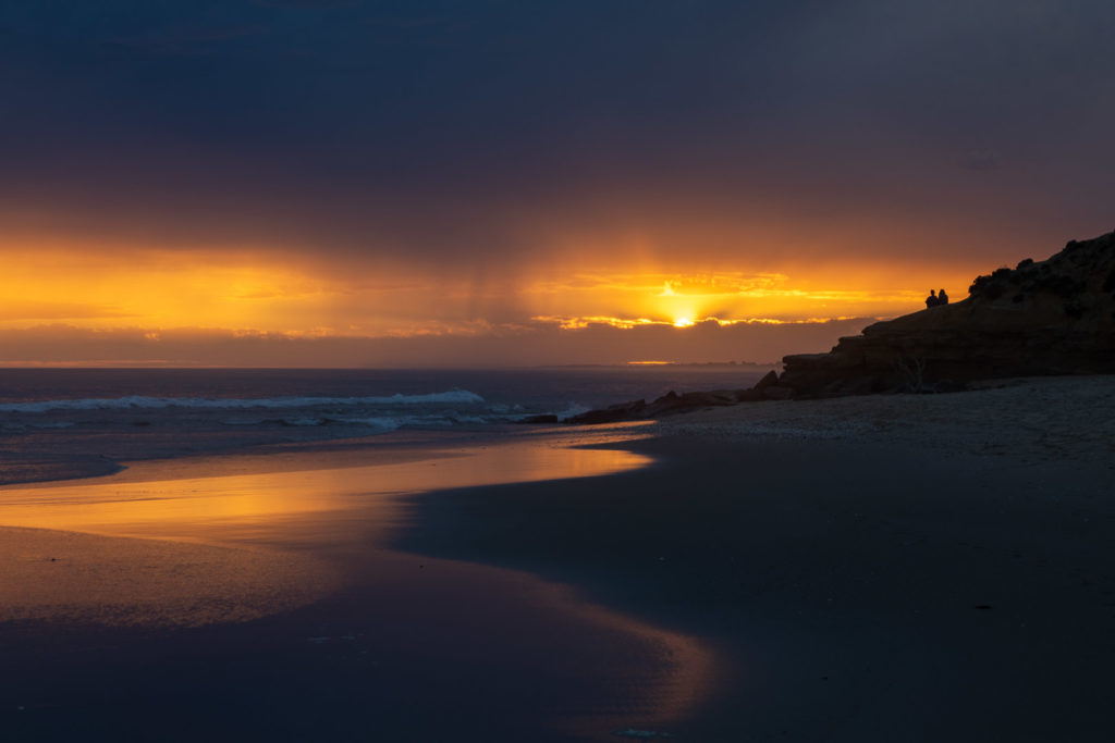
Sunset at Red Bluff

From Lake Tyers Jill and I headed north to Canberra (Viv, Steph and Rory returned to Melbourne). We took the Suggan Buggan road along the Snowy River. Very pleasant.

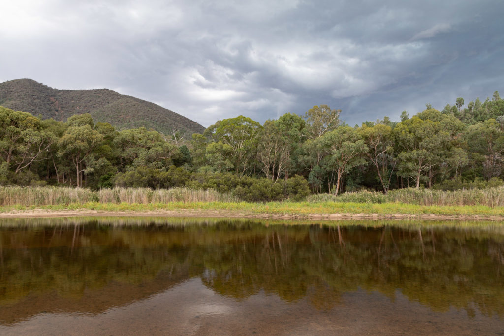
Snowy River where we camped

We headed onwards to Canberra where we had a lovely stay with Steven and Judy, with bushwalks, nature watching, museums and art galleries. All very pleasant.

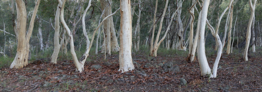
Scribbly gums on Mt Ainslie
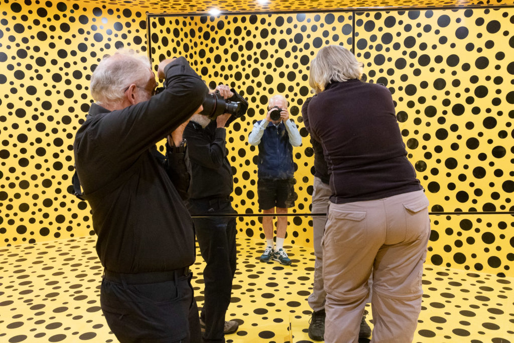
An intriguing artwork in the gallery – lots of spotty walls and mirrors.
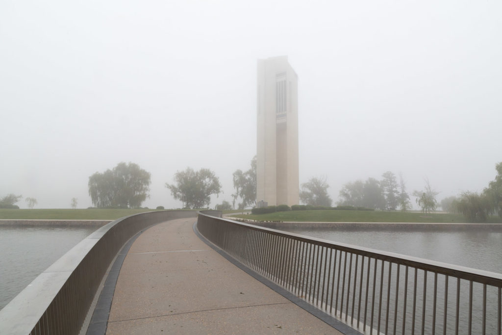
The Carillon in the morning mist.
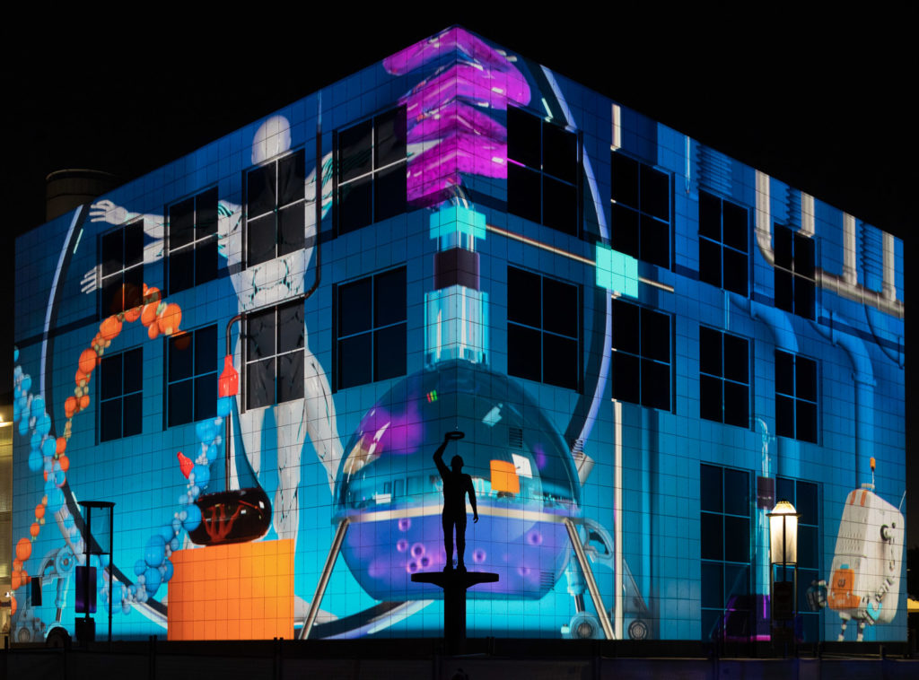
Enlighten – a light show festival in Canberra

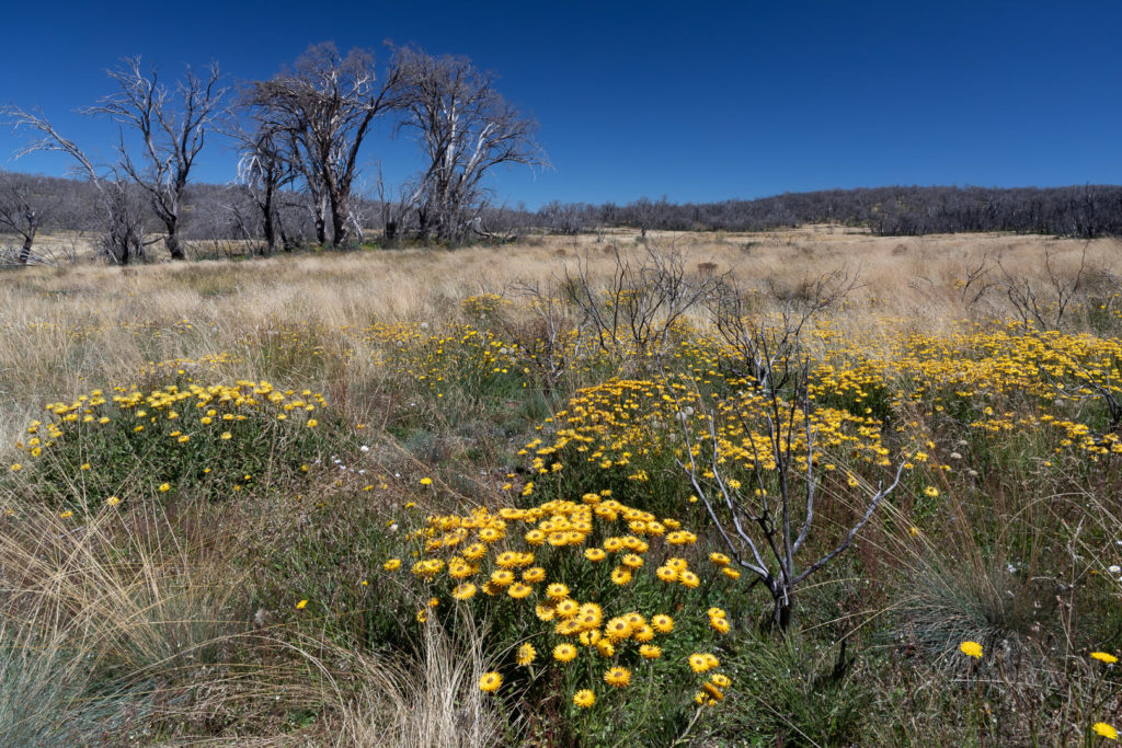
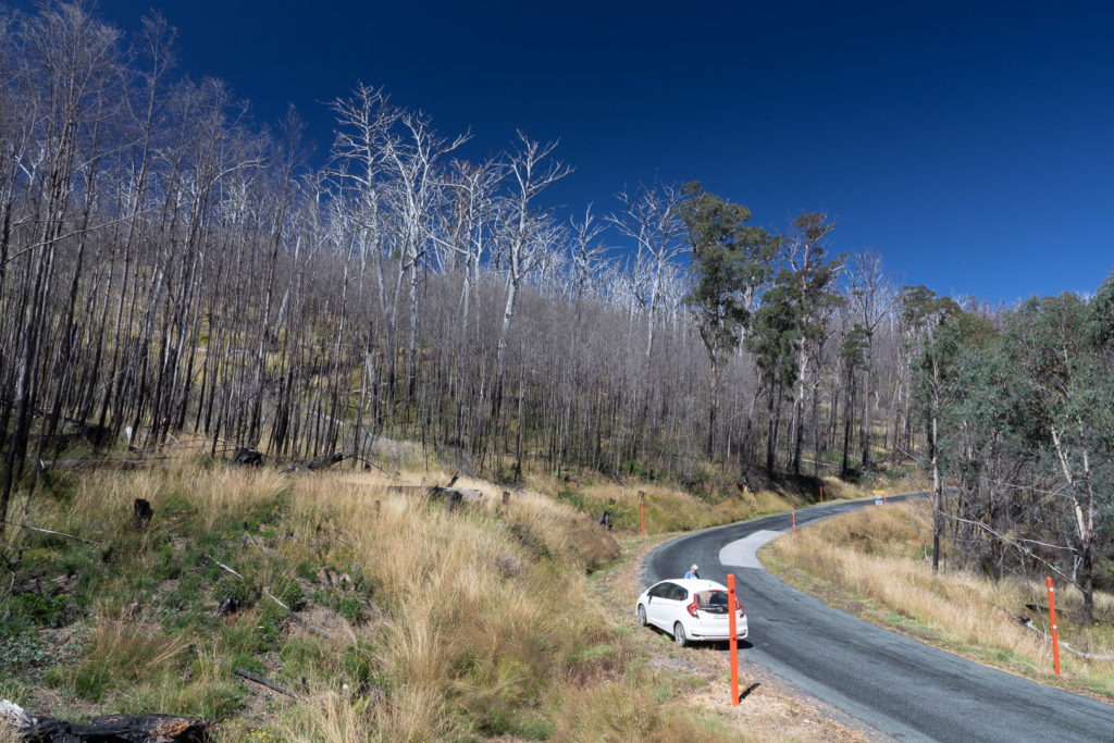
Time to head south, so we took a circuitous route through the snowy mountains, via Cabramurra and Beechworth. Lots of burnt areas from the previous year’s bush-fires was evident, and Cabramurra was closed from fire damage.
High country – trees damaged by fires, but the everlasting daisies are flowering well.
Burnt out forest near Cabramurra.
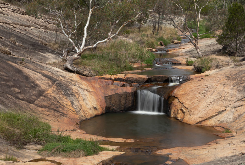
Woolshed falls, Beechworth; Reid’s creek walking track

For lots more photos, see the gallery at https://photos.app.goo.gl/dFGGk8R6UGaMCgdb6